2020s Maps of Clinton, Oklahoma
Explore 5 historic maps of Clinton from the 2020s. These maps offer a rare glimpse into what life looked like during the 2020s — showing old roads, neighborhoods, homes, and landmarks that have changed or disappeared over time.
Whether you're researching your family's past, planning a metal detecting trip, or studying how Clinton's landscape evolved across the 2020s, these high-resolution maps are a powerful tool for exploring the history of this region.
- Focus on a specific era: All maps on this page are from the 2020s, giving you a focused view of this time period.
- See what’s changed: Compare century-old streets, trails, and buildings to today's modern landscape using overlays and satellite layers.
- Research with precision: Use these maps for genealogy, historical research, land use analysis, or educational projects.
- View, download, or print: Maps are fully viewable online in high resolution, and can be downloaded or printed for your own records.
Start exploring Clinton's history through authentic maps from the 2020s. This is your window into the past.
Clinton, OK maps
(5)- 2022 Map of Indianapolis, 2022 Print
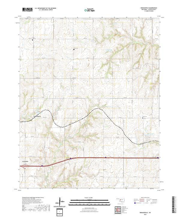 2022 Indianapolis2022 Print · USGSCuster County prairie land surrounds the small settlement of Indianapolis during this modern era of Oklahoma's rural development. Genealogists and local historians can locate several family and community burial sites such as Mount Hope Cem and Summit Cem while tracing the historic path of Rte 66 Hwy.
 - 2022 Map of Dill City NE, 2022 Print
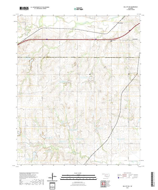 2022 Dill City NE2022 Print · USGSWashita County and Custer County meet on the western edge of Clinton in the early 2020s. Researchers can trace land tracts near the Washita River and locate family history at Parkersburg Cem, Lutheran Cem, and Guy Cem.
 - 2022 Map of Stafford, 2022 Print
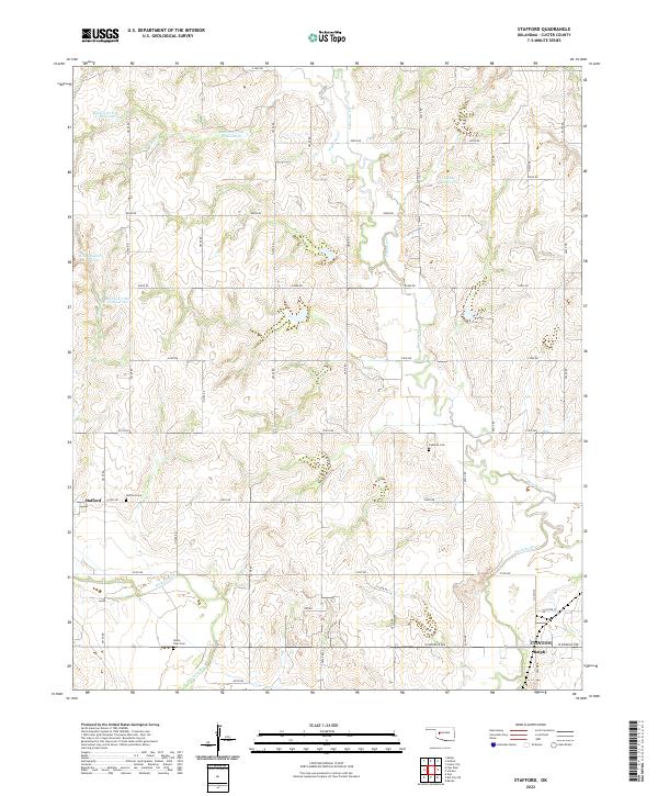 2022 Stafford2022 Print · USGSCuster County land use is on full display in the early twenty-first century, showing the intricate water management of the Washita River valley. Researchers can pinpoint Stafford and Ralph, or trace family sites at Stafford Cem and Cabaniss Cem.
 - 2022 Map of Clinton, 2022 Print
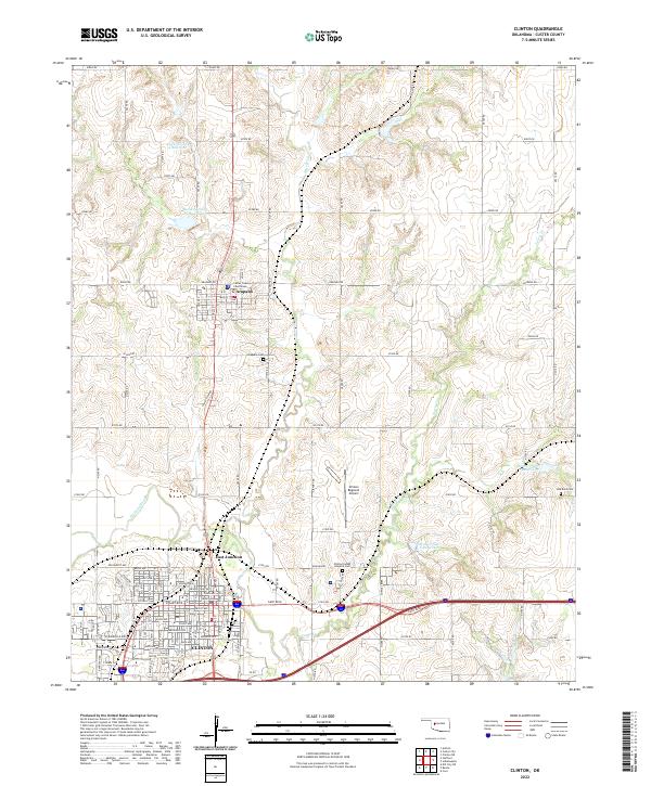 2022 Clinton2022 Print · USGSCuster County life centers on the neighboring towns of Clinton and Arapaho in the early twenty-first century. Genealogists and local historians can trace the precise locations of the Custer County Courthouse and several local burial grounds, including the Clinton Indian Hospital Cem.
 - 2022 Map of Bessie, 2022 Print
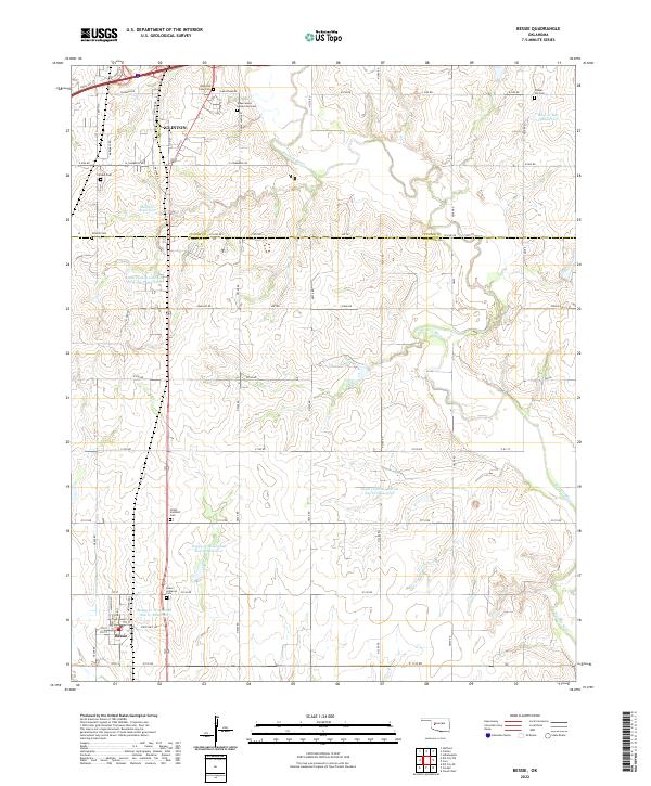 2022 Bessie2022 Print · USGSBessie and southern Clinton are mapped here at the dawn of the 2020s, showing a landscape defined by the Washita River and a dense network of local cemeteries. Genealogists can trace several burial sites including the John Old Crow Cem and Peace Lutheran Cem.
End of results
Showing maps 1-5 of 5
Top cities near Clinton
- New Cordell historical maps
- Burns Flat historical maps
- Arapaho historical maps
- Corn historical maps
- Dill City historical maps
- Custer City historical maps
See more
Top neighborhoods of Clinton
Frequently asked questions
- What are the different types of historical maps available for Clinton?
- What is the oldest map of Clinton?
- Where can I purchase historical maps of Clinton for my home or office?
- Where can I download high-res historical maps of Clinton?
- Are there historical topographic maps available for Clinton?
- Is there historical aerial imagery available for Clinton?
- Where are historical maps of Clinton sourced from?