Old Maps of Katie, Oklahoma for Metal Detecting
Plan your next treasure hunt with 11 historic maps of Katie. Find old homesites, ghost towns, trails, and gathering spots that may be lost to time — perfect for identifying promising metal detecting locations.
- Locate forgotten sites: Uncover places like long-lost settlements, abandoned rail lines, or gathering spots.
- Plan better hunts: Use map overlays combined with LiDAR or satellite views to narrow in on historically rich areas.
- Made for detectorists: Thousands of hobbyists use these maps to discover relics, coins, and hidden history.
Use these historic maps to boost your research and find new opportunities beneath the surface of Katie.
Katie, OK maps
(11)- 1898 Map of Pauls Valley, 1954 Print
 1898 Pauls Valley1954 Print · USGSThe Chickasaw Nation is documented at the turn of the century, showing the rail-driven growth of the Washita River valley. Researchers can trace early settlements like Whitebead and Wynnewood along the Gulf Colorado and Santa Fe RR.
 - 1902 Map of Pauls Valley
 1902 Pauls Valley1902 Print · USGSThe Chickasaw Nation at the turn of the century shows a landscape of river-valley agriculture and burgeoning rail towns. Genealogists and historians can trace the early footprints of Pauls Valley, Wynnewood, and Whitebead before statehood.5 unique versions available
 - 1957 Map of Ardmore, 1968 Print
 1957 Ardmore1968 Print · USGSSouth-central Oklahoma in the late fifties was a landscape of rising reservoir waters and expanding rail lines. Genealogists and historians can trace the foundations of Ardmore and Duncan or locate early recreation sites at Platt National Park and Lake Murray State Park.3 unique versions available
 - 1963 Map of Ardmore
 1963 Ardmore1963 Print · USGSSouthern Oklahoma during the early sixties shows a landscape defined by the Arbuckle Mountains and a booming energy economy. Genealogists and historians can trace family-named sites across the Ardmore Oil Field, find old schools like Southeastern State College, or locate historic markers such as Boggy Depot State Park.2 unique versions available
 - 1969 Map of Hennepin, 1971 Print
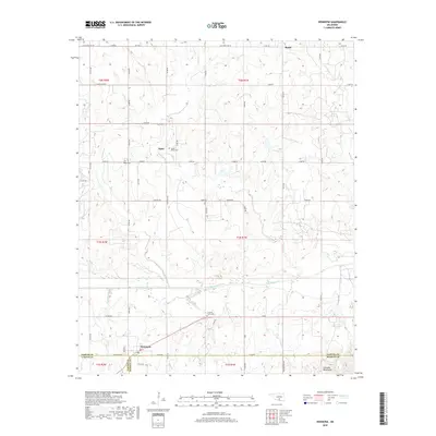
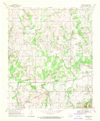 1969 Hennepin1971 Print · USGSSouthern Oklahoma at the end of the sixties reveals a landscape shaped by petroleum production and deep-rooted rural settlements. Researchers can locate the Fort Arbuckle Ruins and trace the boundaries of the Elmore Oil Field near Hennepin.2 unique versions available
 - 1986 Map of Pauls Valley
 1986 Pauls Valley1986 Print · USGSGarvin County and its neighbors are shown in the mid-1980s during a period of steady growth along the Washita River. Researchers can trace the path of the Atchison Topeka and Santa Fe railroad through Pauls Valley or locate rural sites like Mt Olive Church and Erin Springs.2 unique versions available
 - 2009 Map of Hennepin, 2009 Print
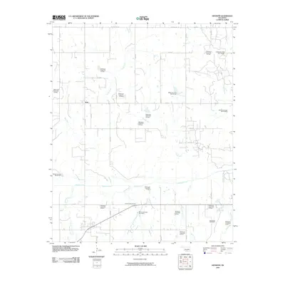 2009 Hennepin2009 Print · USGSCovers Katie, including Brady, Hennepin, and other nearby areas
 - 2012 Map of Hennepin, 2012 Print
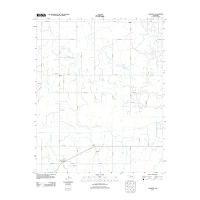 2012 Hennepin2012 Print · USGSCovers Katie, including Brady, Hennepin, and other nearby areas
 - 2016 Map of Hennepin, 2016 Print
 2016 Hennepin2016 Print · USGSCovers Katie, including Brady, Hennepin, and other nearby areas
 - 2018 Map of Hennepin, 2018 Print
 2018 Hennepin2018 Print · USGSCovers Katie, including Brady, Hennepin, and other nearby areas
 - 2022 Map of Hennepin, 2022 Print
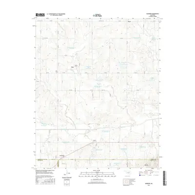
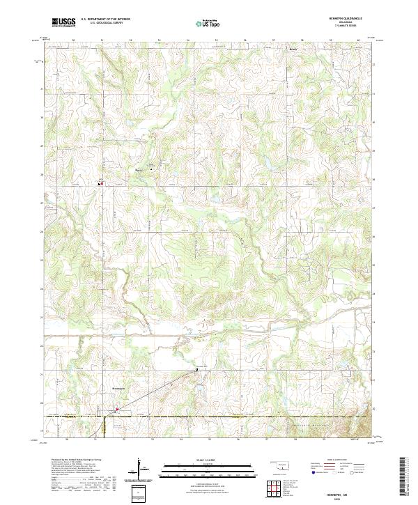 2022 Hennepin2022 Print · USGSThe rural landscapes of south-central Oklahoma are captured here in the 2020s, showing the enduring agricultural and residential patterns of the region. Researchers can trace family sites near Hennepin, Sweet Home Cem, and the foothills of the Arbuckle Mountains.
End of results
Showing maps 1-11 of 11
Top cities near Katie
- Pauls Valley historical maps
- Wynnewood historical maps
- Elmore City historical maps
- Tatums historical maps
- Ratliff City historical maps
- Foster historical maps
Frequently asked questions
- What are the different types of historical maps available for Katie?
- What is the oldest map of Katie?
- Where can I purchase historical maps of Katie for my home or office?
- Where can I download high-res historical maps of Katie?
- Are there historical topographic maps available for Katie?
- Is there historical aerial imagery available for Katie?
- Where are historical maps of Katie sourced from?