2020s Maps of Chickasha, Oklahoma
Explore 6 historic maps of Chickasha from the 2020s. These maps offer a rare glimpse into what life looked like during the 2020s — showing old roads, neighborhoods, homes, and landmarks that have changed or disappeared over time.
Whether you're researching your family's past, planning a metal detecting trip, or studying how Chickasha's landscape evolved across the 2020s, these high-resolution maps are a powerful tool for exploring the history of this region.
- Focus on a specific era: All maps on this page are from the 2020s, giving you a focused view of this time period.
- See what’s changed: Compare century-old streets, trails, and buildings to today's modern landscape using overlays and satellite layers.
- Research with precision: Use these maps for genealogy, historical research, land use analysis, or educational projects.
- View, download, or print: Maps are fully viewable online in high resolution, and can be downloaded or printed for your own records.
Start exploring Chickasha's history through authentic maps from the 2020s. This is your window into the past.
Chickasha, OK maps
(6)- 2022 Map of Alex, 2022 Print
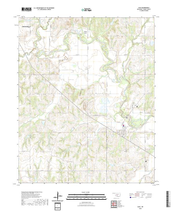 2022 Alex2022 Print · USGSAlex and the surrounding Grady County farmlands are captured in this modern survey during a period of continued rural transition. Researchers can locate family landmarks like Ireton Cem and Alex Cem or trace the winding course of the Washita River and Soldier Cr.
 - 2022 Map of Verden, 2022 Print
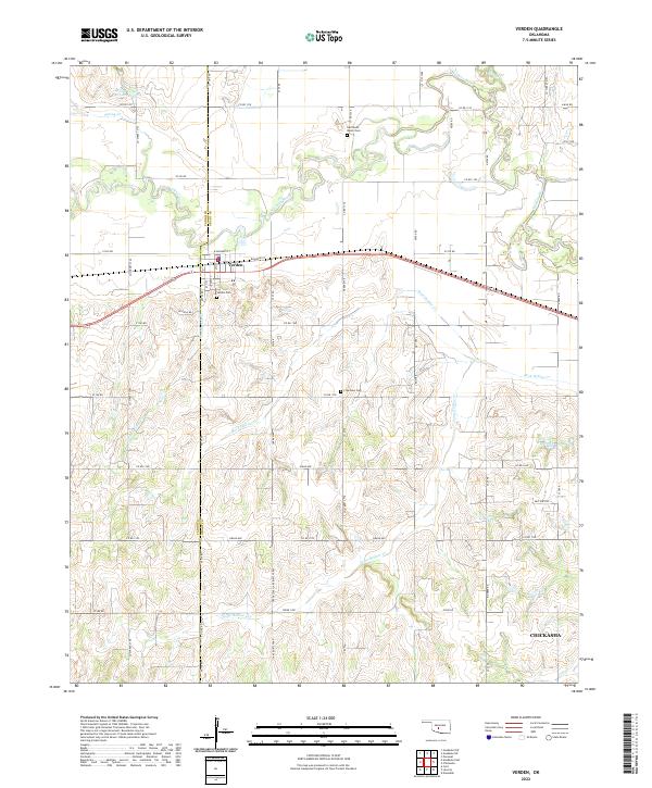 2022 Verden2022 Print · USGSThe Oklahoma prairie surrounding Verden is captured in this recent survey, showcasing the town's position along the Washita River and the rail line. Researchers can locate local landmarks like Half Moon Ranch Cem, Plainview Cem, and Spring Cr Site 103 Reservoir.
 - 2022 Map of Chickasha, 2022 Print
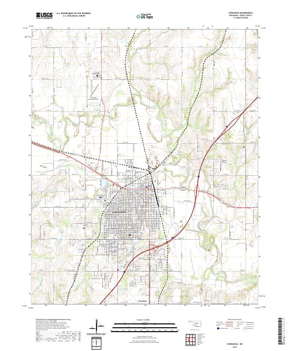 2022 Chickasha2022 Print · USGSThe city of Chickasha and the Washita River valley are captured in this modern survey of central Oklahoma. Researchers can trace the layout of the University of Science and Arts of Oklahoma or locate family plots at Fairview Park Cem and Rose Hill Cem.
 - 2022 Map of Tabler, 2022 Print
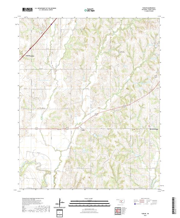 2022 Tabler2022 Print · USGSGrady County agriculture and aviation meet in this recent survey of the Oklahoma plains. Genealogists and locals can trace land tracts near Tabler and the Good Life Ranch Airport or follow the Washita River floodplain.
 - 2022 Map of Laverty, 2022 Print
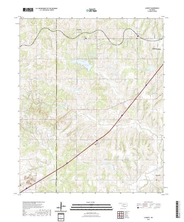 2022 Laverty2022 Print · USGSThe rural landscapes of Grady and Caddo Counties are documented here in the early twenty-first century. Researchers can trace family roots through local sites like Pioneer Cemetery, Laverty Cemetery, and the settlement of Norge.
 - 2022 Map of Ninnekah, 2022 Print
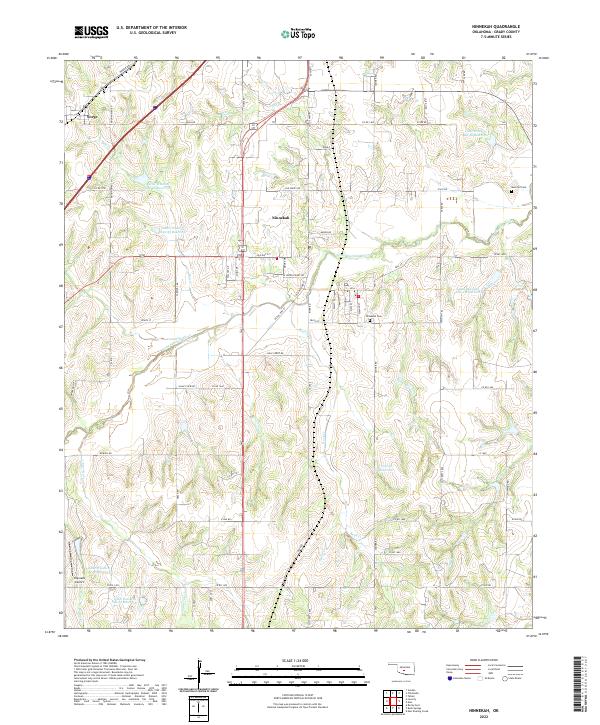 2022 Ninnekah2022 Print · USGSNinnekah and the surrounding Grady County countryside are shown here in the 2020s, a landscape defined by the Little Washita River and its many reservoirs. Researchers can locate family landmarks like Muncrief Cem and the historic route of the Chisolm Trl.
End of results
Showing maps 1-6 of 6
Top cities near Chickasha
- Blanchard historical maps
- Ninnekah historical maps
- Verden historical maps
- Alex historical maps
- Amber historical maps
- Cement historical maps
See more
Frequently asked questions
- What are the different types of historical maps available for Chickasha?
- What is the oldest map of Chickasha?
- Where can I purchase historical maps of Chickasha for my home or office?
- Where can I download high-res historical maps of Chickasha?
- Are there historical topographic maps available for Chickasha?
- Is there historical aerial imagery available for Chickasha?
- Where are historical maps of Chickasha sourced from?