Old Maps of Chickasha, Oklahoma for Metal Detecting
Plan your next treasure hunt with 58 historic maps of Chickasha. Find old homesites, ghost towns, trails, and gathering spots that may be lost to time — perfect for identifying promising metal detecting locations.
- Locate forgotten sites: Uncover places like long-lost settlements, abandoned rail lines, or gathering spots.
- Plan better hunts: Use map overlays combined with LiDAR or satellite views to narrow in on historically rich areas.
- Made for detectorists: Thousands of hobbyists use these maps to discover relics, coins, and hidden history.
Use these historic maps to boost your research and find new opportunities beneath the surface of Chickasha.
Chickasha, OK maps
(58)- 1902 Map of Rush Springs
 1902 Rush Springs1902 Print · USGSThe Chickasaw Nation landscape at the turn of the century is defined by its deep river valleys and the arrival of the iron horse. Genealogists can trace early homesteads and rail-side growth in Rush Springs, Marlow, and settlements like Erin Springs along the Washita River.4 unique versions available
 - 1904 Map of Chickasha
 1904 Chickasha1904 Print · USGSIndian Territory and Oklahoma Territory meet in this detailed 1904 survey, showing the region just years before statehood. Genealogists can trace the early rail stops at Minco and Tuttle or locate family homesteads near Womack and Dibble.4 unique versions available
 - 1945 Map of Anadarko
 1945 Anadarko1945 Print · USGSCaddo and Grady counties are documented during the mid-1940s as the rail-and-river economy flourished. Genealogists can locate numerous rural community landmarks like Liberty Cem, Riverside Indian School, and Oakdale Sch.2 unique versions available
 - 1949 Map of Cement, 1953 Print
 1949 Cement1953 Print · USGSThe oil-and-rail economy of Caddo and Comanche counties is on full display here in the late forties. Researchers can locate dozens of country schools like Highview Sch and Rocky Ford Sch or trace the industrial footprint of the Oil Refinery at Cyril.
 - 1949 Map of Rush Springs, 1964 Print
 1949 Rush Springs1964 Print · USGSGrady County at mid-century reveals a landscape defined by the Washita River valley and the reach of the Rock Island railroad. Genealogists can trace family roots through numerous rural landmarks like Vimy Ridge Sch, Morris Cem, and the settlement of Ninnekah.2 unique versions available
 - 1950 Map of Rush Springs
 1950 Rush Springs1950 Print · USGSGrady County at the mid-point of the twentieth century reveals a landscape shaped by the Washita River and the local rail lines. Researchers can trace rural school locations like Vimy Ridge Sch and Hawkins Sch or locate family plots at Ireland Cem.2 unique versions available
 - 1954 Map of Oklahoma City
 1954 Oklahoma City1954 Print · USGSOklahoma City and its surrounding counties are captured here in the early fifties during a period of significant postwar growth. Researchers can trace the development of the Turner Turnpike and locate aviation hubs like Tinker Field or Will Rogers Field.
 - 1955 Map of Lawton, 1958 Print
 1955 Lawton1958 Print · USGSSouthwestern Oklahoma and North Texas are shown here in the mid-fifties, dominated by the Wichita Mountains and the vital Red River watershed. Genealogists and historians can trace the foundations of Lawton alongside rural landmarks like Rainy Mountain Church and Pleasant Hill School.5 unique versions available
 - 1955 Map of Clinton, 1964 Print
 1955 Clinton1964 Print · USGSWestern Oklahoma during the mid-century transition shows a landscape of growing reservoirs and active military flight lines. Genealogists and historians can locate rural landmarks such as Mountain View Church, Berlin School, and the Riverside Indian School Reserve.3 unique versions available
 - 1956 Map of Laverty, 1959 Print
 1956 Laverty1959 Print · USGSGrady and Caddo counties are captured here in the mid-1950s, showing a landscape defined by the petroleum industry and rural settlement. Genealogists can trace family roots through sites like Pioneer Cemetery, Kechi School, and the community of Laverty.2 unique versions available
 - 1956 Map of Cement, 1960 Print
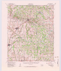 1956 Cement1960 Print · USGSMid-century Caddo and Comanche counties are defined here by a blend of industrial growth and tribal heritage. Genealogists and historians can trace family locations near the Washita Indian Cemetery, the local Oil Refinery, and schools like Pioneer School.3 unique versions available
 - 1957 Map of Clinton
 1957 Clinton1957 Print · USGSWestern Oklahoma in the mid-fifties is captured here as a landscape of river-valley settlements and emerging energy fields. Genealogists can trace family roots through numerous rural landmarks like the Swapping Back Indian School, Hebron Church, and the Riverside Indian School Reserve.
 - 1957 Map of Ardmore, 1968 Print
 1957 Ardmore1968 Print · USGSSouth-central Oklahoma in the late fifties was a landscape of rising reservoir waters and expanding rail lines. Genealogists and historians can trace the foundations of Ardmore and Duncan or locate early recreation sites at Platt National Park and Lake Murray State Park.3 unique versions available
 - 1957 Map of Oklahoma City, 1969 Print
 1957 Oklahoma City1969 Print · USGSCentral Oklahoma is captured here in a period of significant mid-century growth and industrialization. Researchers can trace family roots through numerous rural markers like Memory Lane Cem, New Hope School, and the sprawling grounds of Tinker Air Force Base.3 unique versions available
 - 1963 Map of Ardmore
 1963 Ardmore1963 Print · USGSSouthern Oklahoma during the early sixties shows a landscape defined by the Arbuckle Mountains and a booming energy economy. Genealogists and historians can trace family-named sites across the Ardmore Oil Field, find old schools like Southeastern State College, or locate historic markers such as Boggy Depot State Park.2 unique versions available
 - 1963 Map of Oklahoma City
 1963 Oklahoma City1963 Print · USGSCentral Oklahoma in the early sixties showcases a landscape of rapid suburban growth and established oil production. Researchers can trace historic rail lines like the Chicago Rock Island and Pacific RR or locate rural landmarks such as Mayflower School and Bethel Church.
 - 1966 Map of Chickasha, 1967 Print
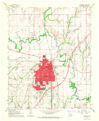 1966 Chickasha1967 Print · USGSChickasha flourished as a vital rail and educational center in central Oklahoma during the mid-sixties. Local researchers can trace the Indian Territory Boundary Line and locate historic sites like the Oklahoma College for Women and Rose Hill Cemetery.2 unique versions available
 - 1966 Map of Tabler, 1967 Print
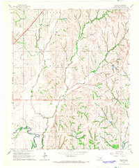 1966 Tabler1967 Print · USGSGrady County rural life in the mid-1960s is centered around the Washita River and the crossroads at Tabler. Researchers can trace the path of an Old Railroad Grade or locate historic settlement sites like Lucille, Naples, and Middleberg.2 unique versions available
 - 1968 Map of Verden, 1969 Print
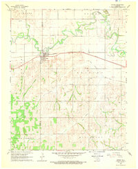 1968 Verden1969 Print · USGSThe town of Verden and the winding Washita River define this Oklahoma landscape in the late sixties. Researchers can trace the path of the Chicago Rock Island and Pacific railroad or locate local landmarks like the Mennonite Ch and Elderberry Ch.
 - 1975 Map of Rush Springs NW, 1976 Print
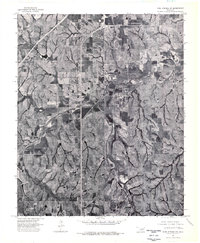 1975 Rush Springs NW1976 Print · USGSOklahoma's agricultural heartland is captured during the mid-seventies in this detailed aerial orthophotograph of Grady County. Genealogists and land researchers can trace property boundaries near Ninnekah and follow the natural meanders of the Little Washita River.
 - 1975 Map of Rush Springs NE, 1976 Print
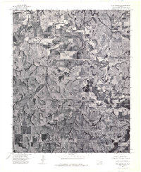 1975 Rush Springs NE1976 Print · USGSMid-century Grady County comes into focus in this orthophotoquad, showing the agricultural patterns and river bends south of Chickasha. Trace the residential growth of Alex and the shifting channels of the Washita River as they appeared in the 1970s.
 - 1981 Map of Lawton
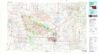 1981 Lawton1981 Print · USGSSouthwestern Oklahoma in the early eighties shows a landscape shaped by military history and the rising peaks of the Wichitas. Researchers can trace the boundaries of the Fort Sill Military Reservation and locate early settlements like Meers, Chattanooga, and Richards Spur.
 - 1981 Map of East Ninnekah, 1982 Print
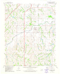 1981 East Ninnekah1982 Print · USGSGrady County's landscape in the early eighties reveals a unique intersection of modern infrastructure and territorial history. Genealogists and local historians can trace the Indian Territory Oklahoma Boundary past Moncrief Cem and the small settlement of Agawam.
 - 1981 Map of Alex, 1982 Print
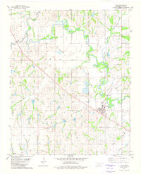 1981 Alex1982 Print · USGSGrady County during the early eighties showcases a landscape defined by the winding Washita River and the rural community of Alex. Researchers can locate family landmarks such as Hawkins Ch, Ireton Cem, and the long-retired Old Railroad Grade.
 - 1985 Map of Oklahoma City South
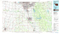 1985 Oklahoma City South1985 Print · USGSOklahoma City and its southern neighbors show a period of significant growth during the mid-eighties as suburban expansion met rural county lines. Researchers can trace the development of Tinker Air Force Base and locate smaller communities like Goldsby, Stella, and Woody Chapel.2 unique versions available
Showing maps 1-25 of 58
Top cities near Chickasha
- Blanchard historical maps
- Ninnekah historical maps
- Verden historical maps
- Alex historical maps
- Amber historical maps
- Cement historical maps
See more
Frequently asked questions
- What are the different types of historical maps available for Chickasha?
- What is the oldest map of Chickasha?
- Where can I purchase historical maps of Chickasha for my home or office?
- Where can I download high-res historical maps of Chickasha?
- Are there historical topographic maps available for Chickasha?
- Is there historical aerial imagery available for Chickasha?
- Where are historical maps of Chickasha sourced from?