Old Maps of Farwell, Oklahoma
Explore 11 old maps of Farwell, spanning from 1949 to today. These high-resolution historic maps reveal how streets, neighborhoods, landmarks, and natural features evolved over time — perfect for genealogy, metal detecting, research, and local history exploration.
What you can do with these maps:
- See how Farwell changed over time: Compare historical maps to modern-day views to trace roads, homesites, rail lines & more.
- View detailed metadata: Each map includes creators, publishers, year, scale, and archive source.
- Overlay maps with satellite & LiDAR: Visualize the past alongside modern tools to explore terrain & human change.
- Trusted historical sources: Maps sourced from the USGS, Library of Congress, and other archives.
- Access maps your way: View online, download high-res files, or order prints for personal or research use.
Start exploring old maps of Farwell to uncover forgotten places, hidden landmarks, and the deep history beneath your feet.
Farwell, OK maps
(11)- 1949 Map of Cement, 1953 Print
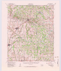
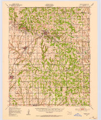 1949 Cement1953 Print · USGSThe oil-and-rail economy of Caddo and Comanche counties is on full display here in the late forties. Researchers can locate dozens of country schools like Highview Sch and Rocky Ford Sch or trace the industrial footprint of the Oil Refinery at Cyril.
 - 1955 Map of Lawton, 1958 Print
 1955 Lawton1958 Print · USGSSouthwestern Oklahoma and North Texas are shown here in the mid-fifties, dominated by the Wichita Mountains and the vital Red River watershed. Genealogists and historians can trace the foundations of Lawton alongside rural landmarks like Rainy Mountain Church and Pleasant Hill School.5 unique versions available
 - 1956 Map of Laverty, 1959 Print
 1956 Laverty1959 Print · USGSGrady and Caddo counties are captured here in the mid-1950s, showing a landscape defined by the petroleum industry and rural settlement. Genealogists can trace family roots through sites like Pioneer Cemetery, Kechi School, and the community of Laverty.2 unique versions available
 - 1956 Map of Cement, 1960 Print
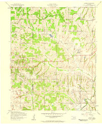
 1956 Cement1960 Print · USGSMid-century Caddo and Comanche counties are defined here by a blend of industrial growth and tribal heritage. Genealogists and historians can trace family locations near the Washita Indian Cemetery, the local Oil Refinery, and schools like Pioneer School.3 unique versions available
 - 1981 Map of Lawton
 1981 Lawton1981 Print · USGSSouthwestern Oklahoma in the early eighties shows a landscape shaped by military history and the rising peaks of the Wichitas. Researchers can trace the boundaries of the Fort Sill Military Reservation and locate early settlements like Meers, Chattanooga, and Richards Spur.
 - 1991 Map of Laverty
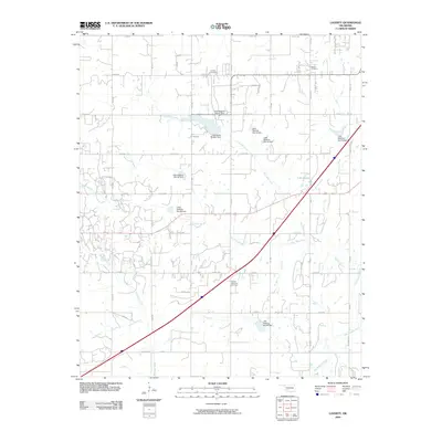
 1991 Laverty1991 Print · USGSGrady and Caddo Counties are captured here in the early nineties, showing a landscape defined by local agriculture and the active oil and gas industry. Researchers can find deep family roots at Pioneer Cem, Woods Mem Cem, and the old settlement of Laverty.
 - 2009 Map of Laverty, 2009 Print
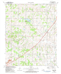
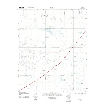
 2009 Laverty2009 Print · USGSCovers Farwell, including Chickasha, Laverty, and other nearby areas
 - 2012 Map of Laverty, 2012 Print
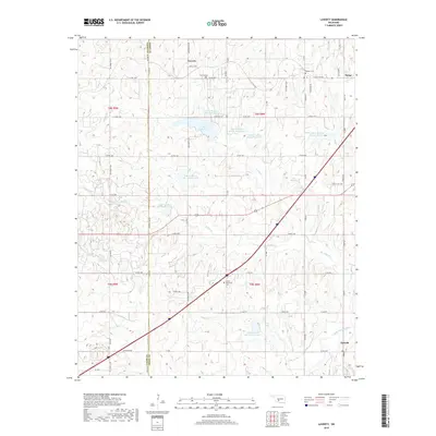
 2012 Laverty2012 Print · USGSCovers Farwell, including Chickasha, Laverty, and other nearby areas
 - 2016 Map of Laverty, 2016 Print
 2016 Laverty2016 Print · USGSCovers Farwell, including Chickasha, Laverty, and other nearby areas
 - 2018 Map of Laverty, 2018 Print
 2018 Laverty2018 Print · USGSCovers Farwell, including Chickasha, Laverty, and other nearby areas
 - 2022 Map of Laverty, 2022 Print
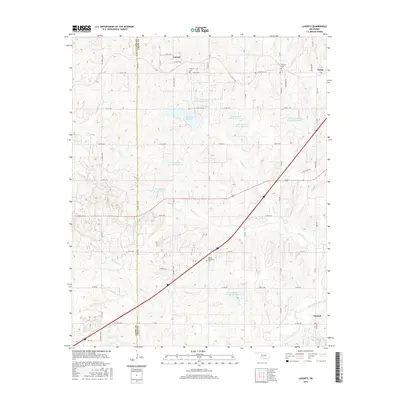
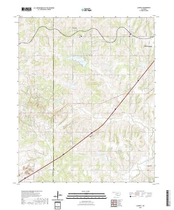 2022 Laverty2022 Print · USGSThe rural landscapes of Grady and Caddo Counties are documented here in the early twenty-first century. Researchers can trace family roots through local sites like Pioneer Cemetery, Laverty Cemetery, and the settlement of Norge.
End of results
Showing maps 1-11 of 11
Top cities near Farwell
- Chickasha historical maps
- Anadarko historical maps
- Marlow historical maps
- Rush Springs historical maps
- Cyril historical maps
- Ninnekah historical maps
See more
Frequently asked questions
- What are the different types of historical maps available for Farwell?
- What is the oldest map of Farwell?
- Where can I purchase historical maps of Farwell for my home or office?
- Where can I download high-res historical maps of Farwell?
- Are there historical topographic maps available for Farwell?
- Is there historical aerial imagery available for Farwell?
- Where are historical maps of Farwell sourced from?