Old Maps of Harmon County, Oklahoma for Academic Research
Study the evolution of Harmon County with 125 high-resolution historic maps. Whether you're teaching, researching, or modeling changes in land use, these maps provide essential visual documentation of urban, environmental, and geographic change.
- Analyze long-term change: Track patterns in development, transportation, and natural features.
- Ideal for environmental or urban studies: Support academic projects with primary historical map data.
- Use in the classroom or lab: Educators and researchers rely on these maps to bring historical context to life.
These maps are a powerful tool for teaching, research, and visualizing how Harmon County has changed over the decades.
Harmon County, OK maps
(125)- 1954 Map of Amarillo, 1966 Print
 1954 Amarillo1966 Print · USGSThe Texas Panhandle in the mid-1960s shows a landscape of rising industrial power and deep-rooted ranching tradition. Local historians can trace the paths of the Panhandle and Santa Fe railroad or locate sites like the Pantex Ordnance Plant and Mobeetie.2 unique versions available
 - 1954 Map of Plainview, 1966 Print
 1954 Plainview1966 Print · USGSThe Texas Panhandle and the rugged Caprock Escarpment appear in detail as the region's agricultural and rail networks reached their mid-century peak. Trace family roots and old land patterns through the canyons and plains near Plainview, Palo Duro State Park, and Childress.3 unique versions available
 - 1955 Map of Lawton, 1958 Print
 1955 Lawton1958 Print · USGSSouthwestern Oklahoma and North Texas are shown here in the mid-fifties, dominated by the Wichita Mountains and the vital Red River watershed. Genealogists and historians can trace the foundations of Lawton alongside rural landmarks like Rainy Mountain Church and Pleasant Hill School.5 unique versions available
 - 1955 Map of Clinton, 1964 Print
 1955 Clinton1964 Print · USGSWestern Oklahoma during the mid-century transition shows a landscape of growing reservoirs and active military flight lines. Genealogists and historians can locate rural landmarks such as Mountain View Church, Berlin School, and the Riverside Indian School Reserve.3 unique versions available
 - 1957 Map of Clinton
 1957 Clinton1957 Print · USGSWestern Oklahoma in the mid-fifties is captured here as a landscape of river-valley settlements and emerging energy fields. Genealogists can trace family roots through numerous rural landmarks like the Swapping Back Indian School, Hebron Church, and the Riverside Indian School Reserve.
 - 1958 Map of Amarillo
 1958 Amarillo1958 Print · USGSThe Texas Panhandle in the mid-1950s reveals a landscape of expanding military installations and oil-rich rail towns. Local historians can trace the development of Amarillo Air Force Base or locate smaller settlements like Magic City and New Mobeetie.
 - 1958 Map of Plainview
 1958 Plainview1958 Print · USGSThe High Plains and Caprock Escarpment meet in the late fifties, showcasing the ranching and rail networks of the Texas Panhandle. Trace family roots and vanished stops along the Panhandle and Santa Fe railroad through Plainview, Silverton, and Matador.
 - 1959 Map of Shinnery Creek, 1960 Print
 1959 Shinnery Creek1960 Print · USGSCollingsworth County sits on the Oklahoma border in the late fifties, where the winding Salt Fork Red River dominates the landscape. Local historians can trace early ranching features like Corral and family landmarks including Hughes and Coon.
 - 1960 Map of Loco, 1962 Print
 1960 Loco1962 Print · USGSChildress and Collingsworth counties are captured here in the early sixties, as the cattle and cotton country straddles the Oklahoma border. Researchers can trace rural lineages through the Loco Cem, find former school sites like Garden Valley Sch, or follow the Fort Worth and Denver rail line.
 - 1961 Map of Erick, 1963 Print
 1961 Erick1963 Print · USGSBeckham County, Oklahoma, sits at the intersection of the Texas border and the great rail lines during the early 1960s. Family historians can trace the community life of Erick and Texola, finding specific landmarks like Munnerson Cem and the local Drive-in Theater.2 unique versions available
 - 1961 Map of Hollis, 1963 Print
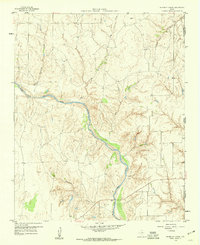
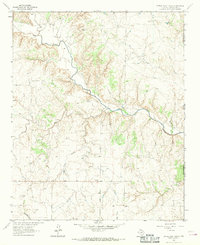
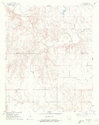
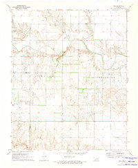
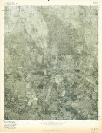
 1961 Hollis1963 Print · USGSHarmon County, Oklahoma, in the early sixties showcases a landscape defined by the Prairie Dog Town Fork Red River and the arrival of modern infrastructure. Researchers can locate family landmarks like Bitter Creek Cem, Antioch Ch, and the local Drive-in Theater in Hollis.
 - 1963 Map of Little Wolf Creek, 1967 Print
 1963 Little Wolf Creek1967 Print · USGSThe Texas-Oklahoma borderlands in the early 1960s are defined by high plains drainage and isolated ranching outposts. Genealogists and historians can locate the Needwood Cem, trace the remote Jeep Trail, and find landmarks like Antelope Peak or the Lost Creek Ranch.
 - 1964 Map of Dodson, 1967 Print
 1964 Dodson1967 Print · USGSThe community of Dodson sits at the Texas and Oklahoma border in the mid-1960s, where the high plains meet the river breaks. Genealogists can trace family locations near Dodson Cem, Kelley Ch, and the remnants of the Old RR Grade.
 - 1971 Map of Russell, 1973 Print
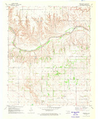
 1971 Russell1973 Print · USGSHarmon and Greer counties appear at the start of the 1970s, showcasing a rural Oklahoma landscape shaped by the Salt Fork Red River. Genealogists can trace family roots through several local burial grounds including Wildcat and White Flat cemeteries, or locate the community Townhall near Russell.
 - 1971 Map of Madge, 1973 Print
 1971 Madge1973 Print · USGSHarmon County, Oklahoma, is documented in the early seventies as a landscape of isolated homesteads and winding creek beds. Researchers can locate the Independence Cem and the small settlements of Madge and Carl along the Texas border.
 - 1971 Map of Vinson, 1973 Print
 1971 Vinson1973 Print · USGSHarmon County in the early 1970s is characterized by its agricultural draws and the winding Elm Fork Red River. Genealogists and local historians can locate Hackberry Cem, Cave Creek Cem, and the small settlement of Vinson.2 unique versions available
 - 1971 Map of Mc Knight, 1973 Print
 1971 Mc Knight1973 Print · USGSHarmon County, Oklahoma, at the start of the 1970s reveals a rural landscape defined by the Salt Fork Red River and the Texas border. Genealogists can trace local roots at McKnight Cem or explore landmarks like Lake Hall and the M Ch.
 - 1971 Map of Mc Queen, 1973 Print
 1971 Mc Queen1973 Print · USGSThe rural landscapes of Harmon and Greer counties are captured here in the early 1970s, focused on the small settlement of McQueen. Researchers can trace the path of the Hollis and Eastern railway and find several family-named land divisions like Looney and Tilley.
 - 1971 Map of Duke SW, 1973 Print
 1971 Duke SW1973 Print · USGSThe Harmon and Jackson County border in the early 1970s reveals a landscape of working quarries and rural townships. Family history researchers can locate the Pleasant Hill Cem and trace the paths of Gypsum Creek and Cottonwood Creek.
 - 1971 Map of Reed, 1973 Print
 1971 Reed1973 Print · USGSSouthwestern Oklahoma's river valley comes alive in the early 1970s, showcasing the winding Elm Fork Red River and its rural settlements. Researchers can locate the community of Reed, find landmarks like Jay Buckle Spring, and trace the grounds of Sulphur Ch.
 - 1971 Map of Shrewder, 1973 Print
 1971 Shrewder1973 Print · USGSHarmon County at the start of the 1970s reveals a landscape of isolated farmsteads and rural community centers. Researchers can trace family roots through the Tea Cross Cem or locate old gathering points like Ron, Shrewder, and Fairview Ch.
 - 1975 Map of Hollis NE
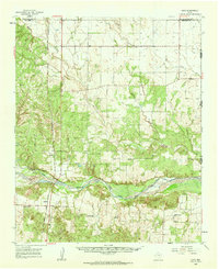
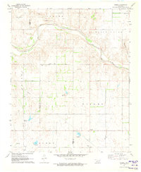
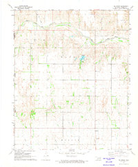
 1975 Hollis NE1975 Print · USGSHarmon County agricultural lands are captured in this mid-seventies aerial survey. Researchers can trace the development of the town of Gould and follow the seasonal flow of Sandy Creek across the southwestern plains.
 - 1975 Map of Hollis SE
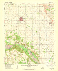
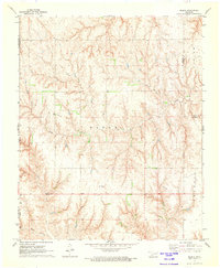
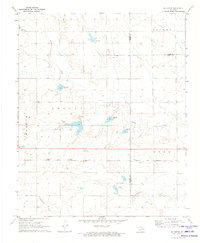
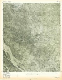 1975 Hollis SE1975 Print · USGSHarmon County at the Oklahoma-Texas border is seen from the air in the mid-seventies, showing the agricultural patterns of the southern plains. Researchers can trace the shifting sandbars of the Red River and the winding course of Sandy Louis Creek through this rural landscape.
 - 1975 Map of Hollis NW
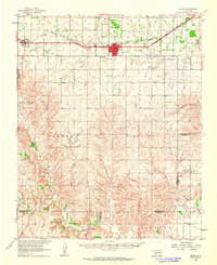
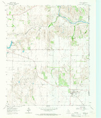
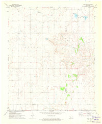
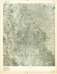
 1975 Hollis NW1975 Print · USGSHollis and the surrounding plains of Southwest Oklahoma are shown in detail just before the mid-seventies. Local historians can trace the street grids of Hollis and the winding course of Sandy Creek across the agricultural landscape.
 - 1983 Map of Shamrock
 1983 Shamrock1983 Print · USGSThe Texas Panhandle in the early 1980s reveals a landscape shaped by petroleum and the rail lines of the southern plains. Genealogists and historians can trace the Chicago Rock Island and Pacific corridor through Mc Lean and Shamrock, or locate smaller centers like Magic City and Lefors.
Showing maps 1-25 of 125
Top cities of Harmon County
Frequently asked questions
- What are the different types of historical maps available for Harmon County?
- What is the oldest map of Harmon County?
- Where can I purchase historical maps of Harmon County for my home or office?
- Where can I download high-res historical maps of Harmon County?
- Are there historical topographic maps available for Harmon County?
- Is there historical aerial imagery available for Harmon County?
- Where are historical maps of Harmon County sourced from?