2020s Maps of Texanna, Oklahoma
Explore 4 historic maps of Texanna from the 2020s. These maps offer a rare glimpse into what life looked like during the 2020s — showing old roads, neighborhoods, homes, and landmarks that have changed or disappeared over time.
Whether you're researching your family's past, planning a metal detecting trip, or studying how Texanna's landscape evolved across the 2020s, these high-resolution maps are a powerful tool for exploring the history of this region.
- Focus on a specific era: All maps on this page are from the 2020s, giving you a focused view of this time period.
- See what’s changed: Compare century-old streets, trails, and buildings to today's modern landscape using overlays and satellite layers.
- Research with precision: Use these maps for genealogy, historical research, land use analysis, or educational projects.
- View, download, or print: Maps are fully viewable online in high resolution, and can be downloaded or printed for your own records.
Start exploring Texanna's history through authentic maps from the 2020s. This is your window into the past.
Texanna, OK maps
(4)- 2022 Map of Eufaula, 2022 Print
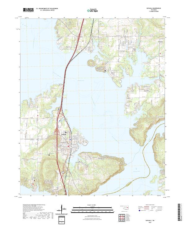 2022 Eufaula2022 Print · USGSOklahoma's lake country comes into focus in this recent study of the area where the Canadian rivers meet. Researchers can trace local heritage at McIntosh County Courthouse or locate family sites at Greenwood Cem and Fishertown Cem.
 - 2022 Map of Warner NW, 2022 Print
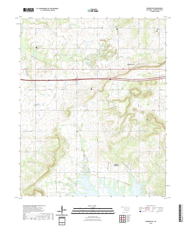 2022 Warner NW2022 Print · USGSMcIntosh County shoreline communities near the northern reaches of Eufaula Lake are documented in this recent survey. Genealogists can locate numerous burial sites including West Cem and Twin Grove Cem near Shady Grove.
 - 2022 Map of Texanna, 2022 Print
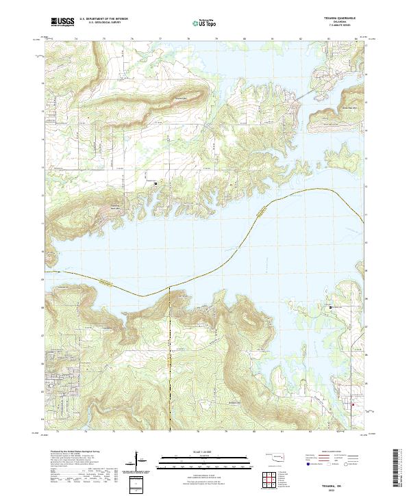 2022 Texanna2022 Print · USGSThe shorelines of eastern Oklahoma meet the elevations of the Cookson Hills region in this modern survey of the lake country. Genealogists and local historians can trace family locations near Triplett Cem, the peaks of Texanna Mtn, and the residential inlets of Eufaula Lake.
 - 2023 Map of Checotah, 2023 Print
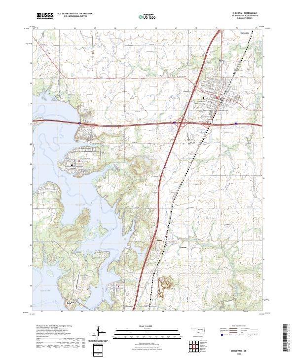 2023 Checotah2023 Print · USGSThe community of Checotah and the northern reaches of Eufaula Lake are documented here in the early twenty-first century. Genealogists and historians can trace cemetery locations like Indian Territory Checotah Cem and rural settlements such as Onapa and Texanna.
End of results
Showing maps 1-4 of 4
Top cities near Texanna
- Checotah historical maps
- Eufaula historical maps
- Warner historical maps
- Quinton historical maps
- Crowder historical maps
- Oktaha historical maps
See more
Top neighborhoods of Texanna
Frequently asked questions
- What are the different types of historical maps available for Texanna?
- What is the oldest map of Texanna?
- Where can I purchase historical maps of Texanna for my home or office?
- Where can I download high-res historical maps of Texanna?
- Are there historical topographic maps available for Texanna?
- Is there historical aerial imagery available for Texanna?
- Where are historical maps of Texanna sourced from?