Old Maps of Texanna, Oklahoma for Academic Research
Study the evolution of Texanna with 33 high-resolution historic maps. Whether you're teaching, researching, or modeling changes in land use, these maps provide essential visual documentation of urban, environmental, and geographic change.
- Analyze long-term change: Track patterns in development, transportation, and natural features.
- Ideal for environmental or urban studies: Support academic projects with primary historical map data.
- Use in the classroom or lab: Educators and researchers rely on these maps to bring historical context to life.
These maps are a powerful tool for teaching, research, and visualizing how Texanna has changed over the decades.
Texanna, OK maps
(33)- 1900 Map of Sansbois
 1900 Sansbois1900 Print · USGSIndian Territory in the late nineteenth century is documented here through its tribal boundaries and early river settlements. Genealogists can trace family roots near Stigler, Porum, and Whitefield, or locate the isolated station at Sandtown along the St L & S F R R.2 unique versions available
 - 1900 Map of Canadian
 1900 Canadian1900 Print · USGSIndian Territory at the turn of the century shows a landscape of tribal nations and developing rail towns along the CANADIAN RIVER. Genealogists and historians can trace early settlements like Fishertown and Indianola or the original Creek Nation Choctaw Nation Boundary Line.6 unique versions available
 - 1909 Map of Sans Bois, 1954 Print
 1909 Sans Bois1954 Print · USGSHaskell and Muskogee counties are seen here in the decade following statehood, when rail lines and river crossings dictated the pulse of rural life. Genealogists can trace family roots through numerous local landmarks like Kanima P O, Belle Starr School, and the Sansbois Sta.
 - 1911 Map of Sansbois
 1911 Sansbois1911 Print · USGSEastern Oklahoma's river valleys and rugged hills come alive in this early twentieth-century survey of the Choctaw Nation's western reaches. Researchers can locate rural landmarks like Sansbois Station, the Belle Starr School, and early river crossings such as the Thornton Ferry.3 unique versions available
 - 1946 Map of Fort Smith
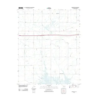
 1946 Fort Smith1946 Print · USGSThe Arkansas-Oklahoma borderlands appear here in the mid-forties, as new reservoirs began to transform the river valleys. Genealogists and historians can trace rail-served towns from Muskogee to Fort Smith and locate landmarks like Camp Chaffee.
 - 1963 Map of Warner NW, 1964 Print
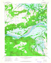
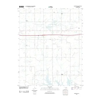
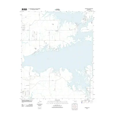
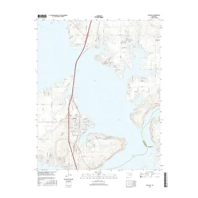
 1963 Warner NW1964 Print · USGSMcIntosh County in the early sixties shows the rising waters of the Eufaula Reservoir and the scars of local industry. Genealogists and historians can trace the Old Indian Treaty Boundary and locate landmarks like Paradise Cem and the Strip Mine.3 unique versions available
 - 1963 Map of Eufaula, 1964 Print
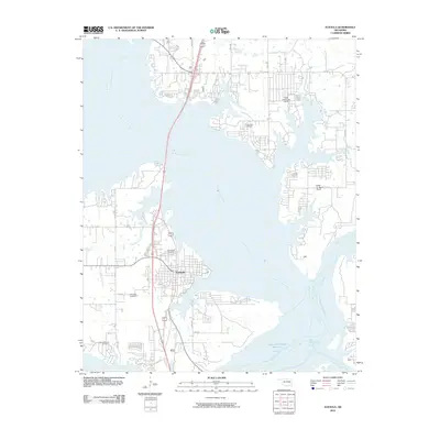
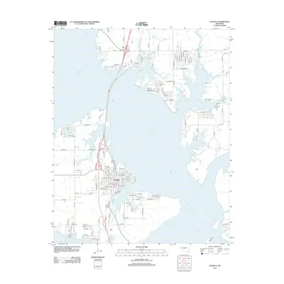
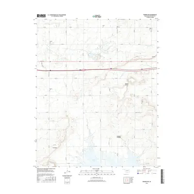
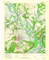 1963 Eufaula1964 Print · USGSThe McIntosh County seat is shown here in the early sixties during the creation of its namesake reservoir. Researchers can trace the original riverbanks before the flooding of the Eufaula Reservoir and locate local landmarks like West Eufaula Ch and McIntosh Cem.3 unique versions available
 - 1963 Map of Checotah, 1964 Print
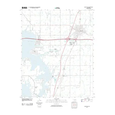
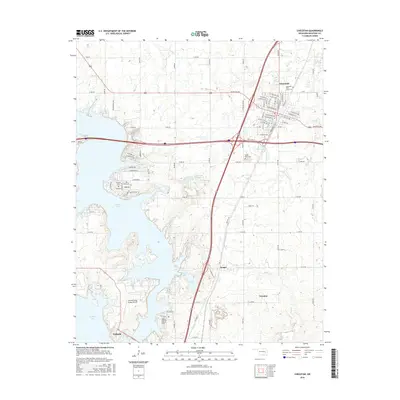
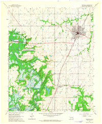 1963 Checotah1964 Print · USGSMcIntosh County during the early sixties shows the landscape changing as the Eufaula Reservoir began to take shape. Genealogists and historians can locate Richard Cem, Deep Fork Ch, and the original rail-side layout of Onapa before the valley was inundated.3 unique versions available
 - 1963 Map of Texanna, 1964 Print
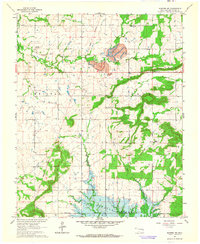
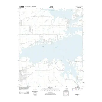
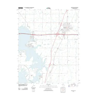
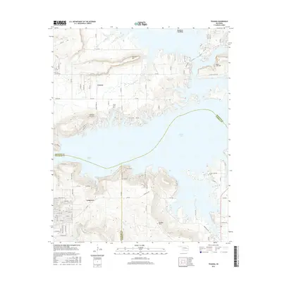
 1963 Texanna1964 Print · USGSOklahoma's river valleys were undergoing a massive transformation in the early sixties as the reservoir began to fill. Researchers can trace land tracts near the Old Indian Treaty Boundary or find family sites like Lindsey Chapel and Triplett Cem.3 unique versions available
 - 1965 Map of Fort Smith
 1965 Fort Smith1965 Print · USGSEastern Oklahoma and Western Arkansas are captured here during a period of massive post-war change as new reservoirs reshaped the river valleys. Genealogists and historians can trace the rail networks of the Midland Valley RR and find established communities like Stilwell, Sallisaw, and Stigler.
 - 1967 Map of Fort Smith
 1967 Fort Smith1967 Print · USGSThe Arkansas River valley and the foothills of the Ozarks are captured here during a period of significant military and industrial activity. Researchers can trace the sprawling bounds of Camp Chaffee and Camp Gruber or locate vanished rail stops along the Midland Valley RR.
 - 1978 Map of Eufaula, 1979 Print
 1978 Eufaula1979 Print · USGSEastern Oklahoma in the late seventies is defined by the sprawling waters of Eufaula Lake and the dense timber of the Sans Bois Mountains. Genealogists and historians can trace the development of towns like Checotah and Stigler or locate legacy sites like the Old R R Grade and Robbers Cave State Park.
 - 1978 Map of Fort Smith, 1979 Print
 1978 Fort Smith1979 Print · USGSThe Arkansas-Oklahoma borderlands in the late seventies show a landscape shaped by massive river reservoirs and sprawling military reservations. Trace the historic rail lines of the Missouri Pacific RR and locate regional landmarks like Fort Gibson, Tenkiller Ferry Lake, and Barling.2 unique versions available
 - 2010 Map of Texanna, 2010 Print
 2010 Texanna2010 Print · USGSCovers Texanna, including Longtown, Duchess Landing, and other nearby areas
 - 2010 Map of Eufaula, 2010 Print
 2010 Eufaula2010 Print · USGSCovers Texanna, including Eufaula, Longtown, and other nearby areas
 - 2010 Map of Checotah, 2010 Print
 2010 Checotah2010 Print · USGSCovers Texanna, including Checotah, Eufaula, and other nearby areas
 - 2010 Map of Warner NW, 2010 Print
 2010 Warner NW2010 Print · USGSCovers Texanna, including Shady Grove, Duchess Landing, and other nearby areas
 - 2012 Map of Checotah, 2012 Print
 2012 Checotah2012 Print · USGSCovers Texanna, including Checotah, Eufaula, and other nearby areas
 - 2012 Map of Eufaula, 2012 Print
 2012 Eufaula2012 Print · USGSCovers Texanna, including Eufaula, Longtown, and other nearby areas
 - 2012 Map of Texanna, 2012 Print
 2012 Texanna2012 Print · USGSCovers Texanna, including Longtown, Duchess Landing, and other nearby areas
 - 2012 Map of Warner NW, 2012 Print
 2012 Warner NW2012 Print · USGSCovers Texanna, including Shady Grove, Duchess Landing, and other nearby areas
 - 2016 Map of Texanna, 2016 Print
 2016 Texanna2016 Print · USGSCovers Texanna, including Longtown, Duchess Landing, and other nearby areas
 - 2016 Map of Eufaula, 2016 Print
 2016 Eufaula2016 Print · USGSCovers Texanna, including Eufaula, Longtown, and other nearby areas
 - 2016 Map of Checotah, 2016 Print
 2016 Checotah2016 Print · USGSCovers Texanna, including Checotah, Eufaula, and other nearby areas
 - 2016 Map of Warner NW, 2016 Print
 2016 Warner NW2016 Print · USGSCovers Texanna, including Shady Grove, Duchess Landing, and other nearby areas
Showing maps 1-25 of 33
Top cities near Texanna
- Checotah historical maps
- Eufaula historical maps
- Warner historical maps
- Quinton historical maps
- Crowder historical maps
- Oktaha historical maps
See more
Top neighborhoods of Texanna
Frequently asked questions
- What are the different types of historical maps available for Texanna?
- What is the oldest map of Texanna?
- Where can I purchase historical maps of Texanna for my home or office?
- Where can I download high-res historical maps of Texanna?
- Are there historical topographic maps available for Texanna?
- Is there historical aerial imagery available for Texanna?
- Where are historical maps of Texanna sourced from?