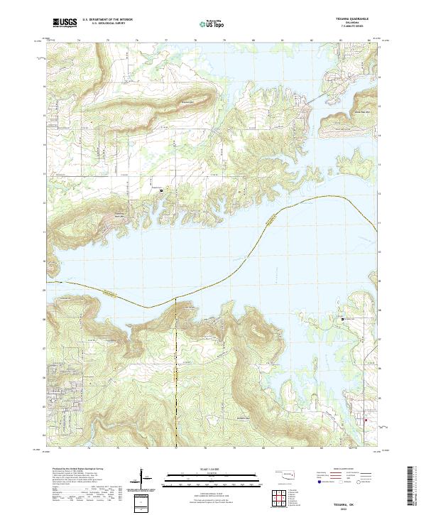
2022 Map of Texanna
USGS Topo · Published 2022About this map
Eufaula Lake dominates this landscape where the waters of the Canadian River meet the complex shorelines of McIntosh, Haskell, and Pittsburg counties. The topography is defined by prominent elevations like Texanna Mtn and Standing Rock Mtn, which rise above the inundated river valley. This 2022 survey details a transition from the dense residential developments along Oak Park Ln and Violet Dr to the more open, high-elevation terrain of Black Haw Mtn and Brooken Mtn. Small family or community landmarks remain preserved in the landscape, including Triplett Cem near the lake’s edge and Brooken Cem further south. The map documents the extensive network of rural routes such as Texanna Rd and Lindsey Chapel Rd that navigate the jagged peninsulas and inlets formed by Texanna Branch and Brooken Creek.
Find a feature on this map
93 named features on this map. Tap any name to fly to it.
Don’t see what you’re looking for? This feature index may not catch every label — zoom into the map to look around manually.
Map Details
Editions of this 2022 Texanna Map
This is the sole edition of this map. No revisions or reprints were ever made.
Other maps of this area

1900 · Sansbois
USGS Topo · 1:125,000

1900 · Canadian
USGS Topo · 1:125,000

1909 · Sans Bois
USGS Topo · 1:125,000

1911 · Sansbois
USGS Topo · 1:125,000

1946 · Fort Smith
USGS Topo · 1:250,000

1963 · Porum
USGS Topo · 1:24,000

1963 · Warner NW
USGS Topo · 1:24,000

1963 · Eufaula
USGS Topo · 1:24,000

1963 · Checotah
USGS Topo · 1:24,000

1963 · Texanna
USGS Topo · 1:24,000