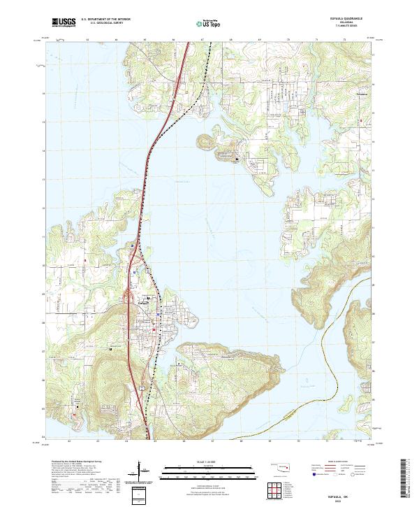
2022 Map of Eufaula
USGS Topo · Published 2022About this map
The confluence of the North Canadian River and the Canadian River dominates this modern landscape, where the waters of Eufaula Lake reach into numerous inlets and bays. The city of Eufaula serves as a central hub, situated along the western shore where the McIntosh County Courthouse marks the local seat of government. The map reveals a complex interface between water and land, characterized by extensive residential developments like Texanna and numerous named roads that service the lake's many peninsulas. Genealogists and local historians will find several burial grounds documented throughout the area, including Greenwood Cem, Evergreen Cem, McIntosh Cem, and the more remote Fishertown Cem. The presence of the McIntosh Co Pittsburg Co line in the south highlights the region's administrative boundaries amidst its significant hydraulic geography.
Find a feature on this map
122 named features on this map. Tap any name to fly to it.
Don’t see what you’re looking for? This feature index may not catch every label — zoom into the map to look around manually.
Map Details
Editions of this 2022 Eufaula Map
This is the sole edition of this map. No revisions or reprints were ever made.
Other maps of this area

1900 · Sansbois
USGS Topo · 1:125,000

1900 · Canadian
USGS Topo · 1:125,000

1909 · Sans Bois
USGS Topo · 1:125,000

1911 · Sansbois
USGS Topo · 1:125,000

1946 · Fort Smith
USGS Topo · 1:250,000

1962 · Pierce
USGS Topo · 1:24,000

1963 · Warner NW
USGS Topo · 1:24,000

1963 · Stidham
USGS Topo · 1:24,000

1963 · Eufaula
USGS Topo · 1:24,000

1963 · Checotah
USGS Topo · 1:24,000