Old Maps of Murray County, Oklahoma for Metal Detecting
Plan your next treasure hunt with 96 historic maps of Murray County. Find old homesites, ghost towns, trails, and gathering spots that may be lost to time — perfect for identifying promising metal detecting locations.
- Locate forgotten sites: Uncover places like long-lost settlements, abandoned rail lines, or gathering spots.
- Plan better hunts: Use map overlays combined with LiDAR or satellite views to narrow in on historically rich areas.
- Made for detectorists: Thousands of hobbyists use these maps to discover relics, coins, and hidden history.
Use these historic maps to boost your research and find new opportunities beneath the surface of Murray County.
Murray County, OK maps
(96)- 1898 Map of Pauls Valley, 1954 Print
 1898 Pauls Valley1954 Print · USGSThe Chickasaw Nation is documented at the turn of the century, showing the rail-driven growth of the Washita River valley. Researchers can trace early settlements like Whitebead and Wynnewood along the Gulf Colorado and Santa Fe RR.
 - 1901 Map of Stonewall
 1901 Stonewall1901 Print · USGSBefore Oklahoma statehood, this late-century survey captures the Chickasaw Nation and Seminole Nation borderlands in high detail. Researchers can locate early schools like Collins Institute and trace the paths between settlements such as Stonewall, Ada, and Fitzhugh.4 unique versions available
 - 1901 Map of Tishomingo
 1901 Tishomingo1901 Print · USGSThe Chickasaw Nation comes to life in this late-frontier survey of Johnston County and the surrounding Indian Territory. Genealogists and historians can locate early industrial sites like the Asphalt Mines, the landmark Harley Institute, and the site of Fort Washita.4 unique versions available
 - 1901 Map of Ardmore
 1901 Ardmore1901 Print · USGSThe Chickasaw Nation of Indian Territory is captured here at the turn of the century, showing a landscape of burgeoning rail towns and early industry. Researchers can trace the Gulf Colorado and Santa Fe line through Ardmore or locate early Asphalt Mine sites near Newport.6 unique versions available
 - 1902 Map of Pauls Valley
 1902 Pauls Valley1902 Print · USGSThe Chickasaw Nation at the turn of the century shows a landscape of river-valley agriculture and burgeoning rail towns. Genealogists and historians can trace the early footprints of Pauls Valley, Wynnewood, and Whitebead before statehood.5 unique versions available
 - 1918 Map of Ardmore
 1918 Ardmore1918 Print · USGSSouthern Oklahoma was a hub of energy production and rail traffic during the late teens. Researchers can trace the early infrastructure of the Healdton Oil Fields, find vanished sites like Joiner City, or locate the Post Oak School.
 - 1957 Map of Ardmore, 1968 Print
 1957 Ardmore1968 Print · USGSSouth-central Oklahoma in the late fifties was a landscape of rising reservoir waters and expanding rail lines. Genealogists and historians can trace the foundations of Ardmore and Duncan or locate early recreation sites at Platt National Park and Lake Murray State Park.3 unique versions available
 - 1963 Map of Ardmore
 1963 Ardmore1963 Print · USGSSouthern Oklahoma during the early sixties shows a landscape defined by the Arbuckle Mountains and a booming energy economy. Genealogists and historians can trace family-named sites across the Ardmore Oil Field, find old schools like Southeastern State College, or locate historic markers such as Boggy Depot State Park.2 unique versions available
 - 1963 Map of Sulphur South, 1964 Print
 1963 Sulphur South1964 Print · USGSMurray County's rolling landscape and mineral springs are documented here in the early sixties as the area around Sulphur developed. Researchers can trace rural life through landmarks like Fletcher Cem, the Fish Hatchery, and the old settlement of Drake.2 unique versions available
 - 1963 Map of Nebo, 1964 Print
 1963 Nebo1964 Print · USGSOklahoma's Arbuckle Mountains region is documented here in the early sixties, showing a landscape defined by the winding Washita River. Researchers can locate old community landmarks like the Nebo Sch and several family burial sites, including Hutchins Cem and Lone Cedar Cem.2 unique versions available
 - 1964 Map of Gene Autry, 1965 Print
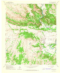 1964 Gene Autry1965 Print · USGSThe Arbuckle Mountains meet the Washita River during the mid-1960s, a period of industrial expansion for Carter County. Researchers can trace the heritage of Gene Autry and locate local landmarks like Academy Ch, Big Canyon Cem, and the Ardmore Municipal Airport.3 unique versions available
 - 1964 Map of Turner Falls, 1966 Print
 1964 Turner Falls1966 Print · USGSThe Arbuckle Mountains meet the Washita River in the mid-1960s, a time of significant highway expansion and recreation growth. Trace the waterfalls of Honey Creek, find the Green Hill Cem, or locate landmarks like the Jolly Aero Airport and Cedar Village.2 unique versions available
 - 1965 Map of Pauls Valley NE, 1966 Print
 1965 Pauls Valley NE1966 Print · USGSGarvin County was a landscape of active petroleum production and rural community life in the mid-1960s. Genealogists and local historians can trace the exact locations of Cottrells Mission, Lewis Cem, and schools like Oak Dale Sch.2 unique versions available
 - 1965 Map of Pauls Valley, 1966 Print
 1965 Pauls Valley1966 Print · USGSGarvin County's river-and-rail corridor is captured here in the mid-sixties as the local economy balances agriculture with a thriving petroleum industry. Genealogists and historians can trace family-named landmarks including Mt Olive Cemetery, Oaklawn Cem, and the Hoover Oil Field.3 unique versions available
 - 1965 Map of Davis, 1966 Print
 1965 Davis1966 Print · USGSMid-century Murray County is shown here during a period of industrial growth, where the town of Davis sits surrounded by several active oil fields. Researchers can locate the Sandy Ch Cem, follow the Old RR Grade, and trace family roots near Chigley or Iona.2 unique versions available
 - 1965 Map of Joy, 1966 Print
 1965 Joy1966 Print · USGSThe Arbuckle Mountains and Washita River valley are captured here in the mid-1960s, showing a landscape defined by oil production and frontier history. Researchers can locate the Fort Arbuckle Ruins, trace the Gulf Colorado and Santa Fe rail line, or find family names at Butterfly Cem and Chigley.2 unique versions available
 - 1965 Map of Dougherty, 1966 Print
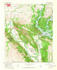 1965 Dougherty1966 Print · USGSThe Arbuckle Mountains and Washita River valley are captured mid-transition in the 1960s as a new reservoir begins to fill. Researchers can locate the Arbuckle Dam (Under Constr) and trace family landmarks like James Cem or the Falls Creek Assembly.3 unique versions available
 - 1967 Map of Roff South, 1968 Print
 1967 Roff South1968 Print · USGSPontotoc and Murray counties are captured here in the late sixties as the local economy balanced ranching, rail transit, and resource extraction. Researchers can trace the St Louis - San Francisco line through Scullin, locate family plots at Hickory Cem, and explore the grounds of Winrock Farms.3 unique versions available
 - 1967 Map of Sulphur North, 1968 Print
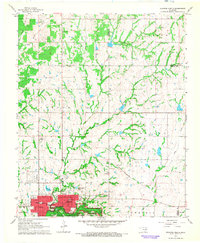 1967 Sulphur North1968 Print · USGSMurray County's landscape in the late sixties reveals the organized street grid of Sulphur just as it bordered the Platt National Park. Researchers can trace the St Louis-San Francisco railroad and locate historic sites like Oaklawn Cemetery, Washington Sch, and the Flowing Well.3 unique versions available
 - 1967 Map of Hart, 1968 Print
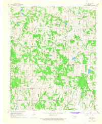 1967 Hart1968 Print · USGSGarvin County's rural landscape is captured here in the mid-1960s, showing a region shaped by winding creek systems and early oil exploration. Genealogists can locate family landmarks like Corley Cem, Hart Cem, and the Prairie View Mission near the town of Hart.2 unique versions available
 - 1968 Map of Fox NE, 1971 Print
 1968 Fox NE1971 Print · USGSThe Arbuckle Mountains landscape along the Carter and Murray county line is captured here in the late sixties. Researchers can trace rural landmarks and old watercourses such as Hennepin Cem, Mountain Lake, and the winding Eightmile Creek.
 - 1969 Map of Hennepin, 1971 Print
 1969 Hennepin1971 Print · USGSSouthern Oklahoma at the end of the sixties reveals a landscape shaped by petroleum production and deep-rooted rural settlements. Researchers can locate the Fort Arbuckle Ruins and trace the boundaries of the Elmore Oil Field near Hennepin.2 unique versions available
 - 1985 Map of Tishomingo, 1986 Print
 1985 Tishomingo1986 Print · USGSSouthern Oklahoma in the mid-eighties reveals a landscape shaped by significant water projects and conservation lands. Genealogists and historians can trace the footprints of communities like Wapanucka and Bromide alongside the Washita River and Lake Texoma.3 unique versions available
 - 1986 Map of Ardmore
 1986 Ardmore1986 Print · USGSSouthern Oklahoma in the mid-eighties was a landscape of rugged geology and deep petroleum roots. Genealogists and historians can trace the development of Ardmore and Healdon alongside the vast Sholem Alechem Oil Field and the rails of the AT & SF RR.2 unique versions available
 - 1986 Map of Pauls Valley
 1986 Pauls Valley1986 Print · USGSGarvin County and its neighbors are shown in the mid-1980s during a period of steady growth along the Washita River. Researchers can trace the path of the Atchison Topeka and Santa Fe railroad through Pauls Valley or locate rural sites like Mt Olive Church and Erin Springs.2 unique versions available
Showing maps 1-25 of 96
Top cities of Murray County
Frequently asked questions
- What are the different types of historical maps available for Murray County?
- What is the oldest map of Murray County?
- Where can I purchase historical maps of Murray County for my home or office?
- Where can I download high-res historical maps of Murray County?
- Are there historical topographic maps available for Murray County?
- Is there historical aerial imagery available for Murray County?
- Where are historical maps of Murray County sourced from?