
1965 Map of Pauls Valley NE
USGS Topo · Published 1966About this map
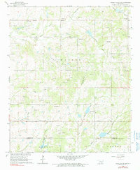
Cherokee Northeast Walker Nahola Oil Field dominates the landscape of north-central Garvin County in the mid-1960s, reflecting an era of intensive petroleum extraction. The terrain is a complex network of resource development and rural community life, where numerous Gravel Pits and oil wells are interspersed with small landmarks of local heritage. Social and religious life is anchored by sites like Cottrells Mission, Walker Ch, and Mt Zion Ch, while education is represented by the Oak Dale Sch and New Hope Sch.
Find a feature on this map
23 named features on this map. Tap any name to fly to it.
Don’t see what you’re looking for? This feature index may not catch every label — zoom into the map to look around manually.
Map Details
Editions of this 1965 Pauls Valley NE Map
2 editions found
Other maps of this area

1898 · Pauls Valley
USGS Topo · 1:125,000

1901 · Stonewall
USGS Topo · 1:125,000

1902 · Pauls Valley
USGS Topo · 1:125,000

1957 · Ardmore
USGS Topo · 1:250,000

1963 · Ardmore
USGS Topo · 1:250,000

1964 · Byars
USGS Topo · 1:24,000

1965 · Byars SW
USGS Topo · 1:24,000

1965 · Pauls Valley
USGS Topo · 1:24,000

1965 · Davis
USGS Topo · 1:24,000

1965 · Joy
USGS Topo · 1:24,000