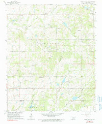
1965 Map of Pauls Valley NE
USGS Topo · Published 1990About this map
Sandy Creek and its many tributaries, including Negro Creek and Turkey Creek, define the rolling landscape of Garvin County in the mid-1960s. The region is characterized by a significant petroleum presence, with the East Pauls Valley Oil Field and the Northeast Walker Nahola Oil Field stretching across the terrain alongside numerous Gravel Pits.
Find a feature on this map
29 named features on this map. Tap any name to fly to it.
Don’t see what you’re looking for? This feature index may not catch every label — zoom into the map to look around manually.
Map Details
Editions of this 1965 Pauls Valley NE Map
2 editions found
Other maps of this area

1898 · Pauls Valley
USGS Topo · 1:125,000

1901 · Stonewall
USGS Topo · 1:125,000

1902 · Pauls Valley
USGS Topo · 1:125,000

1957 · Ardmore
USGS Topo · 1:250,000

1963 · Ardmore
USGS Topo · 1:250,000

1964 · Byars
USGS Topo · 1:24,000

1965 · Pauls Valley NE
USGS Topo · 1:24,000

1965 · Byars SW
USGS Topo · 1:24,000

1965 · Pauls Valley
USGS Topo · 1:24,000

1965 · Davis
USGS Topo · 1:24,000