
1964 Map of Byars
USGS Topo · Published 1966About this map
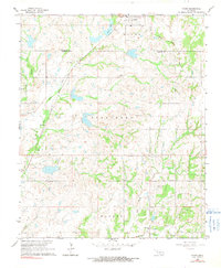
The town of Byars sits at the northern edge of this mid-1960s survey, marking a significant intersection of transport and industry along the Atchison Topeka and Santa Fe railroad. The landscape is characterized by a high density of rural cemeteries, including Dixon Chapel Cem, Abney Cem, and Clabber Flats Cem, which often represent the lasting footprint of earlier communities. The presence of multiple gravel pits and an extensive Oil Field with numerous Oil Wells scattered across the Stratford and Walker districts highlights the extractive economy that defined central Oklahoma's development. Smaller settlements such as Boudinot and Civit appear as modest hubs tied to the local stream network, which is dominated by Sandy Creek and East Peavine Creek. Near the southern border, the low-lying Clabber Flats suggests the topographical variation common to the transition between agricultural uplands and creek bottoms.
Find a feature on this map
27 named features on this map. Tap any name to fly to it.
Don’t see what you’re looking for? This feature index may not catch every label — zoom into the map to look around manually.
Map Details
Editions of this 1964 Byars Map
2 editions found
Other maps of this area

1898 · Pauls Valley
USGS Topo · 1:125,000

1901 · Stonewall
USGS Topo · 1:125,000

1902 · Pauls Valley
USGS Topo · 1:125,000

1957 · Ardmore
USGS Topo · 1:250,000

1963 · Ardmore
USGS Topo · 1:250,000

1965 · Pauls Valley NE
USGS Topo · 1:24,000
1965 · Rosedale
USGS Topo · 1:24,000

1965 · Byars SW
USGS Topo · 1:24,000

1965 · Pauls Valley
USGS Topo · 1:24,000
1965 · Wanette
USGS Topo · 1:24,000