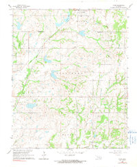
1964 Map of Byars
USGS Topo · Published 1991About this map
Byars sits at the northern edge of this landscape where the Atchison Topeka and Santa Fe railroad cuts across the terrain near Byars Lake. The map captures a rural Oklahoma setting defined by small settlements and the persistent footprint of the energy industry, with a sprawling Oil Field and numerous oil wells dotted across the southern half of the quadrangle. Significant for genealogists and local historians, several small burial grounds are meticulously documented, including Abney Cem, Clabber Flats Cem, and Civit Cem near the small community of Civit. The landscape is etched by drainage systems like Little Peavine Creek and Sandy Creek, while the presence of several Gravel Pits indicates the local extractive economy. Landmarks such as Dixon Chapel and its associated Dixon Chapel Cem provide specific points of reference for those tracing early township history in McClain and Garvin Counties.
Find a feature on this map
24 named features on this map. Tap any name to fly to it.
Don’t see what you’re looking for? This feature index may not catch every label — zoom into the map to look around manually.
Map Details
Editions of this 1964 Byars Map
2 editions found
Other maps of this area

1898 · Pauls Valley
USGS Topo · 1:125,000

1901 · Stonewall
USGS Topo · 1:125,000

1902 · Pauls Valley
USGS Topo · 1:125,000

1957 · Ardmore
USGS Topo · 1:250,000

1963 · Ardmore
USGS Topo · 1:250,000

1964 · Byars
USGS Topo · 1:24,000

1965 · Pauls Valley NE
USGS Topo · 1:24,000
1965 · Rosedale
USGS Topo · 1:24,000

1965 · Byars SW
USGS Topo · 1:24,000

1965 · Pauls Valley
USGS Topo · 1:24,000