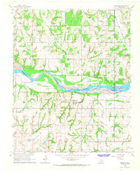
1965 Map of Rosedale
USGS Topo · Published 1966About this map
The Canadian River winds through this mid-1960s landscape, serving as a natural boundary between Cleveland, McClain, and Pottawatomie counties. The settlement of Rosedale occupies the southern portion of the map, anchored by the Rosedale Sch and Rosedale Cem. The area reflects a rural economy shaped by both agriculture and petroleum extraction, with numerous wells scattered across the Rosedale Oil Field and the North Red Springs Oil Field to the north. Smaller communities like Corbett and Box appear as clusters of activity, each supported by local institutions such as Douglas Ch and Mt Zion Ch. Fine red dashed lines throughout the quadrangle provide a unique look at property boundaries and field lines as they existed during the 1962 aerial photography and subsequent 1965 field check.
Find a feature on this map
30 named features on this map. Tap any name to fly to it.
Don’t see what you’re looking for? This feature index may not catch every label — zoom into the map to look around manually.
Map Details
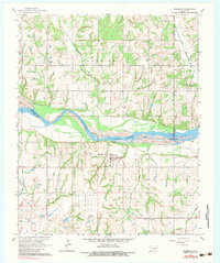
Editions of this 1965 Rosedale Map
2 editions found
Other maps of this area

1893 · Norman
USGS Topo · 1:62,500

1898 · Purcell
USGS Topo · 1:125,000

1898 · Pauls Valley
USGS Topo · 1:125,000

1902 · Pauls Valley
USGS Topo · 1:125,000

1910 · McComb
USGS Topo · 1:62,500

1936 · Norman
USGS Topo · 1:62,500

1954 · Oklahoma City
USGS Topo · 1:250,000

1957 · Ardmore
USGS Topo · 1:250,000

1957 · Oklahoma City
USGS Topo · 1:250,000
1958 · Tribbey
USGS Topo · 1:24,000