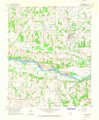
1965 Map of Wanette
USGS Topo · Published 1966About this map
Canadian River bottomlands define the southern half of this landscape, marking the boundary between Pottawatomie and McClain counties. In the mid-1960s, the area around Wanette supported a robust petroleum industry, evidenced by the numerous named production areas such as the South Wanette Oil Field and the Northwest Wanette Oil Field. The town of Wanette itself is a focal point of infrastructure, served by the A T & S F railroad and surrounded by several local burial grounds including the Wanette Cem and Martin Hill Cem. To the south, near Johnsonville, an Old RR Grade reflects the evolving transportation network as it cuts through the terrain near Sandy Creek. This survey reveals a transition from the agricultural river valley to the active energy production zones that shaped the local economy during this era.
Find a feature on this map
23 named features on this map. Tap any name to fly to it.
Don’t see what you’re looking for? This feature index may not catch every label — zoom into the map to look around manually.
Map Details
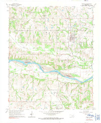
Editions of this 1965 Wanette Map
2 editions found
Other maps of this area

1896 · Seminole and Prague
USGS Topo · 1:125,000

1898 · Purcell
USGS Topo · 1:125,000

1898 · Pauls Valley
USGS Topo · 1:125,000

1901 · Stonewall
USGS Topo · 1:125,000

1902 · Pauls Valley
USGS Topo · 1:125,000

1907 · Maud
USGS Topo · 1:62,500

1908 · Maud
USGS Topo · 1:62,500

1910 · McComb
USGS Topo · 1:62,500

1954 · Oklahoma City
USGS Topo · 1:250,000

1957 · Ardmore
USGS Topo · 1:250,000