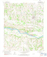
1965 Map of Wanette
USGS Topo · Published 1991About this map
Wanette and the surrounding prairie of south-central Oklahoma are defined by the broad, braided course of the Canadian River and a prolific petroleum landscape. Surveyed in the mid-1960s, this area reflects the maturity of the region's oil industry, with extensive infrastructure including the Northwest Wanette Oil Field, Northeast Crossroads Oil Field, and West Wanette Oil Field scattered across the townships of Eason and Byars. The town of Wanette sits as a central hub, historically connected by the A T & S F rail line, though several sections of the transport network are already marked as Old Railroad Grade. Smaller communities like Johnsonville and Byars anchor the southern reaches near the riverbanks. Local history is preserved in several burial grounds, including Wanette Cem, New Johnsonville Cem, and Martin Hill Cem, providing clear geographic markers for genealogical research in both Pottawatomie and McClain counties.
Find a feature on this map
25 named features on this map. Tap any name to fly to it.
Don’t see what you’re looking for? This feature index may not catch every label — zoom into the map to look around manually.
Map Details
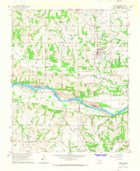
Editions of this 1965 Wanette Map
2 editions found
Other maps of this area

1896 · Seminole and Prague
USGS Topo · 1:125,000

1898 · Purcell
USGS Topo · 1:125,000

1898 · Pauls Valley
USGS Topo · 1:125,000

1901 · Stonewall
USGS Topo · 1:125,000

1902 · Pauls Valley
USGS Topo · 1:125,000

1907 · Maud
USGS Topo · 1:62,500

1908 · Maud
USGS Topo · 1:62,500

1910 · McComb
USGS Topo · 1:62,500

1954 · Oklahoma City
USGS Topo · 1:250,000

1957 · Ardmore
USGS Topo · 1:250,000