2020s Maps of Muskogee County, Oklahoma
Explore 24 historic maps of Muskogee County from the 2020s. These maps offer a rare glimpse into what life looked like during the 2020s — showing old roads, neighborhoods, homes, and landmarks that have changed or disappeared over time.
Whether you're researching your family's past, planning a metal detecting trip, or studying how Muskogee County's landscape evolved across the 2020s, these high-resolution maps are a powerful tool for exploring the history of this region.
- Focus on a specific era: All maps on this page are from the 2020s, giving you a focused view of this time period.
- See what’s changed: Compare century-old streets, trails, and buildings to today's modern landscape using overlays and satellite layers.
- Research with precision: Use these maps for genealogy, historical research, land use analysis, or educational projects.
- View, download, or print: Maps are fully viewable online in high resolution, and can be downloaded or printed for your own records.
Start exploring Muskogee County's history through authentic maps from the 2020s. This is your window into the past.
Muskogee County, OK maps
(24)- 2022 Map of Stigler NE, 2022 Print
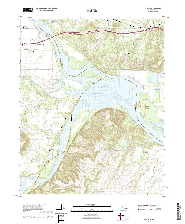 2022 Stigler NE2022 Print · USGSThe confluence of the Arkansas and Illinois Rivers defines this area in the early 2020s, dominated by the Robert S-Kerr Reservoir. Family historians can trace numerous burial sites including the Hanks Family Cem, Fields Cem, and Tom Girty Cem near the settlement of Tamaha.
 - 2022 Map of Keefton, 2022 Print
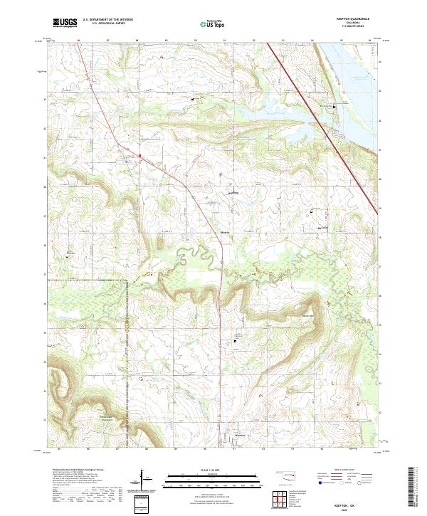 2022 Keefton2022 Print · USGSMuskogee County settlements and the southern banks of the Arkansas River are captured in this recent survey. Local historians can trace family sites at Agnew Cem and McLain Cem or locate rural landmarks near Keefton and Warner Mtn.
 - 2022 Map of Stigler East, 2022 Print
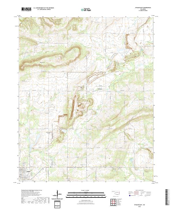 2022 Stigler East2022 Print · USGSHaskell County's seat at Stigler and the neighboring settlement of Garland are shown here in the early twenty-first century. Researchers can trace local history through the Garland Cem, the Haskell County Courthouse, and the winding path of Little Sans Bois Cr.
 - 2022 Map of Wainwright, 2022 Print
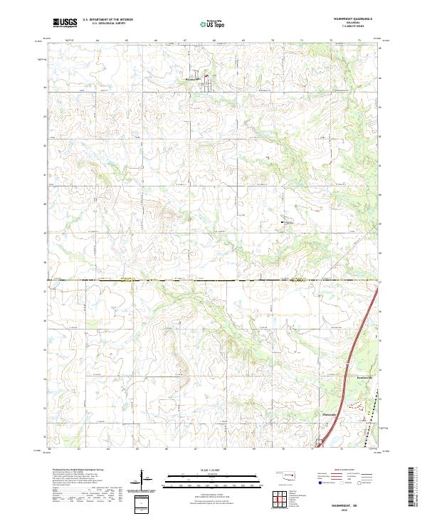 2022 Wainwright2022 Print · USGSMuskogee and McIntosh counties come together in this contemporary survey of the eastern Oklahoma countryside. Researchers can trace the local landscape through the Middleton Chapel Cemetery and the waters of Anderson Creek and Wayside Creek.
 - 2022 Map of Stigler West, 2022 Print
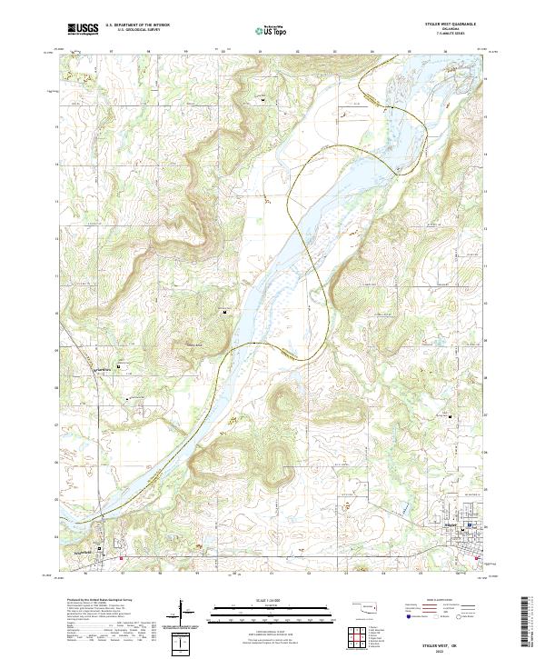 2022 Stigler West2022 Print · USGSThe Haskell and Muskogee county line follows the winding Canadian River in this contemporary survey of eastern Oklahoma. Researchers can trace family sites from Stigler to Briartown, locating landmarks like Starr Family Cem and Turkey Knob.
 - 2022 Map of Boynton, 2022 Print
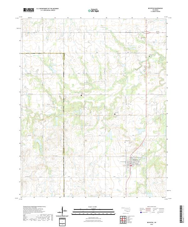 2022 Boynton2022 Print · USGSBoynton and the rural borderlands of Okmulgee and Muskogee Counties are shown here during the early twenty-first century. Genealogists can locate family burial sites at Charles Cem, Lee Cem, and the Boynton Cem while tracing the watershed of Cane Creek.
 - 2022 Map of Council Hill, 2022 Print
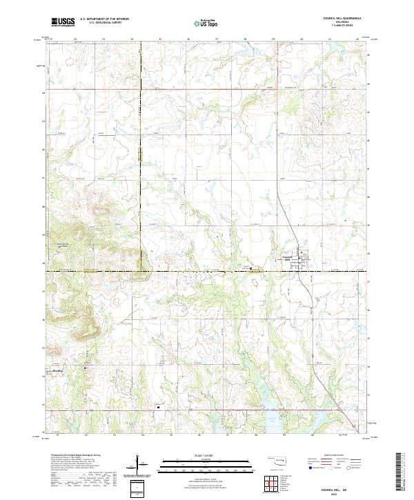 2022 Council Hill2022 Print · USGSEastern Oklahoma farmland and the High Spring Mountains meet in this contemporary survey of Council Hill and Hitchita. Genealogists can locate family sites at Council Hill Cem, Hitchita-Lackey Cem, and the Ridley Cem.
 - 2022 Map of Haskell, 2022 Print
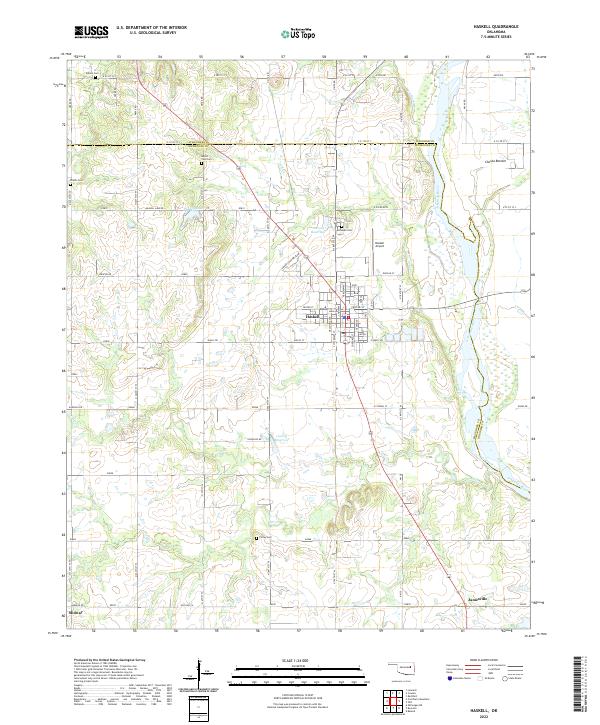 2022 Haskell2022 Print · USGSSettled along the river valley south of Tulsa, this contemporary Oklahoma landscape shows the agricultural and community layout of the region. Researchers can trace family sites at Haskell Cem or Phyllis Cem and locate landmarks like the Haskell Airport.
 - 2022 Map of Porum, 2022 Print
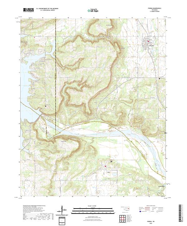 2022 Porum2022 Print · USGSAcross the rolling borderlands of Muskogee and Haskell Counties, this contemporary survey captures a region shaped by the Canadian River and Eufaula Lake. Genealogists can locate family sites at Hi Early Cem, Hoyt Cem, and the community of Whitefield.
 - 2022 Map of Braggs, 2022 Print
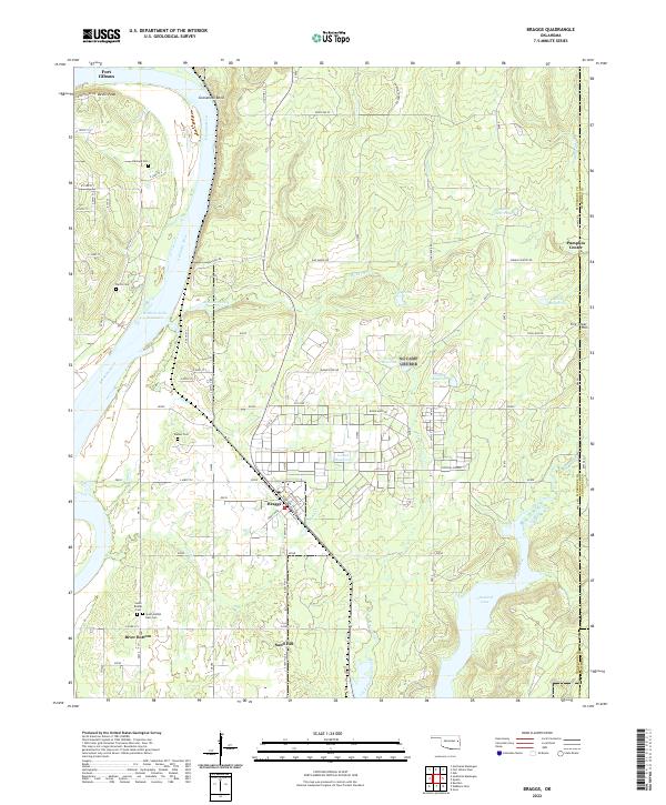 2022 Braggs2022 Print · USGSThe Arkansas River valley comes alive in this contemporary view of Muskogee County, showing the region's unique blend of riverfront lowlands and upland ridges. Genealogists can trace family footprints at Walker Cem and South Bethel Cem or explore the settlements of Braggs and Pumpkin Center.
 - 2022 Map of Okmulgee NE, 2022 Print
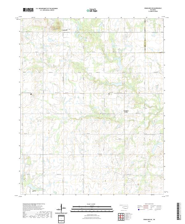 2022 Okmulgee NE2022 Print · USGSEastern Okmulgee County and the Muskogee County line are mapped here in the early 2020s. Genealogists can locate family sites near Bald Hill Cem and Antioch Cem, or trace the rural crossroads at Pumpkin Center and Bald Hill.
 - 2022 Map of Oktaha, 2022 Print
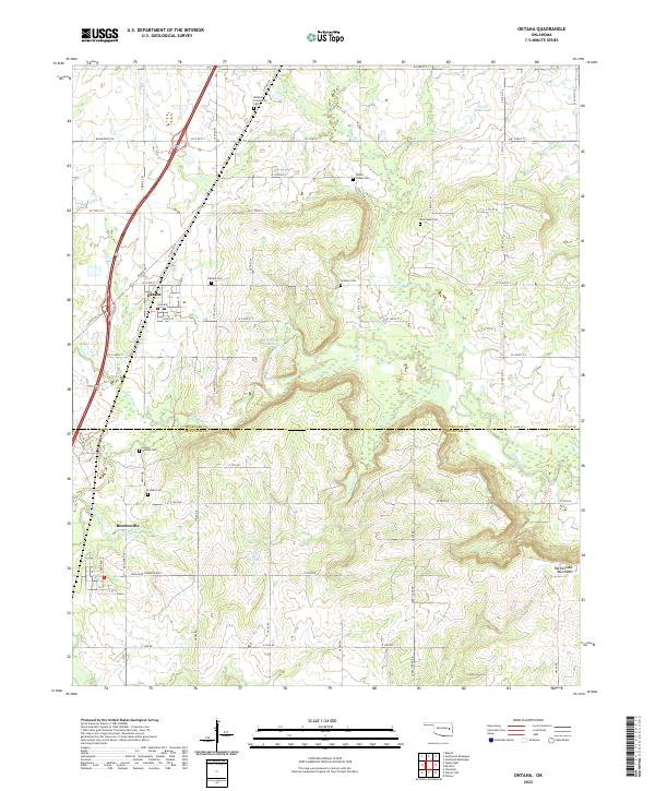 2022 Oktaha2022 Print · USGSOklahoma's prairie landscape near the Muskogee-McIntosh border is shown here in the 2020s, highlighting its long-standing rural communities and cemeteries. Researchers can locate ancestral sites like Oktaha Cem and New Hope Cem or trace terrain near Honey Springs.
 - 2022 Map of Beland, 2022 Print
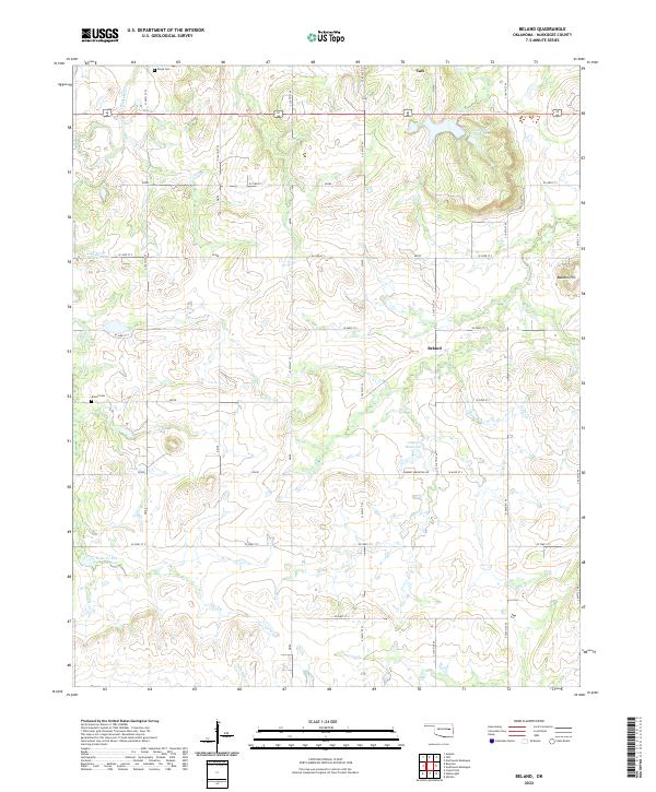 2022 Beland2022 Print · USGSMuskogee County's rural landscape comes into focus here during the early twenty-first century, showing a mix of established small towns and evolving water management. Genealogists and local researchers can trace family landmarks like Doyle Cem, Brown Cem, and the high ground of Baucum Hill.
 - 2022 Map of Fort Gibson Dam, 2022 Print
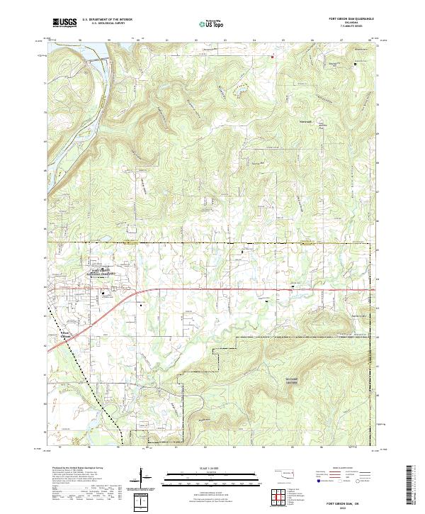 2022 Fort Gibson Dam2022 Print · USGSOklahoma's earliest settlements meet the rugged Ozark foothills in this 2022 look at the Fort Gibson area. Family historians can trace numerous burial grounds including the Fort Gibson National Cemetery, Andersons Cem, and Walker Cem across the varied landscape.
 - 2022 Map of Southeast Muskogee, 2022 Print
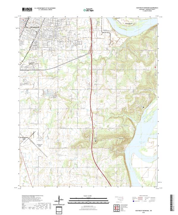 2022 Southeast Muskogee2022 Print · USGSMuskogee County in the early 2020s shows a landscape where aviation and river commerce meet the rising slopes of Brushy Mountain. Researchers can trace the modern boundaries of Muskogee alongside historic sites like Frozen Rock Cem and Fort Gibson.
 - 2022 Map of Webbers Falls, 2022 Print
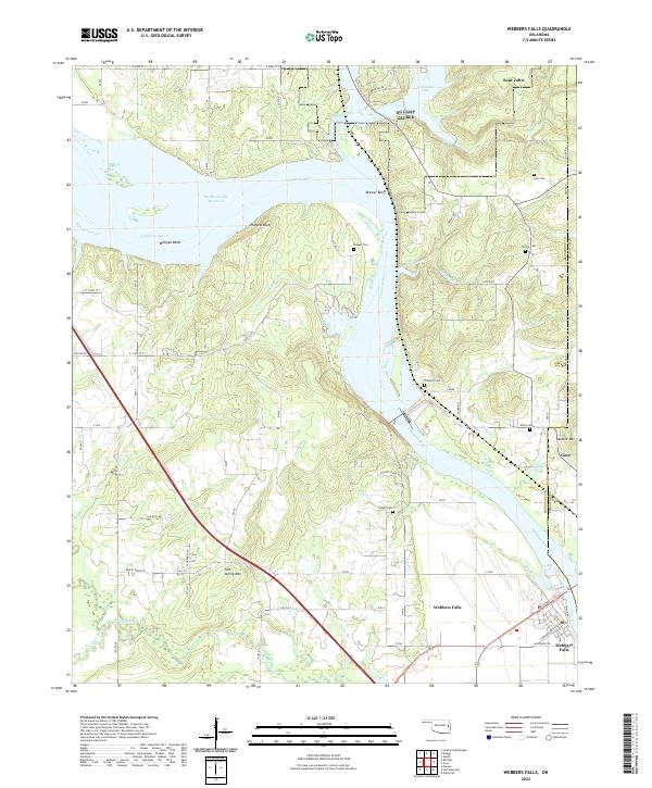 2022 Webbers Falls2022 Print · USGSThe Arkansas River corridor near the Muskogee and Sequoyah county line is documented here in the early twenty-first century. History seekers can trace the river landings and local settlements of Webbers Falls, Gore, and Sour John.
 - 2022 Map of Gore, 2022 Print
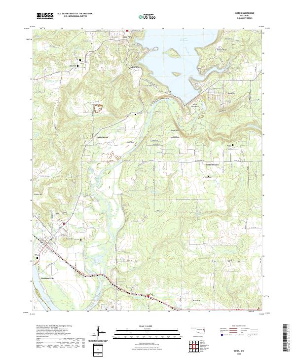 2022 Gore2022 Print · USGSThe Illinois and Arkansas Rivers meet here in the 2020s, a landscape defined by Cherokee history and the Tenkiller Ferry Lake dam. Researchers can trace family roots at Redbird Cem, the Gates Family Cem Gumsprings, or the community of Redbird Smith.
 - 2022 Map of Southwest Muskogee, 2022 Print
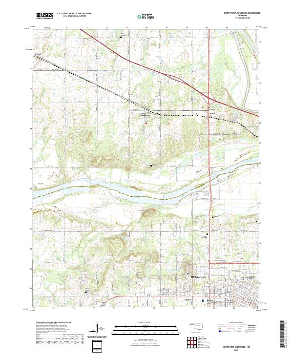
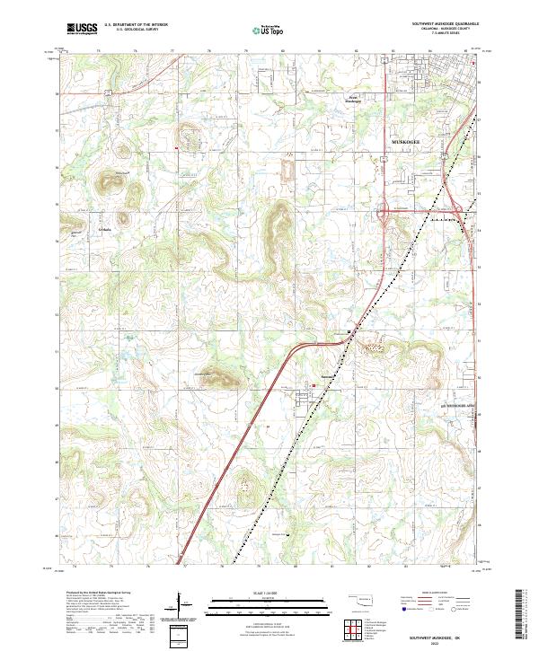 2022 Southwest Muskogee2022 Print · USGSMuskogee and its southwestern hinterlands appear here during a period of modern expansion into the surrounding hills. Genealogists and local historians can trace the outskirts of Muskogee toward rural landmarks like Plainview Cem, Chimney Mtn, and the community of Summit.
 - 2022 Map of Northeast Muskogee, 2022 Print
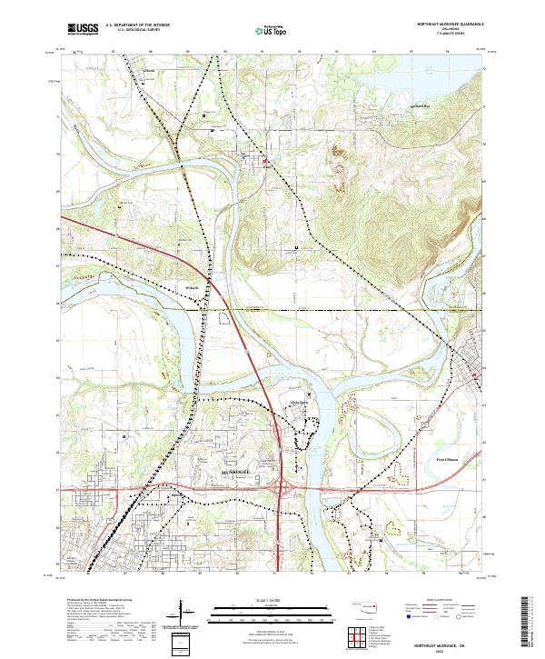 2022 Northeast Muskogee2022 Print · USGSMuskogee and its surrounding river valleys are captured here in the early twenty-first century as a hub of education and water-bound geography. Genealogists can trace family-named sites like Clingan Cem and Evergreen Cem or the grounds of Bacone College.
 - 2022 Map of Taft, 2022 Print
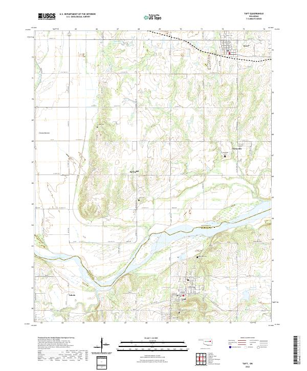 2022 Taft2022 Print · USGSThe river valley between Muskogee and Wagoner Counties comes alive in this modern survey of the Oklahoma plains. Genealogists and researchers can trace the locations of several community burial grounds, including Blackjack Cem, Clarksville Cem, and Vann Cem.
 - 2022 Map of Concharty Mountain, 2022 Print
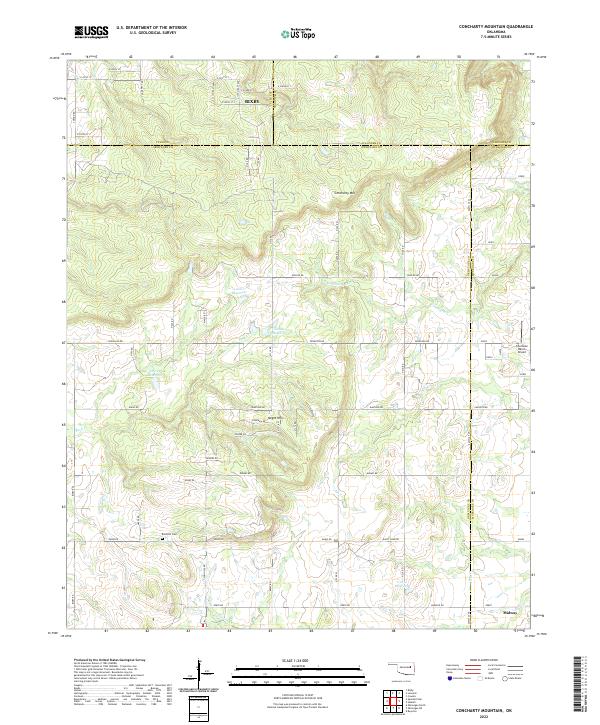 2022 Concharty Mountain2022 Print · USGSThe borderlands of Okmulgee and Tulsa counties are captured here in the early twenty-first century, showing a landscape of high ridges and rural homesteads. Genealogists and hikers can trace landmarks like Bald Hill Cem, Concharty Mtn, and the small community of Midway.
 - 2022 Map of Holt Mountain, 2022 Print
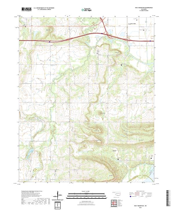 2022 Holt Mountain2022 Print · USGSEastern Oklahoma near the border of Muskogee and Haskell Counties comes into focus in this recent survey. Researchers can trace family history through a high concentration of cemeteries including Snake Girty Cem and Toney Cem near the settlement of Simms.
 - 2022 Map of Northwest Muskogee, 2022 Print
 2022 Northwest Muskogee2022 Print · USGSThe river valleys of eastern Oklahoma meet here in the early 2020s, showing the residential and educational growth of the area. Researchers can identify numerous burial sites such as Wyche Cem and Booker T Washington Cem near Tullahassee.
 - 2022 Map of Warner, 2022 Print
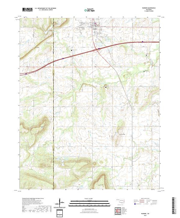 2022 Warner2022 Print · USGSThe town of Warner and its surrounding rural landscapes are documented here in the early 2020s. Local historians and genealogists can trace family footprints at Bennett Cem and Woodall Cem, or study the campus footprint of Connors State College.
End of results
Showing maps 1-24 of 24
Top cities of Muskogee County
- Muskogee historical maps
- Haskell historical maps
- Warner historical maps
- Porum historical maps
- Webbers Falls historical maps
- Taft historical maps
See more
Frequently asked questions
- What are the different types of historical maps available for Muskogee County?
- What is the oldest map of Muskogee County?
- Where can I purchase historical maps of Muskogee County for my home or office?
- Where can I download high-res historical maps of Muskogee County?
- Are there historical topographic maps available for Muskogee County?
- Is there historical aerial imagery available for Muskogee County?
- Where are historical maps of Muskogee County sourced from?