1970s Maps of Muskogee County, Oklahoma
Explore 29 historic maps of Muskogee County from the 1970s. These maps offer a rare glimpse into what life looked like during the 1970s — showing old roads, neighborhoods, homes, and landmarks that have changed or disappeared over time.
Whether you're researching your family's past, planning a metal detecting trip, or studying how Muskogee County's landscape evolved across the 1970s, these high-resolution maps are a powerful tool for exploring the history of this region.
- Focus on a specific era: All maps on this page are from the 1970s, giving you a focused view of this time period.
- See what’s changed: Compare century-old streets, trails, and buildings to today's modern landscape using overlays and satellite layers.
- Research with precision: Use these maps for genealogy, historical research, land use analysis, or educational projects.
- View, download, or print: Maps are fully viewable online in high resolution, and can be downloaded or printed for your own records.
Start exploring Muskogee County's history through authentic maps from the 1970s. This is your window into the past.
Muskogee County, OK maps
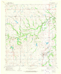
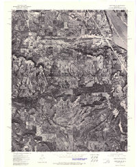
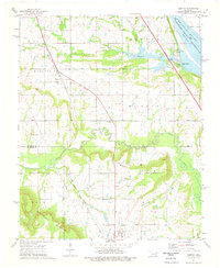
(29)- 1970 Map of Wainwright, 1972 Print
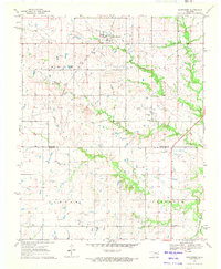 1970 Wainwright1972 Print · USGSCentral Muskogee County and northern McIntosh County appear in the early seventies as a rural landscape of ranching and energy. Genealogists can trace family names and landmarks like Middleton Cem and the Missouri - Kansas - Texas railroad line.
 - 1970 Map of Council Hill, 1972 Print
 1970 Council Hill1972 Print · USGSCouncil Hill and Hitchita appear at the convergence of three Oklahoma counties in the early seventies, just as the regional landscape was being reshaped. Genealogists and researchers can trace family sites at the Council Hill Cem, Ridley Cem, and New Hope Ch while exploring the developing shoreline of the Eufaula Reservoir.2 unique versions available
 - 1971 Map of Beland, 1972 Print
 1971 Beland1972 Print · USGSThe rail junction at Beland and the surrounding Muskogee County countryside are captured here in the early 1970s. Genealogists can trace local landmarks like Wilson Chapel and Doyle Cem alongside the area's active OIL FIELD.
 - 1971 Map of Okmulgee NE, 1972 Print
 1971 Okmulgee NE1972 Print · USGSOkmulgee and Muskogee counties are captured here in the early seventies, showcasing a rural landscape shaped by petroleum and agriculture. Researchers can locate local landmarks like Pumpkin Center, Antioch Cem, and the Ashley Landing Strip.2 unique versions available
 - 1971 Map of Boynton, 1972 Print
 1971 Boynton1972 Print · USGSBoynton and the surrounding plains of Muskogee County appear here during the early 1970s, showing a landscape defined by ranching and petroleum. Trace family history through the locations of Boynton Cem, Charles Cem, and the tracks of the St Louis - San Francisco railroad.2 unique versions available
 - 1971 Map of Taft, 1973 Print
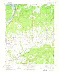
 1971 Taft1973 Print · USGSThe Arkansas River lowlands of eastern Oklahoma appear here in the early 1970s as a landscape of agricultural bottoms and established rail towns. Researchers can locate the Oklahoma Childrens Center in Taft, trace the Missouri-Kansas-Texas tracks, or find family roots at Blackjack Cem.
 - 1971 Map of Haskell, 1973 Print
 1971 Haskell1973 Print · USGSHaskell and the surrounding Oklahoma countryside are documented here in the early 1970s, showcasing a landscape of river bottoms and oil production. Researchers can locate family landmarks like Friday Cem and Simmons Chapel or trace the Texas and Pacific rail line.2 unique versions available
 - 1971 Map of Concharty Mountain, 1973 Print
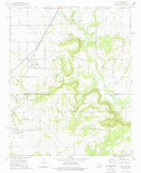
 1971 Concharty Mountain1973 Print · USGSOklahoma's rugged coal and oil country comes into sharp focus during the early 1970s at the junction of four counties. Researchers can trace rural life and industry through landmarks like Bald Hill Cem, Twin Hills Sch, and the local Coal Mines.2 unique versions available
 - 1972 Map of Keefeton SE, 1974 Print
 1972 Keefeton SE1974 Print · USGSMuskogee County in the early seventies is documented through detailed aerial photography showing the rural landscape around Keefeton. Researchers can trace the early shoreline of Webbers Falls Reservoir and the terrain of the Rattlesnake Mountains.
 - 1972 Map of Webbers Falls SE, 1974 Print
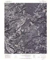 1972 Webbers Falls SE1974 Print · USGSSequoyah County during the early seventies is revealed in sharp photographic detail, showing the developed landscape around the confluence of major waterways. Researchers can trace the path of the Illinois River past Gore to the Arkansas River and study the structural footprint of the Tenkiller Ferry Dam.
 - 1972 Map of Keefeton NE, 1974 Print
 1972 Keefeton NE1974 Print · USGSMuskogee and the surrounding river valley are captured in this early 1970s aerial survey, revealing the regional landscape just after the reservoir was established. Researchers can trace the layout of Davis Field and the rugged terrain of Brushy Mountain near the Arkansas River.
 - 1972 Map of Wagoner SE, 1974 Print
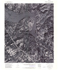
 1972 Wagoner SE1974 Print · USGSMuskogee and the Three Forks river convergence are captured in high detail in the early 1970s. Trace the winding paths of the Verdigris River, Neosho River, and Arkansas River alongside the streets of Muskogee and Fort Gibson.
 - 1972 Map of Keefeton SW, 1974 Print
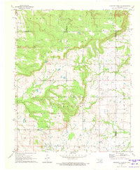
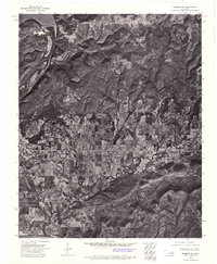
 1972 Keefeton SW1974 Print · USGSEastern Oklahoma's rural landscape is captured in the early 1970s, showing the settlement patterns near the historic town of Rentiesville. Researchers can trace the wooded slopes of the Rattlesnake Mountains and field boundaries near Oktaha.
 - 1972 Map of Webbers Falls SW, 1974 Print
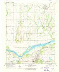
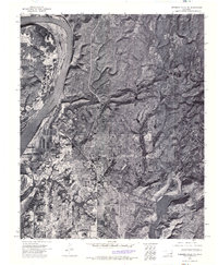
 1972 Webbers Falls SW1974 Print · USGSThe Arkansas River valley of eastern Oklahoma is seen here in the early seventies, just as new infrastructure transformed the landscape. Trace the footprint of Webbers Falls and the engineering of the Webbers Falls Dam and its reservoir.
 - 1972 Map of Wagoner SW, 1974 Print
 1972 Wagoner SW1974 Print · USGSThe river bottomlands of eastern Oklahoma are revealed in this early 1970s aerial survey. Genealogists and local historians can trace the rural layouts of Tullahassee and the outskirts of Muskogee along the banks of the Arkansas River.
 - 1972 Map of Hulbert SW, 1974 Print
 1972 Hulbert SW1974 Print · USGSThe river and rail corridor of Muskogee County appears in remarkable detail during the early 1970s. Trace the industrial and residential footprint of Fort Gibson near the Fort Gibson Dam and the wide expanse of Fort Gibson Lake.
 - 1974 Map of Webbers Falls NW
 1974 Webbers Falls NW1974 Print · USGSMuskogee County in the early seventies is revealed through this detailed aerial survey, showing the transition of the local landscape. Genealogists and historians can trace the footprint of Camp Gruber (Abandoned) and the small town of Braggs alongside Greenleaf Lake.3 unique versions available
 - 1974 Map of Keefton, 1978 Print
 1974 Keefton1978 Print · USGSThe Muskogee County countryside in the 1970s shows a landscape of established rail corridors and family cemeteries near the Arkansas River. Researchers can trace the roots of small communities like Keefton and McLain or locate Agnew Cem and Elm Grove Ch.
 - 1974 Map of Gore, 1978 Print
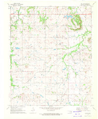
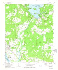 1974 Gore1978 Print · USGSGore and the surrounding Illinois River valley are shown in the mid-seventies just as the regional reservoir system was fully established. Researchers can trace family roots through numerous sites like Stevenson Cem, Notichtown Cem, and the Gum Spring Ch.2 unique versions available
 - 1974 Map of Oktaha, 1978 Print
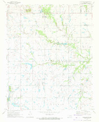
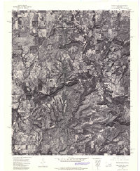
 1974 Oktaha1978 Print · USGSOklahoma's southern Muskogee County and northern McIntosh County are shown here in the mid-seventies, just as the landscape was beginning to modernize. Researchers can trace the Indian Treaty Boundary and locate historic community sites like Rentiesville, Honey Springs Cem, and the Missouri-Kansas-Texas rail line.
 - 1974 Map of Fort Gibson Dam, 1978 Print
 1974 Fort Gibson Dam1978 Print · USGSFort Gibson and the surrounding Cherokee and Muskogee hills are captured in the mid-seventies, showing a landscape of river-fed reservoirs and historic burial grounds. Genealogists can locate family names at Anderson Cem or Walker Cem and trace the old Missouri Pacific rail line.
 - 1974 Map of Southeast Muskogee, 1978 Print
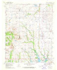
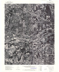
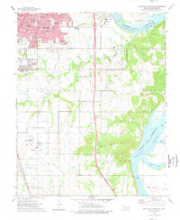 1974 Southeast Muskogee1978 Print · USGSMuskogee was expanding into the surrounding county during the mid-seventies, bridging the gap between urban centers and rural townships. Researchers can trace local development near Davis Field or locate historic neighborhoods like Grandview Heights and Agency.
 - 1974 Map of Northwest Muskogee, 1978 Print
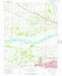 1974 Northwest Muskogee1978 Print · USGSThe Muskogee and Tullahassee riverfronts are captured here in the mid-1970s as the region transitioned through new highway development. Researchers can trace family sites at Jacob Morey Cem and Peters Chapel or locate historical landmarks like the Veterans Hospital and Agency Hill.
 - 1974 Map of Webbers Falls, 1978 Print
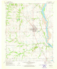
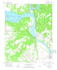 1974 Webbers Falls1978 Print · USGSThe river-and-rail landscape of Webbers Falls is shown here in the mid-1970s, as the Arkansas River reservoirs reached their modern levels. Researchers can trace family sites at Phillips Cem and Mountain Grove Ch or locate the Webbers Falls Lock and Dam.
 - 1974 Map of Northeast Muskogee, 1978 Print
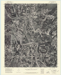
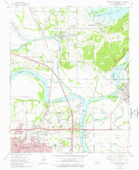 1974 Northeast Muskogee1978 Print · USGSThe river confluence and rail junction at Muskogee are captured here in the mid-seventies, showing a landscape of growing industry and historic institutions. Researchers can trace family roots through Green Hill Cemetery or locate old landmarks like Bacone College and the Port of Muskogee.
Showing maps 1-25 of 29
Top cities of Muskogee County
- Muskogee historical maps
- Haskell historical maps
- Warner historical maps
- Porum historical maps
- Webbers Falls historical maps
- Taft historical maps
See more
Frequently asked questions
- What are the different types of historical maps available for Muskogee County?
- What is the oldest map of Muskogee County?
- Where can I purchase historical maps of Muskogee County for my home or office?
- Where can I download high-res historical maps of Muskogee County?
- Are there historical topographic maps available for Muskogee County?
- Is there historical aerial imagery available for Muskogee County?
- Where are historical maps of Muskogee County sourced from?