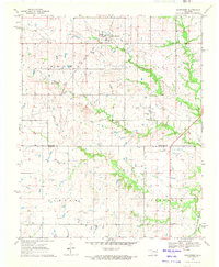
1970 Map of Wainwright
USGS Topo · Published 1972About this map
The small town of Wainwright serves as the focal point of this 1970 landscape, situated at the intersection of a local road network and the Missouri - Kansas - Texas railroad. This survey captures a rural Oklahoma setting defined by the transition between Muskogee and McIntosh counties, where small-scale energy extraction is evidenced by Gas Wells scattered across the southern terrain. The landscape is deeply carved by a network of waterways including Anderson Creek, Darling Creek, and Elk Creek, which shape the local topography.
Find a feature on this map
18 named features on this map. Tap any name to fly to it.
Don’t see what you’re looking for? This feature index may not catch every label — zoom into the map to look around manually.
Map Details
Editions of this 1970 Wainwright Map
This is the sole edition of this map. No revisions or reprints were ever made.
Other maps of this area

1896 · Okmulgee
USGS Topo · 1:125,000

1900 · Sansbois
USGS Topo · 1:125,000

1900 · Canadian
USGS Topo · 1:125,000

1900 · Okmulgee
USGS Topo · 1:125,000

1901 · Muscogee
USGS Topo · 1:125,000

1905 · Muscogee
USGS Topo · 1:125,000

1909 · Sans Bois
USGS Topo · 1:125,000

1911 · Sansbois
USGS Topo · 1:125,000

1946 · Fort Smith
USGS Topo · 1:250,000

1948 · Keefeton
USGS Topo · 1:62,500