2020s Maps of Weleetka, Oklahoma
Explore 3 historic maps of Weleetka from the 2020s. These maps offer a rare glimpse into what life looked like during the 2020s — showing old roads, neighborhoods, homes, and landmarks that have changed or disappeared over time.
Whether you're researching your family's past, planning a metal detecting trip, or studying how Weleetka's landscape evolved across the 2020s, these high-resolution maps are a powerful tool for exploring the history of this region.
- Focus on a specific era: All maps on this page are from the 2020s, giving you a focused view of this time period.
- See what’s changed: Compare century-old streets, trails, and buildings to today's modern landscape using overlays and satellite layers.
- Research with precision: Use these maps for genealogy, historical research, land use analysis, or educational projects.
- View, download, or print: Maps are fully viewable online in high resolution, and can be downloaded or printed for your own records.
Start exploring Weleetka's history through authentic maps from the 2020s. This is your window into the past.
Weleetka, OK maps
(3)- 2022 Map of Weleetka, 2022 Print
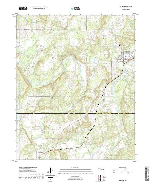 2022 Weleetka2022 Print · USGSThe Okfuskee and Hughes county line comes to life in the early 2020s, centered on the river-valley communities of Weleetka and Wetumka. Researchers can trace local lineage through several identified burial grounds like Salt Creek Cem and Sand Creek Cem.
 - 2022 Map of Pharoah, 2022 Print
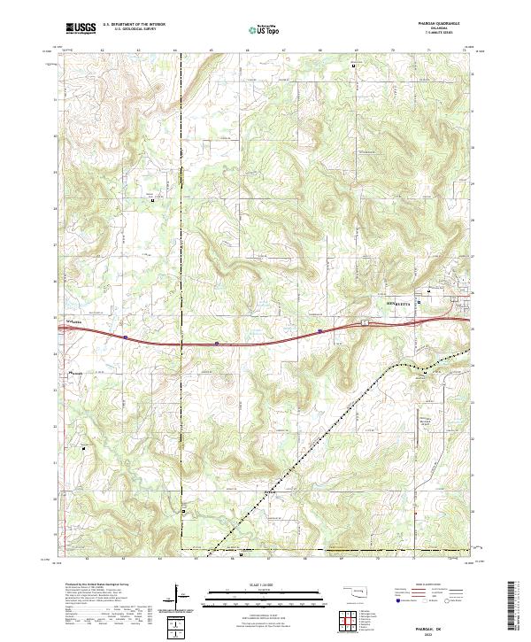 2022 Pharoah2022 Print · USGSThe borderlands of Okmulgee and Okfuskee counties are documented here in the early twenty-first century, centered on the growing hub of Henryetta. Genealogists can trace family heritage through numerous burial sites including West Lawn Cem, Likowski Cem, and Renkie Cem.
 - 2022 Map of Dustin, 2022 Print
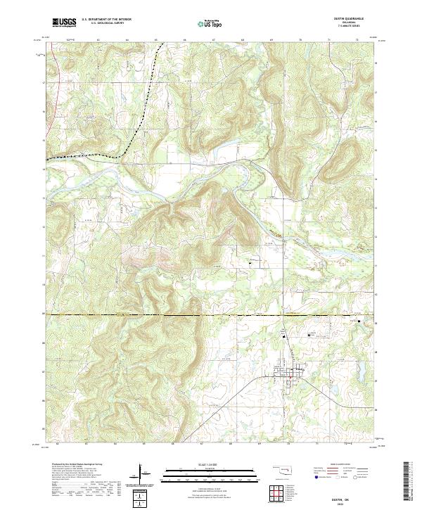 2022 Dustin2022 Print · USGSDustin and the surrounding river bottomlands are captured here in the early twenty-first century. Genealogists can locate several family and community burial grounds, including the Mosewiley Cem and Fife Cem, alongside the waters of the North Canadian River.
End of results
Showing maps 1-3 of 3
Top cities near Weleetka
- Henryetta historical maps
- Okemah historical maps
- Wetumka historical maps
- Dewar historical maps
- Schulter historical maps
- Dustin historical maps
See more
Top neighborhoods of Weleetka
Frequently asked questions
- What are the different types of historical maps available for Weleetka?
- What is the oldest map of Weleetka?
- Where can I purchase historical maps of Weleetka for my home or office?
- Where can I download high-res historical maps of Weleetka?
- Are there historical topographic maps available for Weleetka?
- Is there historical aerial imagery available for Weleetka?
- Where are historical maps of Weleetka sourced from?