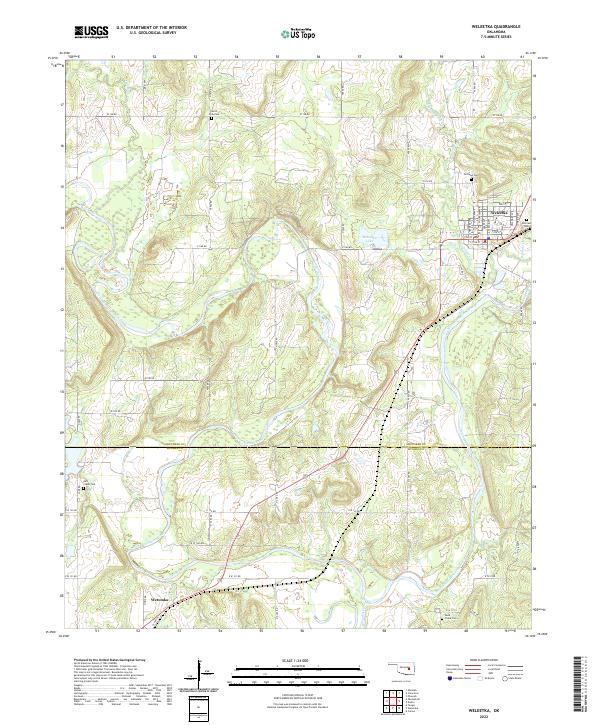
2022 Map of Weleetka
USGS Topo · Published 2022About this map
Weleetka serves as the primary hub in this portion of Okfuskee County, situated near the winding course of the North Canadian River. The town's grid is clearly defined by culturally significant street names such as Choctaw Ave, Chickasaw Ave, and Seminole Ave, reflecting the regional heritage. To the south, Wetumka anchors the corner of the map, while the landscape between these settlements is defined by the convergence of Alabama Creek and Wewoka Creek. For genealogists, the map is particularly useful as it identifies several established burial sites, including North Fork Cem and Fairlawn Cem near the northern boundary, and Salt Creek Cem to the west. The area's hydrology is dominated by the river's broad floodplain and the small reservoir of Weleetka Lake just west of the town center.
Find a feature on this map
55 named features on this map. Tap any name to fly to it.
Don’t see what you’re looking for? This feature index may not catch every label — zoom into the map to look around manually.
Map Details
Editions of this 2022 Weleetka Map
This is the sole edition of this map. No revisions or reprints were ever made.
Other maps of this area

1900 · Wewoka
USGS Topo · 1:125,000

1954 · Oklahoma City
USGS Topo · 1:250,000

1957 · Oklahoma City
USGS Topo · 1:250,000

1963 · Oklahoma City
USGS Topo · 1:250,000
1967 · Pharoah
USGS Topo · 1:24,000

1967 · Okemah SE
USGS Topo · 1:24,000

1967 · Weleetka
USGS Topo · 1:24,000

1967 · Okemah
USGS Topo · 1:24,000
1967 · Clearview
USGS Topo · 1:24,000
1967 · Dustin
USGS Topo · 1:24,000