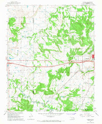
1967 Map of Pharoah
USGS Topo · Published 1968About this map
The Oklahoma oil and gas landscape of the late 1960s dominates this area west of Henryetta, where industrial development meets rural Okmulgee and Okfuskee Counties. Local economy and infrastructure are defined by the St Louis San Francisco railroad and the extensive Oil and Gas Field operations that dot the terrain. The map reveals a high concentration of family and community history through numerous burial grounds like West Lawn Cemetery, Likowski Cem, and Creek Mine Cem, the latter reflecting the area's mining heritage. Small centers of community life appear at Pharoah and Bryant, supported by local institutions like Arbeka Ch. Aviation interests are represented by the Henryetta Municipal Airport and a secondary Landing Strip, while the era's social culture is captured by the presence of a Drive-in Theater near the eastern edge.
Find a feature on this map
37 named features on this map. Tap any name to fly to it.
Don’t see what you’re looking for? This feature index may not catch every label — zoom into the map to look around manually.
Map Details
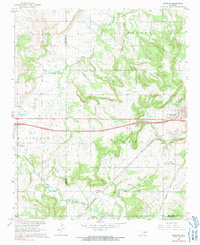
Editions of this 1967 Pharoah Map
2 editions found
Other maps of this area

1896 · Okmulgee
USGS Topo · 1:125,000

1900 · Canadian
USGS Topo · 1:125,000

1900 · Wewoka
USGS Topo · 1:125,000

1900 · Okmulgee
USGS Topo · 1:125,000

1901 · Nuyaka
USGS Topo · 1:125,000

1946 · Fort Smith
USGS Topo · 1:250,000

1954 · Oklahoma City
USGS Topo · 1:250,000

1957 · Oklahoma City
USGS Topo · 1:250,000

1962 · Henryetta
USGS Topo · 1:24,000

1962 · Henryetta SW
USGS Topo · 1:24,000