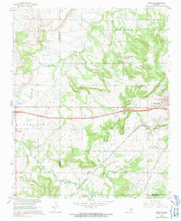
1967 Map of Pharoah
USGS Topo · Published 1991About this map
Henryetta Oil and Gas Field and the Lincoln Field dominate the landscape of this region during the mid-1960s, a period when petroleum extraction defined the local economy and geography. The survey captures the industrial footprint of north-central Oklahoma, documenting numerous oil wells and extensive energy infrastructure alongside the emerging Indian Nation Turnpike. To the east, the city of Henryetta serves as a major hub, supported by the Henryetta Municipal Airport and the intersection of the St Louis San Francisco and Kansas Oklahoma and Gulf railroads. Genealogists will find a wealth of local landmarks, including several family and community burial grounds such as Renkie Cem, Barnet-Fisher Cem, and Creek Mine Cem. The presence of Arbeka Ch and Aztec Ch alongside smaller settlements like Pharoah and Bryant provides a clear view of the rural communities established within the Oklahoma oil patch.
Find a feature on this map
33 named features on this map. Tap any name to fly to it.
Don’t see what you’re looking for? This feature index may not catch every label — zoom into the map to look around manually.
Map Details
Editions of this 1967 Pharoah Map
2 editions found
Other maps of this area

1896 · Okmulgee
USGS Topo · 1:125,000

1900 · Canadian
USGS Topo · 1:125,000

1900 · Wewoka
USGS Topo · 1:125,000

1900 · Okmulgee
USGS Topo · 1:125,000

1901 · Nuyaka
USGS Topo · 1:125,000

1946 · Fort Smith
USGS Topo · 1:250,000

1954 · Oklahoma City
USGS Topo · 1:250,000

1957 · Oklahoma City
USGS Topo · 1:250,000

1962 · Henryetta
USGS Topo · 1:24,000

1962 · Henryetta SW
USGS Topo · 1:24,000