2020s Maps of Midwest City, Oklahoma
Explore 4 historic maps of Midwest City from the 2020s. These maps offer a rare glimpse into what life looked like during the 2020s — showing old roads, neighborhoods, homes, and landmarks that have changed or disappeared over time.
Whether you're researching your family's past, planning a metal detecting trip, or studying how Midwest City's landscape evolved across the 2020s, these high-resolution maps are a powerful tool for exploring the history of this region.
- Focus on a specific era: All maps on this page are from the 2020s, giving you a focused view of this time period.
- See what’s changed: Compare century-old streets, trails, and buildings to today's modern landscape using overlays and satellite layers.
- Research with precision: Use these maps for genealogy, historical research, land use analysis, or educational projects.
- View, download, or print: Maps are fully viewable online in high resolution, and can be downloaded or printed for your own records.
Start exploring Midwest City's history through authentic maps from the 2020s. This is your window into the past.
Midwest City, OK maps
(4)- 2022 Map of Choctaw, 2022 Print
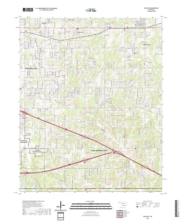 2022 Choctaw2022 Print · USGSOklahoma County at the dawn of the 2020s shows the continued expansion of the metropolitan area into long-standing rural townships. Genealogists can trace family heritage through a high concentration of burial sites, including New Hope Church Cem, Saint Martins Cem, and Clearsprings Mishak Cem.
 - 2022 Map of Jones, 2022 Print
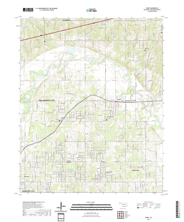 2022 Jones2022 Print · USGSOklahoma County at the start of the 2020s shows a landscape of growing communities and preserved family heritage north of the state capital. Genealogists can trace several local burial grounds including Chitwood Cem and Lillard and Woodard Cem.
 - 2022 Map of Spencer, 2022 Print
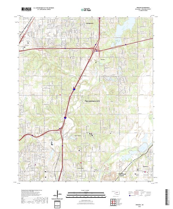 2022 Spencer2022 Print · USGSOklahoma County at the edge of the capital in 2022 shows the growth of Edmond and Forest Park along the Deep Fork. Trace local family history through numerous memorial sites like Trice Hill Cem, Witcher Cem, and Arlington Memory Gardens.
 - 2022 Map of Midwest City, 2022 Print
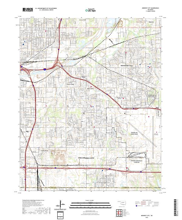 2022 Midwest City2022 Print · USGSMidwest City and its neighbors are shown in the early 2020s as a dense network of suburban residential streets and industrial hubs. Researchers can trace property near Tinker Air Force Base or locate local landmarks like Rose State College and Sunny Lane Cem.
End of results
Showing maps 1-4 of 4
Top cities near Midwest City
- Oklahoma City historical maps
- Norman historical maps
- Edmond historical maps
- Moore historical maps
- Del City historical maps
- Choctaw historical maps
See more
Top neighborhoods of Midwest City
Frequently asked questions
- What are the different types of historical maps available for Midwest City?
- What is the oldest map of Midwest City?
- Where can I purchase historical maps of Midwest City for my home or office?
- Where can I download high-res historical maps of Midwest City?
- Are there historical topographic maps available for Midwest City?
- Is there historical aerial imagery available for Midwest City?
- Where are historical maps of Midwest City sourced from?