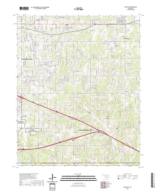
2022 Map of Choctaw
USGS Topo · Published 2022About this map
Choctaw and the eastern fringes of Oklahoma City appear here in a landscape where suburban growth meets established rural landmarks. The drainage of Choctaw Creek and Hog Creek carves through the undulating terrain, shaping the development of settlements like Nicoma Park, Spencer, and the small community of Woods. For local historians and genealogists, this map is especially significant for its density of burial grounds, including New Hope Church Cem, Clearsprings Mishak Cem, and Saint Martins Cem. These sites, along with Worley Cem and Schwartz Cem further south, provide a primary record of the families that established the area’s farming roots. The grid system of major roads such as SE 29th St and E Reno Ave highlights the 21st-century connectivity between Midwest City and the surrounding townships.
Find a feature on this map
36 named features on this map. Tap any name to fly to it.
Don’t see what you’re looking for? This feature index may not catch every label — zoom into the map to look around manually.
Map Details
Editions of this 2022 Choctaw Map
This is the sole edition of this map. No revisions or reprints were ever made.
Other maps of this area

1892 · Moore
USGS Topo · 1:62,500

1892 · Edmond
USGS Topo · 1:62,500

1898 · Purcell
USGS Topo · 1:125,000

1909 · Luther
USGS Topo · 1:62,500

1930 · McLoud
USGS Topo · 1:62,500

1934 · Crutcho Creek
USGS Topo · 1:24,000

1934 · Moore
USGS Topo · 1:62,500

1935 · Spencer
USGS Topo · 1:24,000

1935 · Edmond
USGS Topo · 1:48,000

1938 · Moore
USGS Topo · 1:62,500