2020s Maps of Quinton, Oklahoma
Explore 4 historic maps of Quinton from the 2020s. These maps offer a rare glimpse into what life looked like during the 2020s — showing old roads, neighborhoods, homes, and landmarks that have changed or disappeared over time.
Whether you're researching your family's past, planning a metal detecting trip, or studying how Quinton's landscape evolved across the 2020s, these high-resolution maps are a powerful tool for exploring the history of this region.
- Focus on a specific era: All maps on this page are from the 2020s, giving you a focused view of this time period.
- See what’s changed: Compare century-old streets, trails, and buildings to today's modern landscape using overlays and satellite layers.
- Research with precision: Use these maps for genealogy, historical research, land use analysis, or educational projects.
- View, download, or print: Maps are fully viewable online in high resolution, and can be downloaded or printed for your own records.
Start exploring Quinton's history through authentic maps from the 2020s. This is your window into the past.
Quinton, OK maps
(4)- 2022 Map of Quinton South, 2022 Print
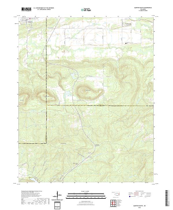 2022 Quinton South2022 Print · USGSThe borderlands of Haskell, Latimer, and Pittsburg counties come alive in this survey of the northern Sans Bois Mountains. Researchers can pinpoint Lewisville Cem, trace the waters of Fourche Maline, and locate summits like Tucker Knob.
 - 2022 Map of Featherston, 2022 Print
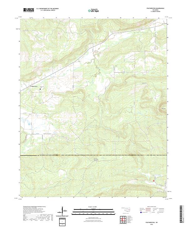 2022 Featherston2022 Print · USGSIn the valley north of the Sans Bois Mountains, this survey captures the rural landscape at the intersection of Pittsburg and Latimer Counties. Researchers can trace the layout of Featherston and locate local landmarks like the Featherston Cem and Shoe Mtn.
 - 2022 Map of Quinton North, 2022 Print
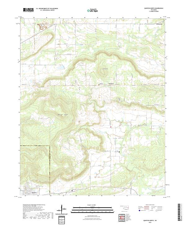 2022 Quinton North2022 Print · USGSHaskell and Pittsburg counties meet in this rugged corner of eastern Oklahoma during the early twenty-first century. Genealogists and local historians can trace burial sites like Mountain Home Cem and Quinton Cem or follow the paths of Longtown Cr and Elm Cr.
 - 2022 Map of Enterprise, 2022 Print
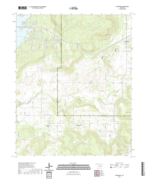 2022 Enterprise2022 Print · USGSThe border of Haskell and Pittsburg counties comes alive in this contemporary record of a landscape shaped by hills and water. Genealogists and local historians can locate Enterprise, Russellville, and several burial grounds including Palestine Cem and West Liberty Cem.
End of results
Showing maps 1-4 of 4
Top cities near Quinton
- Wilburton historical maps
- Eufaula historical maps
- Porum historical maps
- Kinta historical maps
- Whitefield historical maps
- Carlton Landing historical maps
Frequently asked questions
- What are the different types of historical maps available for Quinton?
- What is the oldest map of Quinton?
- Where can I purchase historical maps of Quinton for my home or office?
- Where can I download high-res historical maps of Quinton?
- Are there historical topographic maps available for Quinton?
- Is there historical aerial imagery available for Quinton?
- Where are historical maps of Quinton sourced from?