1990s Maps of Roger Mills County, Oklahoma
Explore 13 historic maps of Roger Mills County from the 1990s. These maps offer a rare glimpse into what life looked like during the 1990s — showing old roads, neighborhoods, homes, and landmarks that have changed or disappeared over time.
Whether you're researching your family's past, planning a metal detecting trip, or studying how Roger Mills County's landscape evolved across the 1990s, these high-resolution maps are a powerful tool for exploring the history of this region.
- Focus on a specific era: All maps on this page are from the 1990s, giving you a focused view of this time period.
- See what’s changed: Compare century-old streets, trails, and buildings to today's modern landscape using overlays and satellite layers.
- Research with precision: Use these maps for genealogy, historical research, land use analysis, or educational projects.
- View, download, or print: Maps are fully viewable online in high resolution, and can be downloaded or printed for your own records.
Start exploring Roger Mills County's history through authentic maps from the 1990s. This is your window into the past.
Roger Mills County, OK maps
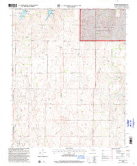
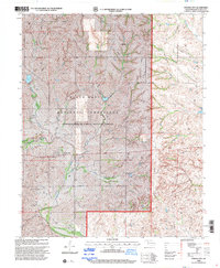
(13)- 1990 Map of Foss Reservoir, 1991 Print
 1990 Foss Reservoir1991 Print · USGSWestern Oklahoma’s prairie and river systems are shown here as they appeared in the 1990s, dominated by conservation lands and water management. Researchers can trace the rail paths of the Atchison Topeka and Santa Fe and locate old rural centers like Strong City and Hammon.
 - 1998 Map of Dempsey, 2001 Print
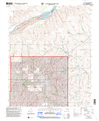
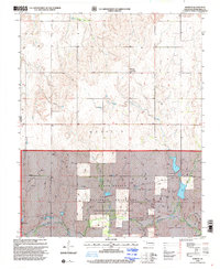
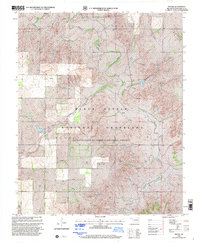
 1998 Dempsey2001 Print · USGSRoger Mills County at the end of the millennium shows a landscape defined by the expansive Black Kettle National Grassland and traditional prairie ranching. Genealogists can locate the Dempsey Cem near Dempsey, or trace drainage patterns along Buffalo Creek and Brokenleg Creek.
 - 1998 Map of Roll SE, 2001 Print
 1998 Roll SE2001 Print · USGSRoger Mills County was still defined by its prairie roots and conservation efforts in the late nineties. Genealogists and local historians can trace the rural layout of the Black Kettle National Grassland, locating sites like Three Corner Sch and Rhome Cem.
 - 1998 Map of Cheyenne, 2001 Print
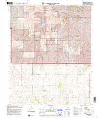
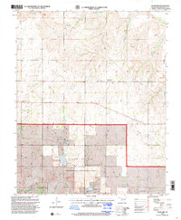
 1998 Cheyenne2001 Print · USGSWestern Oklahoma’s prairie landscape is documented here in the late 1990s, centered on the historic Washita River valley. Genealogists and historians can locate the Cheyenne Cemetery, the Battle of the Washita Historical Marker, and the small community of Rosehill.
 - 1998 Map of Reydon, 2001 Print
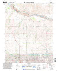
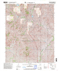
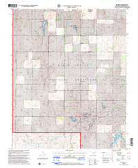 1998 Reydon2001 Print · USGSRoger Mills County was a center of prairie conservation and energy production in the late nineties. Local researchers can locate family sites at Union Chapel Cem or trace the rural developments around Reydon, Midway, and Skipout Lake.
 - 1998 Map of Reydon SW, 2001 Print
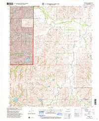
 1998 Reydon SW2001 Print · USGSWestern Oklahoma in the late nineties shows a landscape defined by ranching, energy extraction, and conservation. Genealogists and researchers can trace the White Rose Cem, the Petersen Landing Strip, and the bounds of the Black Kettle National Grassland.
 - 1998 Map of Durham, 2001 Print
 1998 Durham2001 Print · USGSWestern Oklahoma during the late twentieth century reveals a landscape defined by the Washita River and the Black Kettle National Grassland. Researchers can pinpoint family history at Fairview Cem or Lindley Cem and trace the small community of Durham.
 - 1998 Map of Crawford, 2001 Print
 1998 Crawford2001 Print · USGSWestern Oklahoma’s prairie and grasslands are captured here in the late nineties as a mix of conservation land and rural community life. Researchers can locate family landmarks like Sunrise Cem and the United Pentecostal Ch, or trace the banks of the Washita River.
 - 1998 Map of Roll, 2001 Print
 1998 Roll2001 Print · USGSRoger Mills County in the late nineties is a landscape of rugged grasslands and quiet prairie settlements. You can trace family history at the Silent Home Cem and explore the natural boundaries of the Canadian River or the Black Kettle National Grassland.
 - 1998 Map of Strong City, 2001 Print
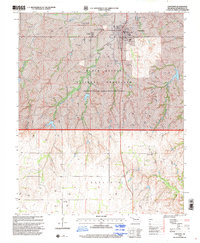
 1998 Strong City2001 Print · USGSStrong City and the Washita River valley are captured here in the late 1990s as energy production and ranching define the Roger Mills County landscape. Researchers can locate Strong Cem and Snake Bend Cem or trace the boundaries of the Black Kettle National Grassland.
 - 1998 Map of Mackie, 2001 Print
 1998 Mackie2001 Print · USGSWestern Oklahoma’s high plains in the late twentieth century reveal a landscape of managed prairie and active energy extraction. Researchers can trace the drainage of the Washita River and locate remote infrastructure like the Mackie settlement and Camp Hollow.
 - 1998 Map of Cheyenne NW, 2001 Print
 1998 Cheyenne NW2001 Print · USGSThe Oklahoma high plains in the late 1990s are defined here by conservation lands and an active energy sector. Researchers can trace the river economy along the Washita River or locate recreation landmarks like Dead Indian Lake and the Streeter settlement area.
 - 1998 Map of Herring, 2001 Print
 1998 Herring2001 Print · USGSRoger Mills and Beckham counties are captured here in the late nineties as energy extraction shaped the plains. Researchers can locate the Sandstone Sch (Historical), the Sandstone Cem, and the sprawling Kiowa Gas Field.
End of results
Showing maps 1-13 of 13
Top cities of Roger Mills County
Frequently asked questions
- What are the different types of historical maps available for Roger Mills County?
- What is the oldest map of Roger Mills County?
- Where can I purchase historical maps of Roger Mills County for my home or office?
- Where can I download high-res historical maps of Roger Mills County?
- Are there historical topographic maps available for Roger Mills County?
- Is there historical aerial imagery available for Roger Mills County?
- Where are historical maps of Roger Mills County sourced from?