Old Maps of Tulsa, Oklahoma
Explore 30 old maps of Tulsa, spanning from 1896 to today. These high-resolution historic maps reveal how streets, neighborhoods, landmarks, and natural features evolved over time — perfect for genealogy, metal detecting, research, and local history exploration.
What you can do with these maps:
- See how Tulsa changed over time: Compare historical maps to modern-day views to trace roads, homesites, rail lines & more.
- View detailed metadata: Each map includes creators, publishers, year, scale, and archive source.
- Overlay maps with satellite & LiDAR: Visualize the past alongside modern tools to explore terrain & human change.
- Trusted historical sources: Maps sourced from the USGS, Library of Congress, and other archives.
- Access maps your way: View online, download high-res files, or order prints for personal or research use.
Start exploring old maps of Tulsa to uncover forgotten places, hidden landmarks, and the deep history beneath your feet.
Tulsa, OK maps
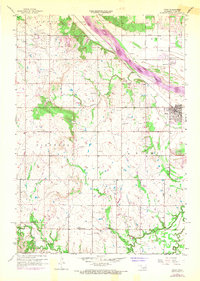
(30)- 1896 Map of Okmulgee, 1954 Print
 1896 Okmulgee1954 Print · USGSCovers Tulsa, including Bixby, Jenks, and other nearby areas
 - 1900 Map of Okmulgee
 1900 Okmulgee1900 Print · USGSCovers Tulsa, including Bixby, Jenks, and other nearby areas4 unique versions available
 - 1901 Map of Claremore
 1901 Claremore1901 Print · USGSCovers Tulsa, including Broken Arrow, Owasso, and other nearby areas4 unique versions available
 - 1912 Map of Hominy, 1960 Print
 1912 Hominy1960 Print · USGSCovers Tulsa, including Sapulpa, Sand Springs, and other nearby areas
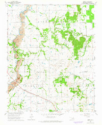
 - 1914 Map of Claremore, 1959 Print
 1914 Claremore1959 Print · USGSCovers Tulsa, including Broken Arrow, Owasso, and other nearby areas
 - 1915 Map of Hominy
 1915 Hominy1915 Print · USGSCovers Tulsa, including Sapulpa, Sand Springs, and other nearby areas2 unique versions available
 - 1916 Map of Claremore
 1916 Claremore1916 Print · USGSCovers Tulsa, including Broken Arrow, Owasso, and other nearby areas4 unique versions available
 - 1946 Map of Fort Smith
 1946 Fort Smith1946 Print · USGSCovers Tulsa, including Fayetteville, Fort Smith, and other nearby areas
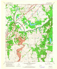
 - 1952 Map of Jenks, 1953 Print
 1952 Jenks1953 Print · USGSCovers Tulsa, including Bixby, Jenks, and other nearby areas6 unique versions available
 - 1954 Map of Tulsa
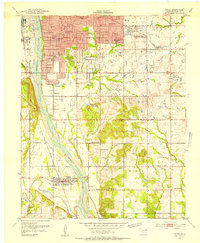
 1954 Tulsa1954 Print · USGSCovers Tulsa, including Broken Arrow, Fayetteville, and other nearby areas2 unique versions available
 - 1954 Map of Tulsa, 1955 Print
 1954 Tulsa1955 Print · USGSCovers Tulsa, including Owasso, Turley, and other nearby areas5 unique versions available
 - 1955 Map of Sperry, 1956 Print
 1955 Sperry1956 Print · USGSCovers Tulsa, including Owasso, Skiatook, and other nearby areas3 unique versions available
 - 1955 Map of Mingo, 1956 Print
 1955 Mingo1956 Print · USGSCovers Tulsa, including Owasso, Catoosa, and other nearby areas4 unique versions available
 - 1955 Map of Broken Arrow, 1956 Print
 1955 Broken Arrow1956 Print · USGSCovers Tulsa, including Broken Arrow, Bixby, and other nearby areas5 unique versions available
 - 1955 Map of Enid, 1966 Print
 1955 Enid1966 Print · USGSCovers Tulsa, including Enid, Stillwater, and other nearby areas4 unique versions available
 - 1956 Map of Sand Springs, 1957 Print
 1956 Sand Springs1957 Print · USGSCovers Tulsa, including Sand Springs, Lefko Hill, and other nearby areas6 unique versions available
 - 1956 Map of Sapulpa North, 1957 Print
 1956 Sapulpa North1957 Print · USGSCovers Tulsa, including Sapulpa, Sand Springs, and other nearby areas4 unique versions available
 - 1957 Map of Bixby, 1968 Print
 1957 Bixby1968 Print · USGSCovers Tulsa, including Bixby, Jenks, and other nearby areas3 unique versions available
 - 1958 Map of Enid
 1958 Enid1958 Print · USGSCovers Tulsa, including Enid, Stillwater, and other nearby areas
 - 1958 Map of Tulsa, 1968 Print
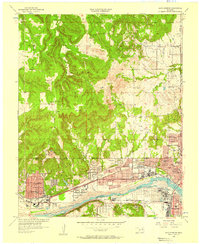
 1958 Tulsa1968 Print · USGSCovers Tulsa, including Broken Arrow, Fayetteville, and other nearby areas3 unique versions available
 - 1963 Map of Tulsa
 1963 Tulsa1963 Print · USGSCovers Tulsa, including Broken Arrow, Fayetteville, and other nearby areas
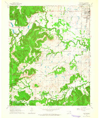
 - 1963 Map of Oneta, 1964 Print
 1963 Oneta1964 Print · USGSCovers Tulsa, including Coweta, Fair Oaks, and other nearby areas3 unique versions available
 - 1963 Map of Catoosa, 1964 Print
 1963 Catoosa1964 Print · USGSCovers Tulsa, including Owasso, Catoosa, and other nearby areas4 unique versions available
 - 1963 Map of Avant SE, 1964 Print
 1963 Avant SE1964 Print · USGSCovers Tulsa, including Sand Springs, Skiatook, and other nearby areas4 unique versions available
 - 1965 Map of Fort Smith
 1965 Fort Smith1965 Print · USGSCovers Tulsa, including Fayetteville, Fort Smith, and other nearby areas
Showing maps 1-25 of 30
Top cities near Tulsa
- Broken Arrow historical maps
- Owasso historical maps
- Bixby historical maps
- Sapulpa historical maps
- Sand Springs historical maps
- Claremore historical maps
See more
Top neighborhoods of Tulsa
- Mingo historical maps
- Fair Oaks historical maps
- Garnett historical maps
- Tulsa Fire Safety Training Center historical maps
- Lefko Hill historical maps
- Civic Center Plaza historical maps
See more
Frequently asked questions
- What are the different types of historical maps available for Tulsa?
- What is the oldest map of Tulsa?
- Where can I purchase historical maps of Tulsa for my home or office?
- Where can I download high-res historical maps of Tulsa?
- Are there historical topographic maps available for Tulsa?
- Is there historical aerial imagery available for Tulsa?
- Where are historical maps of Tulsa sourced from?