1970s Maps of Wagoner, Oklahoma
Explore 7 historic maps of Wagoner from the 1970s. These maps offer a rare glimpse into what life looked like during the 1970s — showing old roads, neighborhoods, homes, and landmarks that have changed or disappeared over time.
Whether you're researching your family's past, planning a metal detecting trip, or studying how Wagoner's landscape evolved across the 1970s, these high-resolution maps are a powerful tool for exploring the history of this region.
- Focus on a specific era: All maps on this page are from the 1970s, giving you a focused view of this time period.
- See what’s changed: Compare century-old streets, trails, and buildings to today's modern landscape using overlays and satellite layers.
- Research with precision: Use these maps for genealogy, historical research, land use analysis, or educational projects.
- View, download, or print: Maps are fully viewable online in high resolution, and can be downloaded or printed for your own records.
Start exploring Wagoner's history through authentic maps from the 1970s. This is your window into the past.
Wagoner, OK maps
(7)- 1970 Map of Rocky Point, 1972 Print
 1970 Rocky Point1972 Print · USGSThe shorelines of the Fort Gibson Reservoir and Neosho River define this part of Wagoner and Mayes counties in the early seventies. Researchers can locate early burial sites like Union Mission Cem, the village of Mazie, and the track of the Old RR Grade.2 unique versions available
 - 1972 Map of Wagoner NE, 1974 Print
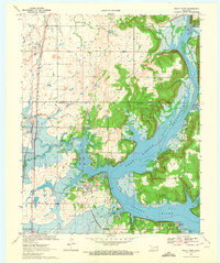
 1972 Wagoner NE1974 Print · USGSNortheastern Oklahoma's landscape is captured in the early seventies, showcasing the expansive reach of Fort Gibson Lake. Local historians can trace the development of Wagoner and the intricate shoreline that reshaped this region.
 - 1972 Map of Wagoner NW, 1974 Print
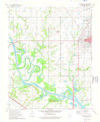
 1972 Wagoner NW1974 Print · USGSWagoner and its surrounding farmsteads are captured in the early 1970s just as the modern highway network began reshaping the Oklahoma landscape. Researchers can trace land use patterns and town expansion near the Verdigris River and Billy Creek.
 - 1974 Map of Wagoner East, 1978 Print
 1974 Wagoner East1978 Print · USGSThe lakeside community of Wagoner and the eastern shores of Fort Gibson Lake are captured here in the mid-seventies. Genealogists and local historians can trace legacy sites like Elmwood Cem and Ora Ellington Sch alongside the busy Missouri Pacific Railroad.
 - 1974 Map of Wagoner West, 1978 Print
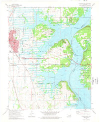
 1974 Wagoner West1978 Print · USGSThe Verdigris River valley west of Wagoner is captured here in the mid-seventies as recreational areas and transit corridors expanded. Genealogists and local historians can trace rural roots at Star Sch, Sandtown Ch, and Elmwood Cem.2 unique versions available
 - 1978 Map of Muskogee, 1979 Print
 1978 Muskogee1979 Print · USGSThe confluence of the Arkansas, Verdigris, and Neosho Rivers defines the Muskogee region in the late seventies. Genealogists and historians can trace the footprints of Camp Gruber (Abandoned), the campus of Bacone College, and early aviation at Hatbox Field.
 - 1978 Map of Fort Smith, 1979 Print
 1978 Fort Smith1979 Print · USGSThe Arkansas-Oklahoma borderlands in the late seventies show a landscape shaped by massive river reservoirs and sprawling military reservations. Trace the historic rail lines of the Missouri Pacific RR and locate regional landmarks like Fort Gibson, Tenkiller Ferry Lake, and Barling.2 unique versions available
End of results
Showing maps 1-7 of 7
Top cities near Wagoner
- Muskogee historical maps
- Coweta historical maps
- Chouteau historical maps
- Inola historical maps
- Locust Grove historical maps
- Okay historical maps
See more
Frequently asked questions
- What are the different types of historical maps available for Wagoner?
- What is the oldest map of Wagoner?
- Where can I purchase historical maps of Wagoner for my home or office?
- Where can I download high-res historical maps of Wagoner?
- Are there historical topographic maps available for Wagoner?
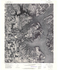
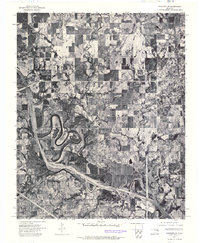
- Is there historical aerial imagery available for Wagoner?
- Where are historical maps of Wagoner sourced from?