Old Maps of Sparta, Oregon for Hiking & Exploration
Hike through history with 10 historic maps of Sparta. Explore old trails, ghost towns, and forgotten backroads — perfect for outdoor adventurers and local explorers.
- Rediscover forgotten places: Map out old mining camps, roads, and footpaths that no longer exist on modern maps.
- Layer with modern tools: Combine with LiDAR or satellite views to plan hikes through historical terrain.
- Made for exploration: Popular among hikers, overlanders, and local history lovers.
Use these maps to find adventure and explore the hidden past of Sparta.
Sparta, OR maps
(10)- 1915 Map of Pine
 1915 Pine1915 Print · USGSEastern Oregon was a hub of gold mining and river commerce in the early twentieth century. Researchers can trace the legacy of pioneer families and industry at the Sanger Mine, follow the old Oregon-Washington Railroad, or locate the Mineral P O along the river.3 unique versions available
 - 1955 Map of Baker, 1964 Print
 1955 Baker1964 Print · USGSThe Oregon-Idaho borderlands are captured here in the mid-fifties as the Snake River underwent massive changes from dam construction. Trace the Oregon Trail Memorial Monument near Baker, find early mines like Virtue Mine, and follow the Union Pacific Railroad through Huntington.4 unique versions available
 - 1957 Map of Sparta, 1958 Print
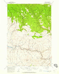 1957 Sparta1958 Print · USGSThe high timber and mining country of eastern Oregon is shown here in the late fifties, during a period of active resource extraction. Researchers can locate numerous historic workings including the Gem Mine, Del Monte Mine, and the rail-connected Colvard Station.2 unique versions available
 - 1959 Map of Baker
 1959 Baker1959 Print · USGSThe Oregon and Idaho borderlands come alive in the late fifties, showing the rugged corridor along the Snake River and the high peaks of the Wallowa Mountains. Researchers can trace the legacy of the Union Pacific railroad or locate historic mining sites like the Flagstaff Mine and Virtue Mine.2 unique versions available
 - 1981 Map of Baker
 1981 Baker1981 Print · USGSEastern Oregon in the early eighties shows a landscape of deep canyons and high mountain mining districts. Genealogists and researchers can trace the Union Pacific corridor through Baker or locate remote operations like the Young American Mine and Rachel Mine.2 unique versions available
 - 1988 Map of Sparta
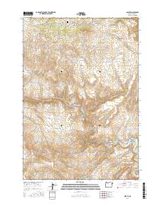
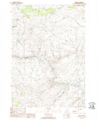 1988 Sparta1988 Print · USGSIn the high country of Baker County during the late eighties, the Sparta area remains a landscape defined by its mining heritage. Genealogists and historians can locate numerous named claims like the Macy Mine and Keystone Mine or trace water rights along the Goodwin Ditch.
 - 2011 Map of Sparta, 2011 Print
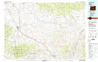
 2011 Sparta2011 Print · USGSCovers Sparta, including Baker County, United States, and other nearby areas
 - 2017 Map of Sparta, 2017 Print
 2017 Sparta2017 Print · USGSCovers Sparta, including Baker County, United States, and other nearby areas
 - 2020 Map of Sparta, 2020 Print
 2020 Sparta2020 Print · USGSCovers Sparta, including Baker County, United States, and other nearby areas
 - 2023 Map of Sparta, 2023 Print
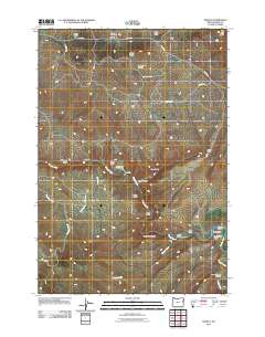
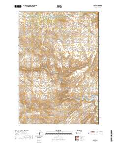
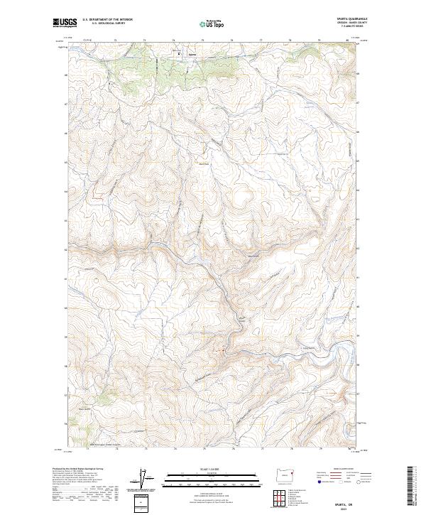 2023 Sparta2023 Print · USGSBaker County's high-desert mining and ranching landscape is captured here in the contemporary era. Researchers can trace the layout of Sparta, locate the Sparta Cem, and follow historical water routes like the Dry Gulch-Ditch toward the Powder River.
End of results
Showing maps 1-10 of 10
Top cities near Sparta
Frequently asked questions
- What are the different types of historical maps available for Sparta?
- What is the oldest map of Sparta?
- Where can I purchase historical maps of Sparta for my home or office?
- Where can I download high-res historical maps of Sparta?
- Are there historical topographic maps available for Sparta?
- Is there historical aerial imagery available for Sparta?
- Where are historical maps of Sparta sourced from?