
1981 Map of Baker
USGS Topo · Published 1981About this map
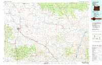
Baker and the surrounding Baker Valley serve as the focal point for this regional study, which illustrates the complex intersection of mining, agriculture, and transportation in eastern Oregon. The Union Pacific rail line and U.S. 30 parallel each other through the valley, connecting settlements like Haines and Pleasant Valley. To the east, the landscape shifts toward the Whitman National Forest, where a dense network of mining operations such as the Young American Mine, Rachel Mine, and Keystone Mine dot the terrain near Sparta. The map documents the water resources of the era, from the winding Powder River and its various sloughs—Old Settlers Slough and Missouri Slough—to the significant expanse of the Brownlee Reservoir along the Snake River on the Idaho border. Small communities like Halfway and Richland remain established in the agricultural pockets between the mountains and the river.
Find a feature on this map
71 named features on this map. Tap any name to fly to it.
Don’t see what you’re looking for? This feature index may not catch every label — zoom into the map to look around manually.
Map Details
Editions of this 1981 Baker Map
2 editions found
Other maps of this area

1897 · Weiser
USGS Topo · 1:125,000

1901 · Baker City
USGS Topo · 1:125,000

1901 · Sumpter
USGS Topo · 1:125,000

1906 · Telocaset
USGS Topo · 1:125,000

1908 · Ironside Mountain
USGS Topo · 1:125,000

1915 · Pine
USGS Topo · 1:125,000

1951 · Huntington
USGS Topo · 1:62,500

1952 · Olds Ferry NW
USGS Topo · 1:24,000

1952 · Olds Ferry
USGS Topo · 1:62,500

1953 · Mann Creek
USGS Topo · 1:62,500