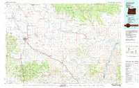
1981 Map of Baker
USGS Topo · Published 1981About this map
Baker serves as the central hub of this eastern Oregon landscape, situated where the Union Pacific railroad and major roads meet in the valley. The map documents an intensive history of resource extraction, particularly concentrated in the hills east of town where the Virtue Mine, Flagstaff Hill Mine, and Rachel Mine are located. This industrial footprint extends toward the Snake River border, where the Brownlee Reservoir dominates the eastern edge of the quadrangle.
Find a feature on this map
190 named features on this map. Tap any name to fly to it.
Don’t see what you’re looking for? This feature index may not catch every label — zoom into the map to look around manually.
Map Details
Editions of this 1981 Baker Map
2 editions found

Other maps of this area

1897 · Weiser
USGS Topo · 1:125,000

1901 · Baker City
USGS Topo · 1:125,000

1901 · Sumpter
USGS Topo · 1:125,000

1906 · Telocaset
USGS Topo · 1:125,000

1908 · Ironside Mountain
USGS Topo · 1:125,000

1915 · Pine
USGS Topo · 1:125,000

1951 · Huntington
USGS Topo · 1:62,500

1952 · Olds Ferry NW
USGS Topo · 1:24,000

1952 · Olds Ferry
USGS Topo · 1:62,500

1953 · Mann Creek
USGS Topo · 1:62,500