Old Maps of Beaver Springs, Oregon for Academic Research
Study the evolution of Beaver Springs with 12 high-resolution historic maps. Whether you're teaching, researching, or modeling changes in land use, these maps provide essential visual documentation of urban, environmental, and geographic change.
- Analyze long-term change: Track patterns in development, transportation, and natural features.
- Ideal for environmental or urban studies: Support academic projects with primary historical map data.
- Use in the classroom or lab: Educators and researchers rely on these maps to bring historical context to life.
These maps are a powerful tool for teaching, research, and visualizing how Beaver Springs has changed over the decades.
Beaver Springs, OR maps
(12)- 1921 Map of Kalama
 1921 Kalama1921 Print · USGSThe Columbia River corridor is captured here in the early twenties, showing the vital rail and road networks connecting Washington and Oregon. Genealogists and historians can locate riverside settlements like Carrolls PO, industrial landmarks like the Ostrander Tunnel, and early routes like the Pacific Highway.
 - 1953 Map of Hoquiam
 1953 Hoquiam1953 Print · USGSSouthwest Washington in the early fifties shows a landscape shaped by timber, rail, and river commerce from the coast to the Cascades. Genealogists and historians can trace the development of timber towns like Ryderwood and the industrial hubs of Hoquiam and Kelso.2 unique versions available
 - 1953 Map of Rainier, 1955 Print
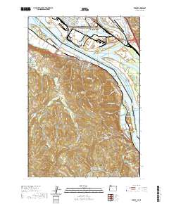
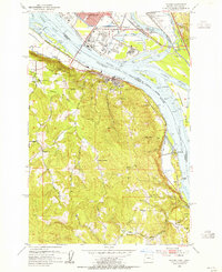 1953 Rainier1955 Print · USGSThe Columbia River waterfront at the start of the fifties reveals a heavy industrial corridor between Oregon and Washington. Genealogists and local historians can locate early landmarks like Hudson Cem, Neer City Sch, and the Reuben (site).4 unique versions available
 - 1957 Map of Hoquiam
 1957 Hoquiam1957 Print · USGSCoastal timber ports and inland rail hubs define Southwest Washington during the late fifties. Genealogists can trace early twentieth-century settlements like Bordeaux, Tono, and Cosmopolis alongside the expanding tracks of the Northern Pacific.
 - 1958 Map of Hoquiam, 1969 Print
 1958 Hoquiam1969 Print · USGSSouthwest Washington and the Columbia River estuary appear here in the mid-century, before major landscape shifts. Researchers can trace the rail lines of the Northern Pacific, locate the Fort Henness Site, or explore the Naselle Air Force Station.2 unique versions available
 - 1962 Map of Hoquiam
 1962 Hoquiam1962 Print · USGSSouthwest Washington in the late fifties is defined by the bustling timber ports of Hoquiam and the rail-linked commerce of the interior valleys. Genealogists and historians can trace the early footprints of settlements like Raymond and Pe Ell, or locate family sites at Grand Mound Cem and Odd Fellows Cem.
 - 1990 Map of Rainier, 1995 Print
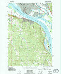 1990 Rainier1995 Print · USGSAlong the Columbia River in the early nineties, industrial waterfronts met the rural hills of Oregon. Trace family roots at Hudson Cem, explore the riverside at Rainier, or locate the Power Plant at Trojan.
 - 2011 Map of Rainier, 2011 Print
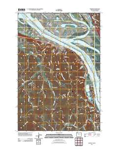 2011 Rainier2011 Print · USGSCovers Beaver Springs, including Longview, Kelso, and other nearby areas
 - 2014 Map of Rainier, 2014 Print
 2014 Rainier2014 Print · USGSCovers Beaver Springs, including Longview, Kelso, and other nearby areas
 - 2017 Map of Rainier, 2017 Print
 2017 Rainier2017 Print · USGSCovers Beaver Springs, including Longview, Kelso, and other nearby areas
 - 2020 Map of Rainier, 2020 Print
 2020 Rainier2020 Print · USGSCovers Beaver Springs, including Longview, Kelso, and other nearby areas
 - 2024 Map of Rainier, 2024 Print
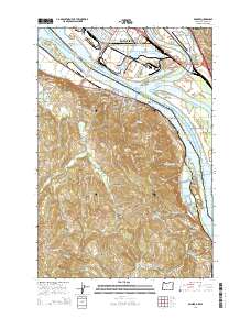
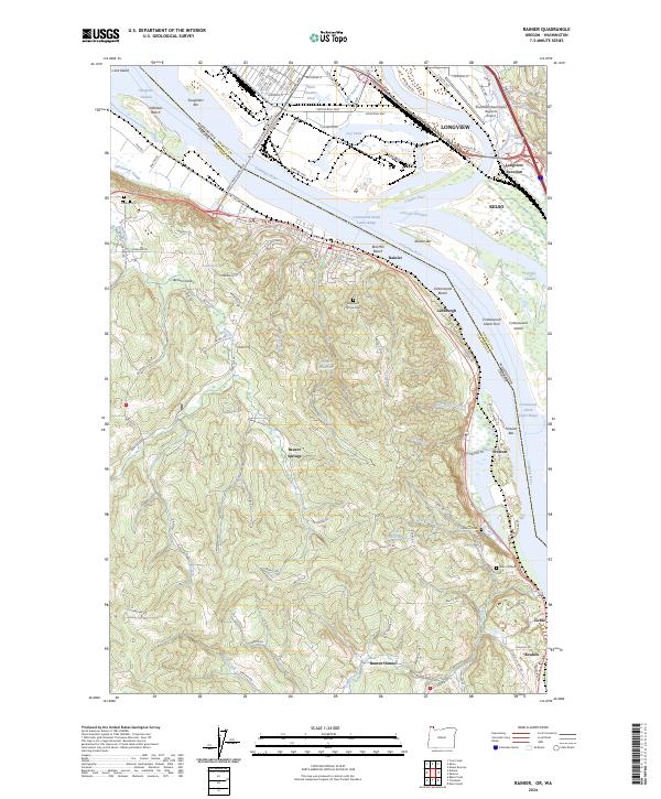 2024 Rainier2024 Print · USGSThe Oregon-Washington borderlands near Rainier and Longview are defined by the Columbia River's industrial shoreline and the inland valleys of Columbia County. Genealogists can locate Hudson Cem and Prescott Cem or trace rural life through Beaver Springs and Beaver Homes.
End of results
Showing maps 1-12 of 12
Top cities near Beaver Springs
- Longview historical maps
- Saint Helens historical maps
- Kelso historical maps
- Ridgefield historical maps
- Woodland historical maps
- Kalama historical maps
See more
Frequently asked questions
- What are the different types of historical maps available for Beaver Springs?
- What is the oldest map of Beaver Springs?
- Where can I purchase historical maps of Beaver Springs for my home or office?
- Where can I download high-res historical maps of Beaver Springs?
- Are there historical topographic maps available for Beaver Springs?
- Is there historical aerial imagery available for Beaver Springs?
- Where are historical maps of Beaver Springs sourced from?