Old Maps of North Bend, Oregon for Academic Research
Study the evolution of North Bend with 19 high-resolution historic maps. Whether you're teaching, researching, or modeling changes in land use, these maps provide essential visual documentation of urban, environmental, and geographic change.
- Analyze long-term change: Track patterns in development, transportation, and natural features.
- Ideal for environmental or urban studies: Support academic projects with primary historical map data.
- Use in the classroom or lab: Educators and researchers rely on these maps to bring historical context to life.
These maps are a powerful tool for teaching, research, and visualizing how North Bend has changed over the decades.
North Bend, OR maps
(19)- 1896 Map of Coos Bay
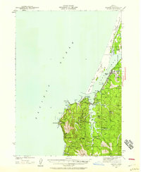
 1896 Coos Bay1896 Print · USGSCoastal Oregon at the turn of the century was a world defined by its waterways and timber ports. Trace the early layout of Marshfield, locate coal-era sites like Beaver Hill and Coaledo, or find riverfront landings at Prosper and Parkersburg along the Coquille River.
 - 1898 Map of Coos Bay
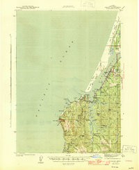
 1898 Coos Bay1898 Print · USGSThe Oregon coast at the end of the nineteenth century is defined here by the bustling maritime hubs of Coos Bay and the Coquille River. Genealogists and historians can trace early port towns like Marshfield, Empire, and Bandon alongside the timber-and-coal infrastructure of Beaver Hill.
 - 1900 Map of Coos Bay
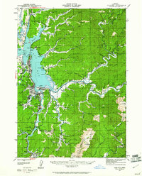
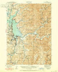
 1900 Coos Bay1900 Print · USGSThe Oregon coast at the turn of the century was a landscape of tide-water towns and river commerce centered on the massive Coos Bay inlet. Genealogists and local historians can trace early settlements like Marshfield, follow the Randolph Trail, and locate forgotten landings along Isthmus Slough.7 unique versions available
 - 1942 Map of Empire, 1958 Print
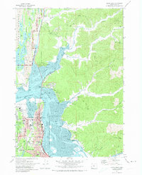
 1942 Empire1958 Print · USGSThe Oregon coast at Coos Bay is documented here in the early 1940s, showing a transition from maritime industry to rural ranching. Researchers can locate early family homesteads like Oldland Ranch and trace industrial sites such as the Chickamin Mine and the Pulp Mill in Empire.2 unique versions available
 - 1942 Map of Coos Bay, 1961 Print
 1942 Coos Bay1961 Print · USGSCoastal Oregon at the start of the war years reveals a landscape shaped by coal mining, timber, and a complex network of tidal sloughs. Researchers can locate vanished infrastructure like the Enegren Ferry or trace industrial roots at the Southport Coal Mine and Libby Coal Mine.2 unique versions available
 - 1944 Map of Empire
 1944 Empire1944 Print · USGSCoastal Coos County during the mid-1940s reveals a maritime economy balanced between ranching and industry. Genealogists can locate family-named landmarks like Sengstacken Ranch or trace early school sites such as Beach View Sch and South Slough Sch.4 unique versions available
 - 1945 Map of Coos Bay
 1945 Coos Bay1945 Print · USGSThe Coos Bay region in the mid-1940s shows a landscape where industrial coal mining and timber met the rising Oregon coast tourism era. Genealogists and historians can trace defunct operations like the Libby Coal Mine or find rural landmarks such as Masters Landing and Sunset Cem.3 unique versions available
 - 1954 Map of Coos Bay
 1954 Coos Bay1954 Print · USGSCoastal Oregon at mid-century shows a landscape of timber and tides, from the river ports to the edge of the Pacific. Researchers can trace family roots through coastal schools like Beachview School or follow the Southern Pacific RR through Reedsport and Coos Bay.
 - 1958 Map of Coos Bay, 1974 Print
 1958 Coos Bay1974 Print · USGSThe Southern Oregon coastline at mid-century reveals a bustling maritime and timber economy centered on Coos Bay and North Bend. Researchers can trace the legacy of coastal settlements from Bandon to Brookings, including rail lines of the Southern Pacific RR and the rugged reaches of the Siuslaw National Forest.
 - 1962 Map of Coos Bay
 1962 Coos Bay1962 Print · USGSThe Oregon coast at the end of the fifties reveals a landscape of timber ports and fishing villages connected by U.S. Highway 101. Researchers can trace the rail infrastructure of the Southern Pacific RR and locate early settlements from Florence down to Brookings.2 unique versions available
 - 1970 Map of Empire, 1973 Print
 1970 Empire1973 Print · USGSThe Coos Bay shoreline at the start of the 1970s reveals a landscape defined by industrial expansion and coastal preservation. Researchers can trace the layout of the Empire settlement, the campus of Southwestern Oregon Community College, and the sprawling North Spit.2 unique versions available
 - 1971 Map of North Bend, 1974 Print
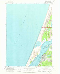
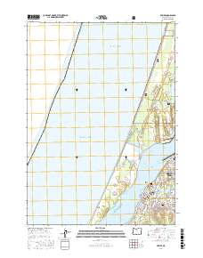
 1971 North Bend1974 Print · USGSThe Coos Bay shoreline was a hub of industrial and timber activity in the early seventies, centered on the growing port cities. Genealogists and researchers can trace local neighborhoods and schools like Sunny Hill Sch, the historic McCullough Bridge, and rural corners such as Cooston.
 - 1993 Map of Coos Bay
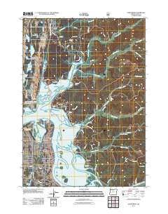
 1993 Coos Bay1993 Print · USGSCoastal Oregon at the start of the nineties reveals a complex landscape of maritime trade, timber forests, and riverside hamlets. Researchers can trace the legacy of the Southern Pacific railroad and find localized landmarks like Parkersburg, Prosper, and Bunker Hill.
 - 2011 Map of North Bend, 2011 Print
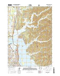
 2011 North Bend2011 Print · USGSCovers North Bend, including Coos Bay, Shorewood, and other nearby areas
 - 2017 Map of Empire, 2017 Print
 2017 Empire2017 Print · USGSCovers North Bend, including Coos Bay, Coos County, and other nearby areas
 - 2017 Map of North Bend, 2017 Print
 2017 North Bend2017 Print · USGSCovers North Bend, including Coos Bay, Shorewood, and other nearby areas
 - 2020 Map of Empire, 2020 Print
 2020 Empire2020 Print · USGSCovers North Bend, including Coos Bay, Coos County, and other nearby areas
 - 2024 Map of North Bend, 2024 Print
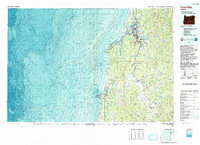
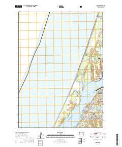
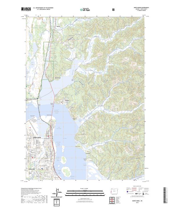 2024 North Bend2024 Print · USGSThe Coos Bay waterfront and the city of North Bend are captured in this modern record of Oregon's coast. Researchers can trace the maritime industry through Kentuck Inlet and Pony Slough, or locate landmarks like Sunnyhill Airport and Glasgow.
 - 2024 Map of Empire, 2024 Print
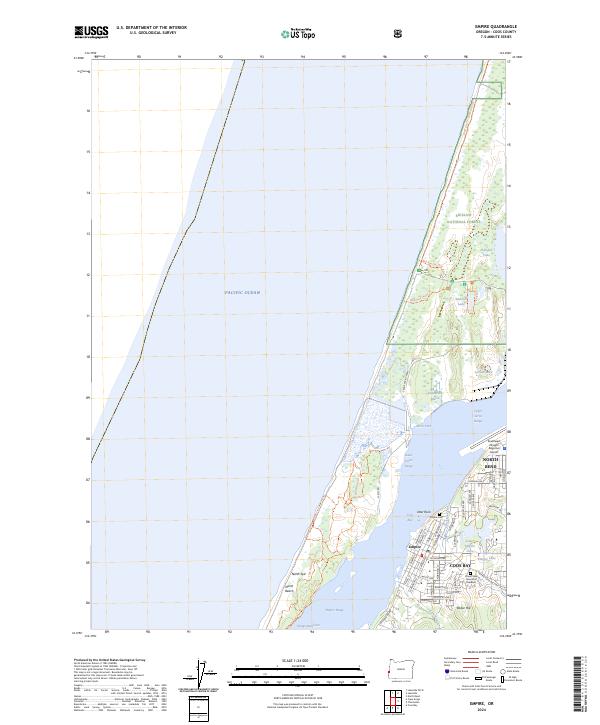 2024 Empire2024 Print · USGSThe coastal edge of Coos County comes into focus in this contemporary study of the North Spit and the waterfront districts of Empire and Coos Bay. Researchers can trace the layout of the Southwest Oregon Regional Airport or locate family sites at the Empire Cem.
End of results
Showing maps 1-19 of 19
Top cities near North Bend
- Coos Bay historical maps
- Coquille historical maps
- Barview historical maps
- Lakeside historical maps
- Charleston historical maps
Frequently asked questions
- What are the different types of historical maps available for North Bend?
- What is the oldest map of North Bend?
- Where can I purchase historical maps of North Bend for my home or office?
- Where can I download high-res historical maps of North Bend?
- Are there historical topographic maps available for North Bend?
- Is there historical aerial imagery available for North Bend?
- Where are historical maps of North Bend sourced from?