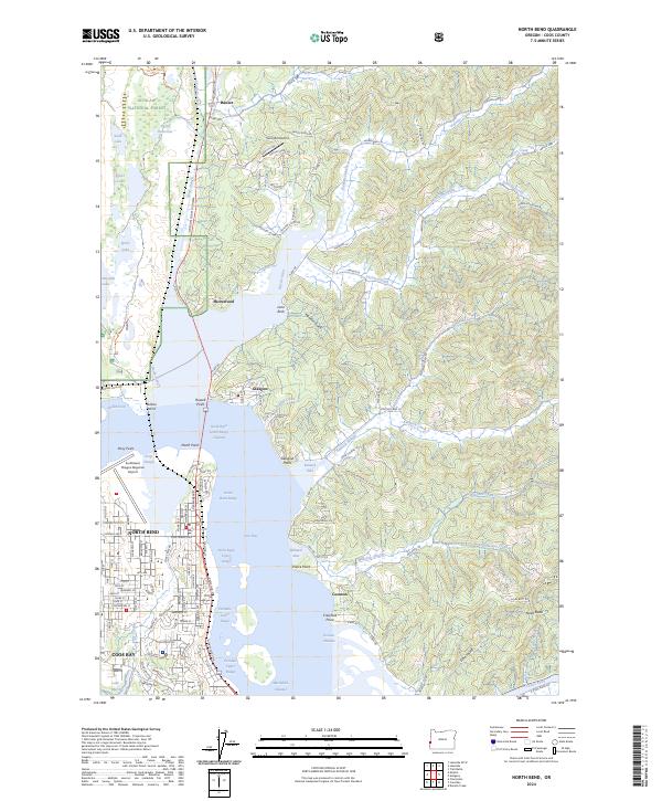
2024 Map of North Bend
USGS Topo · Published 2024About this map
North Bend and Coos Bay center this coastal landscape where the waters of Coos Bay meet a complex network of sloughs and inlets. The map illustrates the specialized maritime geography of the region, featuring critical navigation markers like the North Bend Lower Range Channel and Marshfield Channel. Along the northern shores, small communities such as Glasgow and Shorewood sit across from the more industrial developments near the Southwest Oregon Regional Airport.
Find a feature on this map
78 named features on this map. Tap any name to fly to it.
Don’t see what you’re looking for? This feature index may not catch every label — zoom into the map to look around manually.
Map Details
Editions of this 2024 North Bend Map
This is the sole edition of this map. No revisions or reprints were ever made.
Other maps of this area

1896 · Coos Bay
USGS Topo · 1:125,000

1898 · Coos Bay
USGS Topo · 1:125,000

1900 · Coos Bay
USGS Topo · 1:125,000

1923 · Reedsport
USGS Topo · 1:62,500

1942 · Reedsport
USGS Topo · 1:62,500

1942 · Empire
USGS Topo · 1:62,500

1942 · Coos Bay
USGS Topo · 1:62,500

1944 · Empire
USGS Topo · 1:62,500

1945 · Coos Bay
USGS Topo · 1:62,500

1954 · Coos Bay
USGS Topo · 1:250,000