Old Maps of Coos County, Oregon
Explore 100 old maps of Coos County, spanning from 1896 to today. These high-resolution historic maps reveal how streets, neighborhoods, landmarks, and natural features evolved over time — perfect for genealogy, metal detecting, research, and local history exploration.
What you can do with these maps:
- See how Coos County changed over time: Compare historical maps to modern-day views to trace roads, homesites, rail lines & more.
- View detailed metadata: Each map includes creators, publishers, year, scale, and archive source.
- Overlay maps with satellite & LiDAR: Visualize the past alongside modern tools to explore terrain & human change.
- Trusted historical sources: Maps sourced from the USGS, Library of Congress, and other archives.
- Access maps your way: View online, download high-res files, or order prints for personal or research use.
Start exploring old maps of Coos County to uncover forgotten places, hidden landmarks, and the deep history beneath your feet.
Coos County, OR maps
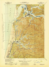
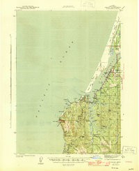
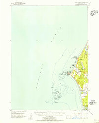
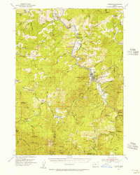
(100)- 1896 Map of Coos Bay
 1896 Coos Bay1896 Print · USGSCovers Coos County, including Coos Bay, North Bend, and other nearby areas
 - 1898 Map of Coos Bay
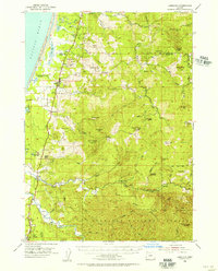
 1898 Coos Bay1898 Print · USGSCovers Coos County, including Coos Bay, North Bend, and other nearby areas
 - 1899 Map of Port Orford
 1899 Port Orford1899 Print · USGSCovers Coos County, including Port Orford, Powers, and other nearby areas
 - 1900 Map of Coos Bay
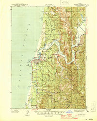
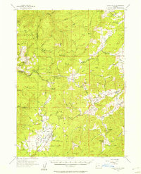
 1900 Coos Bay1900 Print · USGSCovers Coos County, including Coos Bay, North Bend, and other nearby areas7 unique versions available
 - 1903 Map of Port Orford
 1903 Port Orford1903 Print · USGSCovers Coos County, including Port Orford, Powers, and other nearby areas7 unique versions available
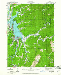
 - 1923 Map of Reedsport
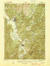
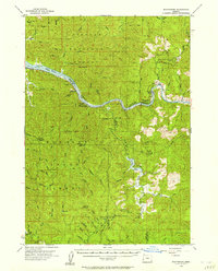
 1923 Reedsport1923 Print · USGSCovers Coos County, including Reedsport, Lakeside, and other nearby areas4 unique versions available
 - 1928 Map of Sitkum, 1939 Print
 1928 Sitkum1939 Print · USGSCovers Coos County, including Remote, Camas Valley, and other nearby areas
 - 1942 Map of Reedsport
 1942 Reedsport1942 Print · USGSCovers Coos County, including Reedsport, Lakeside, and other nearby areas2 unique versions available
 - 1942 Map of Empire, 1958 Print
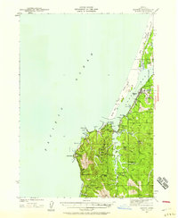 1942 Empire1958 Print · USGSCovers Coos County, including Coos Bay, North Bend, and other nearby areas2 unique versions available
 - 1942 Map of Coquille, 1960 Print
 1942 Coquille1960 Print · USGSCovers Coos County, including Coquille, Myrtle Point, and other nearby areas3 unique versions available
 - 1942 Map of Coos Bay, 1961 Print
 1942 Coos Bay1961 Print · USGSCovers Coos County, including Coos Bay, North Bend, and other nearby areas2 unique versions available
 - 1943 Map of Bandon, 1955 Print
 1943 Bandon1955 Print · USGSCovers Coos County, including Bandon, Laurel Grove, and other nearby areas3 unique versions available
 - 1944 Map of Empire
 1944 Empire1944 Print · USGSCovers Coos County, including Coos Bay, North Bend, and other nearby areas4 unique versions available
 - 1944 Map of Bandon
 1944 Bandon1944 Print · USGSCovers Coos County, including Bandon, Laurel Grove, and other nearby areas2 unique versions available
 - 1945 Map of Coquille
 1945 Coquille1945 Print · USGSCovers Coos County, including Coquille, Myrtle Point, and other nearby areas
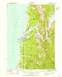
 - 1945 Map of Coos Bay
 1945 Coos Bay1945 Print · USGSCovers Coos County, including Coos Bay, North Bend, and other nearby areas3 unique versions available
 - 1954 Map of Coos Bay
 1954 Coos Bay1954 Print · USGSCovers Coos County, including Coos Bay, North Bend, and other nearby areas
 - 1954 Map of Bone Mountain, 1955 Print
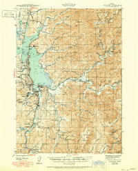
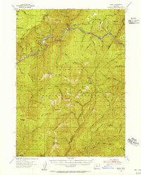
 1954 Bone Mountain1955 Print · USGSCovers Coos County, including Douglas County, Curry County, and other nearby areas2 unique versions available
 - 1954 Map of Marial, 1956 Print
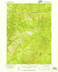
 1954 Marial1956 Print · USGSCovers Coos County, including Josephine County, Curry County, and other nearby areas4 unique versions available
 - 1954 Map of Cape Blanco, 1956 Print
 1954 Cape Blanco1956 Print · USGSCovers Coos County, including Port Orford, Curry County, and other nearby areas3 unique versions available
 - 1954 Map of Agness, 1956 Print
 1954 Agness1956 Print · USGSCovers Coos County, including Agness, Illahe, and other nearby areas3 unique versions available
 - 1954 Map of Powers, 1956 Print
 1954 Powers1956 Print · USGSCovers Coos County, including Powers, Bancroft, and other nearby areas3 unique versions available
 - 1954 Map of Langlois, 1956 Print
 1954 Langlois1956 Print · USGSCovers Coos County, including Port Orford, Denmark, and other nearby areas3 unique versions available
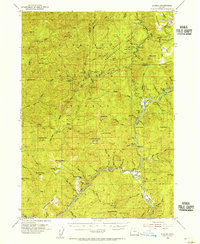
 - 1955 Map of Camas Valley, 1957 Print
 1955 Camas Valley1957 Print · USGSCovers Coos County, including Camas Valley, Tenmile, and other nearby areas3 unique versions available
 - 1955 Map of Scottsburg, 1957 Print
 1955 Scottsburg1957 Print · USGSCovers Coos County, including Scottsburg, Ash Valley, and other nearby areas3 unique versions available
Showing maps 1-25 of 100
Top cities of Coos County
- Coos Bay historical maps
- North Bend historical maps
- Coquille historical maps
- Bandon historical maps
- Myrtle Point historical maps
- Barview historical maps
See more
Frequently asked questions
- What are the different types of historical maps available for Coos County?
- What is the oldest map of Coos County?
- Where can I purchase historical maps of Coos County for my home or office?
- Where can I download high-res historical maps of Coos County?
- Are there historical topographic maps available for Coos County?
- Is there historical aerial imagery available for Coos County?
- Where are historical maps of Coos County sourced from?