1990s Maps of Coos County, Oregon
Explore 31 historic maps of Coos County from the 1990s. These maps offer a rare glimpse into what life looked like during the 1990s — showing old roads, neighborhoods, homes, and landmarks that have changed or disappeared over time.
Whether you're researching your family's past, planning a metal detecting trip, or studying how Coos County's landscape evolved across the 1990s, these high-resolution maps are a powerful tool for exploring the history of this region.
- Focus on a specific era: All maps on this page are from the 1990s, giving you a focused view of this time period.
- See what’s changed: Compare century-old streets, trails, and buildings to today's modern landscape using overlays and satellite layers.
- Research with precision: Use these maps for genealogy, historical research, land use analysis, or educational projects.
- View, download, or print: Maps are fully viewable online in high resolution, and can be downloaded or printed for your own records.
Start exploring Coos County's history through authentic maps from the 1990s. This is your window into the past.
Coos County, OR maps
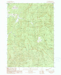
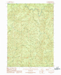
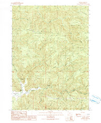
(31)- 1990 Map of Remote
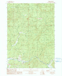 1990 Remote1990 Print · USGSCoos County as it appeared in the 1990s was a landscape defined by the winding Middle Fork Coquille River and its timbered ridges. Researchers can locate family landmarks like the Enchanted Prairie Cemetery or trace early roads near Remote and Plum Prairie.
 - 1990 Map of Cedar Creek
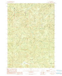
 1990 Cedar Creek1990 Print · USGSThe Oregon Coast Range at the turn of the 1990s was a landscape of deep drainages and limited back-roads access. Researchers can trace the rugged intersection of the Williams River and Cedar Creek, or locate high points like Green Peak and the remote 4WD trails.
 - 1990 Map of Mount Bolivar
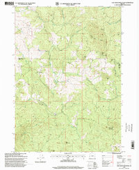
 1990 Mount Bolivar1990 Print · USGSThe Oregon Coast Range at the turn of the 1990s reveals a landscape of protected wilderness and legacy resource extraction. Researchers can locate remote mining sites like Fuller Mine and trace the headwaters of the South Fork Coquille River near Mount Bolivar.
 - 1990 Map of Golden Falls
 1990 Golden Falls1990 Print · USGSIn the Oregon Coast Range during the late eighties, this area shows a landscape defined by forestry and protected natural landmarks. Researchers can trace the winding forks of the Millicoma River and locate remote features like Golden Falls, Hewett Falls, and Schoolhouse Creek.
 - 1990 Map of Kenyon Mountain
 1990 Kenyon Mountain1990 Print · USGSThe Oregon Coast Range at the start of the nineties is captured here, showing the ridgelines along the COOS CO and DOUGLAS CO line. Researchers can locate the Radio Facility Camas Lookout and trace the paths of Sandy Creek or Upper Rock Creek.
 - 1990 Map of Rasler Creek
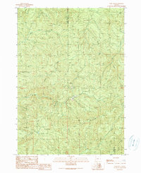
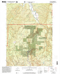
 1990 Rasler Creek1990 Print · USGSThe timberlands of Coos County are captured in the late 1980s, showing a landscape defined by industrial forest roads and complex mountain drainages. Genealogists and researchers can trace the old clearing at Jenkins Prairie or follow the waters of the M Fk Coquille R and the rugged slopes of Eden Ridge.
 - 1990 Map of Ivers Peak
 1990 Ivers Peak1990 Print · USGSThe rugged timberlands along the Coos and Douglas county border are documented here in the late twentieth century. Researchers can trace the steep drainages of the East Fork Millicoma River and find evidence of industry at the Quarry or Tailings.
 - 1990 Map of Camas Valley
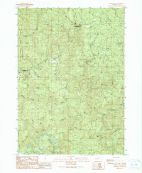
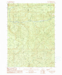
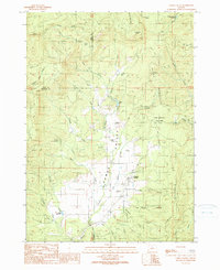 1990 Camas Valley1990 Print · USGSCamas Valley sits at the meeting of the Coquille River forks in the final decade of the twentieth century. Genealogists can locate several historic family plots including Martindale Cemetery, Murry Cemetery, and the Day Cemetery.
 - 1990 Map of Mount Gurney
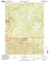
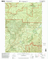
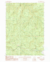 1990 Mount Gurney1990 Print · USGSThe Douglas and Coos county line crosses a landscape of deep timber and high ridges in the late twentieth century. Genealogists and local historians can trace family-named landmarks and recreation sites like Severt Iverson Memorial County Park, Tioga, and the heights of Mount Gurney.
 - 1990 Map of Coos Mountain
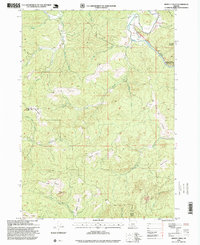
 1990 Coos Mountain1990 Print · USGSThe Oregon Coast Range interior during the late twentieth century is defined by the headwaters of two major river systems. Researchers can trace the timber and mining access routes through Dellwood and identify remote features like Coos Mountain and the Borrow Pit.
 - 1990 Map of Bone Mountain
 1990 Bone Mountain1990 Print · USGSCoastal mountain timberlands in the late eighties and early nineties are shown here at the Coos and Douglas county line. Researchers can trace forest management through numerous quarries, the Bear Creek Campground, and landmarks like Bone Mountain and Ketchin Butte.
 - 1990 Map of Eden Valley
 1990 Eden Valley1990 Print · USGSCoastal Oregon timberlands and protected wilderness meet in the Siskiyou National Forest during the late twentieth century. Researchers can trace the winding course of the South Fork Coquille River and identify localized landmarks like Camp Two or the remote Wild Rogue Wilderness.
 - 1990 Map of Dora
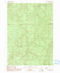
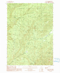
 1990 Dora1990 Print · USGSThe rural backcountry of Coos County comes into focus in the late twentieth century as timber trails and river valleys define the landscape. Local historians can trace the McKinley Grange Hall, the community at Dora, and isolated landmarks like a lone Grave near the Coquille River.
 - 1990 Map of Sitkum
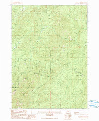
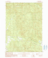
 1990 Sitkum1990 Print · USGSCoos County in the early nineties is shown here as a landscape of timber ridges and deep river canyons. Researchers can locate the small settlements of Sitkum and Brewster, or trace the rugged paths near Burnt Mountain and Skeeter Camp.
 - 1990 Map of Tioga
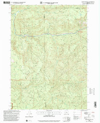
 1990 Tioga1990 Print · USGSThe Coos and Douglas county borderlands come into focus in the early nineties, showing a landscape defined by timber access and river forks. Researchers can trace the rugged network of logging roads connecting Farrin Camp, Tioga, and the South Fork Coos River.
 - 1992 Map of Port Orford, 1993 Print
 1992 Port Orford1993 Print · USGSThe southern Oregon coast and the coastal ranges of the early nineties are captured here in both topographic and bathymetric detail. Researchers can trace landforms from the reefs of Oregon Islands to inland landmarks like Bingham Mountain and Albert H Powers Memorial State Park.
 - 1993 Map of Coos Bay
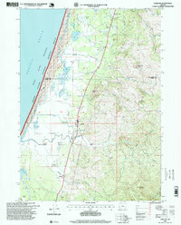
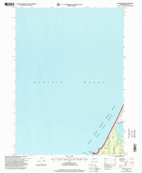
 1993 Coos Bay1993 Print · USGSCoastal Oregon at the start of the nineties reveals a complex landscape of maritime trade, timber forests, and riverside hamlets. Researchers can trace the legacy of the Southern Pacific railroad and find localized landmarks like Parkersburg, Prosper, and Bunker Hill.
 - 1996 Map of Langlois, 1999 Print
 1996 Langlois1999 Print · USGSThe Oregon coast near the Coos and Curry county line is shown here in the mid-nineties, where cranberry farming meets the Pacific wilderness. Researchers can locate the Denmark Cemetery, the inland waters of Floras Lake, and family-named landmarks like Woodens Butte.
 - 1996 Map of Barklow Mountain, 1999 Print
 1996 Barklow Mountain1999 Print · USGSCoastal mountains and river headwaters in Curry and Coos Counties define this area during the late twentieth century. Researchers can trace remote ranching outposts like Dement Ranch, find a lonely Cem, and explore the high meadows of Carlton Prairie.
 - 1996 Map of Calf Ranch Mountain, 1999 Print
 1996 Calf Ranch Mountain1999 Print · USGSThe rugged Coast Range interior on the Coos and Curry County border comes into focus in the mid-nineties. Trace old mountain outposts and local landmarks like Graves, Camp Fir Croft, and the curiously named White Elephant Bridge.
 - 1996 Map of Dement Creek, 1999 Print
 1996 Dement Creek1999 Print · USGSThe interior mountains of Coos and Curry Counties are captured here in the late twentieth century, showing a landscape of high prairies and winding river forks. Researchers can trace family-named landmarks like Sears Rock, the Dement Cem, and the remote Long Prairie.
 - 1996 Map of Floras Lake, 1999 Print
 1996 Floras Lake1999 Print · USGSThe Curry County coastline and its unique freshwater lagoons are captured in the mid-nineties, showing a region defined by conservation. Researchers can trace the boundaries of Floras Lake State Park or locate the Boat Ramp near Boise-Cope Park.
 - 1996 Map of China Flat, 1999 Print
 1996 China Flat1999 Print · USGSCoos County, Oregon, is captured here in the mid-1990s as a hub of forest management and river-valley transit. Trace the river's path past China Flat and Orchard Park, or locate landmarks like Powers State Airport and Sand Rock Mountain.
 - 1998 Map of Eden Valley, 2001 Print
 1998 Eden Valley2001 Print · USGSCoastal range forests and river headwaters are captured here at the close of the twentieth century. Genealogists and outdoorsmen can locate specific camps and summits like Coal Creek Camp, Table Rock, and Buck Creek Campground.
 - 1998 Map of Bone Mountain, 2001 Print
 1998 Bone Mountain2001 Print · USGSThe Oregon Coast Range at the close of the century shows a landscape of timber management and forest recreation. Researchers can trace the rugged topography of Bone Mountain and Skull Ridge, identifying scattered Quarry sites and the Bear Creek Campground.
Showing maps 1-25 of 31
Top cities of Coos County
- Coos Bay historical maps
- North Bend historical maps
- Coquille historical maps
- Bandon historical maps
- Myrtle Point historical maps
- Barview historical maps
See more
Frequently asked questions
- What are the different types of historical maps available for Coos County?
- What is the oldest map of Coos County?
- Where can I purchase historical maps of Coos County for my home or office?
- Where can I download high-res historical maps of Coos County?
- Are there historical topographic maps available for Coos County?
- Is there historical aerial imagery available for Coos County?
- Where are historical maps of Coos County sourced from?