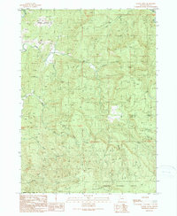
1990 Map of Rasler Creek
USGS Topo · Published 1990About this map
Jenkins Prairie sits in the northwestern corner of this landscape, marking a rare break in the dense, drainage-heavy terrain of the Siskiyou National Forest. Surveyed in the late 1980s, the map reveals a complex network of forest roads and trails that navigate the steep slopes of Eden Ridge and the surrounding basins. The drainage pattern is the dominant geographic feature, defined by the M Fk Coquille R and its numerous tributaries including Rasler Creek, Rock Creek, and Myrtle Creek. This provisional survey preserves the detailed topography of the timberlands during a period of transition in the Pacific Northwest, capturing the intricate water systems of Pheasant Creek, Cole Creek, and Shields Creek before further modernization of the forest's access routes.
Find a feature on this map
15 named features on this map. Tap any name to fly to it.
Don’t see what you’re looking for? This feature index may not catch every label — zoom into the map to look around manually.
Map Details
Editions of this 1990 Rasler Creek Map
This is the sole edition of this map. No revisions or reprints were ever made.
Other maps of this area

1896 · Coos Bay
USGS Topo · 1:125,000

1898 · Coos Bay
USGS Topo · 1:125,000

1899 · Port Orford
USGS Topo · 1:125,000

1900 · Coos Bay
USGS Topo · 1:125,000

1903 · Port Orford
USGS Topo · 1:125,000

1928 · Sitkum
USGS Topo · 1:125,000

1942 · Coquille
USGS Topo · 1:62,500

1945 · Coquille
USGS Topo · 1:62,500

1954 · Coos Bay
USGS Topo · 1:250,000

1954 · Bone Mountain
USGS Topo · 1:62,500