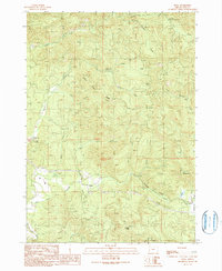
1990 Map of Dora
USGS Topo · Published 1990About this map
The East Fork Coquille River winds through this rugged interior of Coos County, where the small settlement of Dora sits at the junction of valley roads and river bends. This 1990 provisional survey records a landscape shaped by timber management and early local institutions, such as the McKinley Grange Hall and multiple public spaces like Frona County Park and Cherry Creek County Park. The terrain is defined by steep ridges and narrow drainages, including Cherry Creek Ridge and notable elevations like Sheeps Head and Brewster Rock.
Find a feature on this map
39 named features on this map. Tap any name to fly to it.
Don’t see what you’re looking for? This feature index may not catch every label — zoom into the map to look around manually.
Map Details
Editions of this 1990 Dora Map
This is the sole edition of this map. No revisions or reprints were ever made.
Other maps of this area

1896 · Coos Bay
USGS Topo · 1:125,000

1898 · Coos Bay
USGS Topo · 1:125,000

1900 · Coos Bay
USGS Topo · 1:125,000

1928 · Sitkum
USGS Topo · 1:125,000

1942 · Coquille
USGS Topo · 1:62,500

1942 · Coos Bay
USGS Topo · 1:62,500

1945 · Coquille
USGS Topo · 1:62,500

1945 · Coos Bay
USGS Topo · 1:62,500

1954 · Coos Bay
USGS Topo · 1:250,000

1955 · Ivers Peak
USGS Topo · 1:62,500