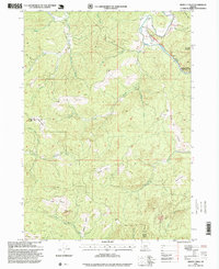
1996 Map of Dement Creek
USGS Topo · Published 1999About this map
The South Fork Coquille River winds through the northeast corner of this landscape, where the Albert H Powers Memorial State Park and the settlement of Dement are situated along the river's path. This 1990s U.S. Forest Service revision reveals a complex terrain defined by numerous named clearings or "prairies," suggesting a history of high-country grazing or natural openings within the timbered slopes. Notable examples include Long Prairie, Sears Prairie, and Hermann Prairie, which are interspersed among high points like Whobrey Mountain and Bald Hill.
Find a feature on this map
35 named features on this map. Tap any name to fly to it.
Don’t see what you’re looking for? This feature index may not catch every label — zoom into the map to look around manually.
Map Details
Editions of this 1996 Dement Creek Map
This is the sole edition of this map. No revisions or reprints were ever made.
Other maps of this area

1896 · Coos Bay
USGS Topo · 1:125,000

1898 · Coos Bay
USGS Topo · 1:125,000

1899 · Port Orford
USGS Topo · 1:125,000

1900 · Coos Bay
USGS Topo · 1:125,000

1903 · Port Orford
USGS Topo · 1:125,000

1942 · Coquille
USGS Topo · 1:62,500

1943 · Bandon
USGS Topo · 1:62,500

1944 · Bandon
USGS Topo · 1:62,500

1945 · Coquille
USGS Topo · 1:62,500

1954 · Coos Bay
USGS Topo · 1:250,000