Old Maps of Quimby, Oregon for Metal Detecting
Plan your next treasure hunt with 10 historic maps of Quimby. Find old homesites, ghost towns, trails, and gathering spots that may be lost to time — perfect for identifying promising metal detecting locations.
- Locate forgotten sites: Uncover places like long-lost settlements, abandoned rail lines, or gathering spots.
- Plan better hunts: Use map overlays combined with LiDAR or satellite views to narrow in on historically rich areas.
- Made for detectorists: Thousands of hobbyists use these maps to discover relics, coins, and hidden history.
Use these historic maps to boost your research and find new opportunities beneath the surface of Quimby.
Quimby, OR maps
(10)- 1955 Map of Mace Mtn, 1957 Print
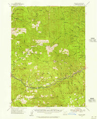 1955 Mace Mtn1957 Print · USGSThe Umpqua National Forest in the 1950s was a hub of forest service activity and early mountain recreation. Researchers can trace historic outposts and campsites like the Rock Cr Guard Sta, Old Fairview, and Smith Springs Campground.2 unique versions available
 - 1958 Map of Roseburg, 1960 Print
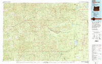
 1958 Roseburg1960 Print · USGSThe timber valleys and high volcanic peaks of Southern Oregon are captured here in the late fifties. Researchers can trace the Southern Pacific rail line through historic settlements like Cottage Grove, Yoncalla, and Oakridge near the Cascade Range crest.4 unique versions available
 - 1959 Map of Roseburg
 1959 Roseburg1959 Print · USGSThe Umpqua and Willamette valleys meet the high Cascades in this late-fifties study of Southern Oregon's timber and rail corridors. Genealogists and researchers can trace the Southern Pacific RR through historic towns like Roseburg, Yoncalla, and Cottage Grove.
 - 1978 Map of Diamond Lake, 1994 Print
 1978 Diamond Lake1994 Print · USGSThe Cascades of the late 1970s are seen here at a point of high-mountain industry and recreation across the Umpqua and Willamette forests. Researchers can trace the development of timber and water resources around Toketee Falls, Umpqua Mine, and Steamboat.2 unique versions available
 - 1989 Map of Old Fairview, 1990 Print
 1989 Old Fairview1990 Print · USGSDouglas County’s river-carved landscape is captured here in the late eighties as it balances recreation and natural resources. Researchers can trace the North Umpqua River corridor to find Smith Springs, Old Fairview, and the heights of Chimney Rock.
 - 1997 Map of Old Fairview, 2000 Print
 1997 Old Fairview2000 Print · USGSThe Douglas County backcountry during the late nineties centers on the winding North Fork Umpqua River and its recreational corridors. Researchers can locate riverfront landmarks like Smith Springs and trace the paths to Susan Creek Falls or the high point at Old Fairview.
 - 2011 Map of Old Fairview, 2011 Print
 2011 Old Fairview2011 Print · USGSCovers Quimby, including Douglas County, United States, and other nearby areas
 - 2014 Map of Old Fairview, 2014 Print
 2014 Old Fairview2014 Print · USGSCovers Quimby, including Douglas County, United States, and other nearby areas
 - 2020 Map of Old Fairview, 2020 Print
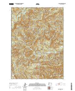 2020 Old Fairview2020 Print · USGSCovers Quimby, including Douglas County, United States, and other nearby areas
 - 2023 Map of Old Fairview, 2023 Print
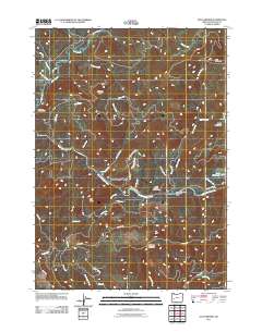
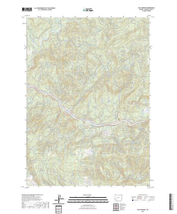 2023 Old Fairview2023 Print · USGSThe North Umpqua River corridor in Douglas County appears here in the early 2020s, showing a landscape defined by timber management and recreation. Researchers can trace the North Umpqua Trl past landmarks like Susan Creek Falls and the summit of Old Fairview.
End of results
Showing maps 1-10 of 10
Frequently asked questions
- What are the different types of historical maps available for Quimby?
- What is the oldest map of Quimby?
- Where can I purchase historical maps of Quimby for my home or office?
- Where can I download high-res historical maps of Quimby?
- Are there historical topographic maps available for Quimby?
- Is there historical aerial imagery available for Quimby?
- Where are historical maps of Quimby sourced from?