1960s Maps of Gilliam County, Oregon
Explore 14 historic maps of Gilliam County from the 1960s. These maps offer a rare glimpse into what life looked like during the 1960s — showing old roads, neighborhoods, homes, and landmarks that have changed or disappeared over time.
Whether you're researching your family's past, planning a metal detecting trip, or studying how Gilliam County's landscape evolved across the 1960s, these high-resolution maps are a powerful tool for exploring the history of this region.
- Focus on a specific era: All maps on this page are from the 1960s, giving you a focused view of this time period.
- See what’s changed: Compare century-old streets, trails, and buildings to today's modern landscape using overlays and satellite layers.
- Research with precision: Use these maps for genealogy, historical research, land use analysis, or educational projects.
- View, download, or print: Maps are fully viewable online in high resolution, and can be downloaded or printed for your own records.
Start exploring Gilliam County's history through authentic maps from the 1960s. This is your window into the past.
Gilliam County, OR maps
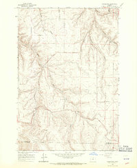
(14)- 1962 Map of Alderdale, 1963 Print
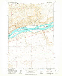 1962 Alderdale1963 Print · USGSThe Columbia River corridor is captured here in the early sixties, showing the rail-dominated landscape of the Oregon-Washington border. Researchers can trace the dual rail lines of the Spokane Portland and Seattle and Union Pacific through Alderdale and past Thanksgiving Island.2 unique versions available
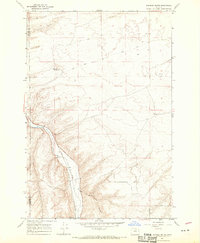
 - 1962 Map of Heppner Junction, 1963 Print
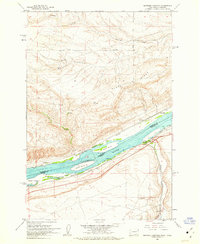 1962 Heppner Junction1963 Print · USGSThe Columbia River corridor in the early sixties showcases the vital rail and river networks connecting Washington and Oregon. Genealogists and historians can locate Heppner Junction, Sixprong Ranch, and the paths of the Union Pacific and Spokane Portland and Seattle railroads.3 unique versions available
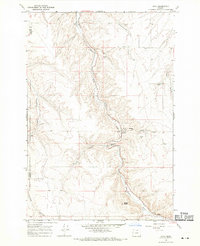
 - 1962 Map of Wood Gulch, 1963 Print
 1962 Wood Gulch1963 Print · USGSThe Columbia River corridor is captured here in the early 1960s, documenting the border between Washington and Oregon. Genealogists can trace family holdings at Goodknight Ranch or Whitmore Ranch while historians study the Union Pacific and Spokane Portland and Seattle rail lines.3 unique versions available
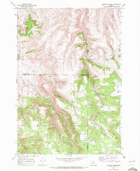
 - 1964 Map of Turner Butte, 1965 Print
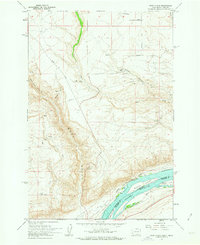
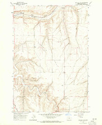
 1964 Turner Butte1965 Print · USGSMid-century Gilliam County comes into focus in this survey of the high desert along the Sherman Co Gilliam Co border. Trace the historical Oregon Trail (Approximate Route), the Union Pacific tracks, and the remote settlement of Barnett near the John Day River.2 unique versions available
 - 1964 Map of Shutler Flat, 1965 Print
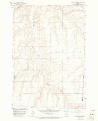
 1964 Shutler Flat1965 Print · USGSGilliam County's high plateau and deep canyons are documented in the mid-1960s, showing the intersection of pioneer history and modern industry. Trace the Oregon Trail near the Weatherford Historical Mon or locate rural landmarks like the Olex PO and Roddy.
 - 1964 Map of Hickland Butte, 1965 Print
 1964 Hickland Butte1965 Print · USGSOregon's high desert plateau near the Gilliam and Morrow county line is captured here in the mid-sixties. You can trace the historic Oregon Trail (Approx Route) and locate isolated rural landmarks like Hickland Butte and local Cem sites.
 - 1964 Map of Mc Donald, 1965 Print
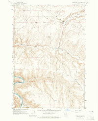
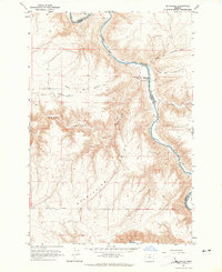 1964 Mc Donald1965 Print · USGSThe high plateau of Sherman County meets the John Day River in the mid-1960s, preserving the intersecting paths of early pioneers. You can trace the historic Oregon Trail and Barlow Cutoff as they descend toward the river crossing at McDonald Ford.2 unique versions available
 - 1964 Map of Horn Butte, 1965 Print
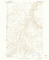 1964 Horn Butte1965 Print · USGSGilliam County's high plateau comes into focus during the mid-1960s, showing a landscape defined by ranching and historic migration routes. Researchers can trace the original Oregon Tr across the coulees or follow the Union Pacific line as it winds past Willow Creek.
 - 1968 Map of Gooseberry, 1970 Print
 1968 Gooseberry1970 Print · USGSGooseberry and the high canyon country of north-central Oregon are captured here in the late sixties. Researchers can trace the layout of the Gooseberry settlement, identifying local landmarks like the Gooseberry Cem and the remote Landing Strip among the deep draws.
 - 1968 Map of Dalreed Butte, 1970 Print
 1968 Dalreed Butte1970 Print · USGSMorrow and Gilliam counties were still remote desert landscapes in the late sixties, where pioneer history and rail infrastructure met. Trace the historic paths of the Oregon Tr and Immigrant Road as they overlook the Union Pacific tracks in the Willow Creek canyon.
 - 1968 Map of Cecil, 1970 Print
 1968 Cecil1970 Print · USGSMorrow County was a landscape of deep canyons and historic transit paths in the late 1960s. Researchers can trace the Oregon Trail and Immigrant Road as they cross the plateau above Willow Creek and the settlement of Morgan.
 - 1969 Map of Lefevre Prairie, 1972 Print
 1969 Lefevre Prairie1972 Print · USGSHigh-country prairies and deep canyons meet at the intersection of three counties during the late sixties. Genealogists and hikers can trace the Lonerock Cem, explore the reaches of The Frog, or follow the timbered boundaries of the Umatilla National Forest.2 unique versions available
 - 1969 Map of Buttermilk Canyon, 1973 Print
 1969 Buttermilk Canyon1973 Print · USGSMorrow and Gilliam Counties appear at the end of the sixties as a land of deep canyons and high cattle ridges. Researchers can trace historic ranching infrastructure and family-named landmarks like Rood Trail, Hale Ridge, and Fichter Canyon.
 - 1969 Map of Lonerock, 1973 Print
 1969 Lonerock1973 Print · USGSLonerock and the high plateau country of the Gilliam and Wheeler county line appear here as they were in the late sixties. Genealogists and researchers can locate the Lonerock settlement and local Cem, or trace landmarks like Cone Mill and the Jeep Tr.2 unique versions available
End of results
Showing maps 1-14 of 14
Top cities of Gilliam County
Frequently asked questions
- What are the different types of historical maps available for Gilliam County?
- What is the oldest map of Gilliam County?
- Where can I purchase historical maps of Gilliam County for my home or office?
- Where can I download high-res historical maps of Gilliam County?
- Are there historical topographic maps available for Gilliam County?
- Is there historical aerial imagery available for Gilliam County?
- Where are historical maps of Gilliam County sourced from?