Old Maps of Gilliam County, Oregon for Hiking & Exploration
Hike through history with 219 historic maps of Gilliam County. Explore old trails, ghost towns, and forgotten backroads — perfect for outdoor adventurers and local explorers.
- Rediscover forgotten places: Map out old mining camps, roads, and footpaths that no longer exist on modern maps.
- Layer with modern tools: Combine with LiDAR or satellite views to plan hikes through historical terrain.
- Made for exploration: Popular among hikers, overlanders, and local history lovers.
Use these maps to find adventure and explore the hidden past of Gilliam County.
Gilliam County, OR maps
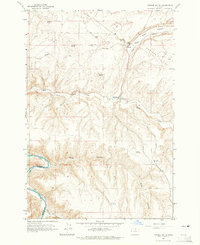
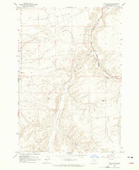
(219)- 1906 Map of Blalock Island, 1954 Print
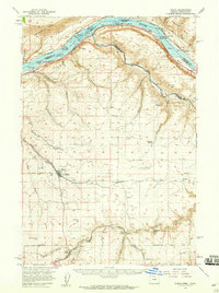
 1906 Blalock Island1954 Print · USGSThe Columbia River corridor in the early twentieth century served as a vital nexus for Pacific Northwest rail and river trade. Researchers can trace the routes of three major railroads and locate early settlements and landmarks like Irrigon, Blalock Island, and Castle Rock.2 unique versions available
 - 1908 Map of Blalock Island
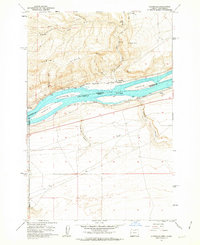
 1908 Blalock Island1908 Print · USGSThe Columbia River frontier of Oregon and Washington is captured here in the years before massive dam projects altered the basin. Researchers can trace the path of the Emigrant Road and locate early settlements like Douglas Morgan P.O., Cecil, and Irrigon.3 unique versions available
 - 1916 Map of Arlington
 1916 Arlington1916 Print · USGSThe Columbia River frontier of the mid-1910s reveals a world where the Oregon Trail and early railroads met the water. Genealogists can trace family roots through rural landmarks like Stegeman Ranch, Shutler, and the Locust Grove School.4 unique versions available
 - 1916 Map of Condon
 1916 Condon1916 Print · USGSNorth-central Oregon at the start of the twentieth century was a land of high plateaus and deep canyons centered on the Condon wheat country. Genealogists can trace a vast network of rural schoolhouses like Linville School and Buckhorn School, alongside early rail stops at Mikkalo and Gwendolen.3 unique versions available
 - 1953 Map of Pendleton, 1957 Print
 1953 Pendleton1957 Print · USGSNortheastern Oregon and the Columbia River frontier are captured here in the early fifties, a time of massive federal infrastructure projects. Researchers can trace the historic route of The Old Oregon Trail as it passes near the Umatilla Ordnance Depot and the new McNary Dam.4 unique versions available
 - 1953 Map of The Dalles, 1965 Print
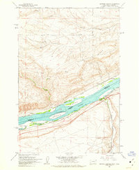
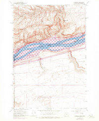
 1953 The Dalles1965 Print · USGSThe Columbia River Gorge at mid-century shows a region being transformed by massive hydroelectric dams and a growing highway network. Researchers can trace the development of The Dalles Dam, locate the Maryhill Museum, and find old rail stops in Rufus, Wishram, and Arlington.3 unique versions available
 - 1956 Map of The Dalles
 1956 The Dalles1956 Print · USGSThe Columbia River Gorge and the high Cascades are captured in the mid-1950s, showing a vital corridor of rail and road. Researchers can trace the original path of The Old Oregon Trail or locate historical landmarks like the Maryhill Museum and Mount Hood.
 - 1956 Map of Pendleton
 1956 Pendleton1956 Print · USGSNortheastern Oregon’s high plateau and timbered peaks appear here in the mid-fifties, during a time of major military and hydroelectric development. Trace the path of The Old Oregon Trail alongside modern landmarks like McNary Dam and the Umatilla Ordnance Depot.
 - 1957 Map of The Dalles
 1957 The Dalles1957 Print · USGSThe Columbia River Gorge and the high plateaus of the mid-1950s come alive on this detailed survey of northern Oregon and southern Washington. Researchers can trace the path of the Oregon Trail and The Old Barlow Road alongside river towns like The Dalles and Wishram.
 - 1957 Map of Wasco, 1959 Print
 1957 Wasco1959 Print · USGSSherman County and the Columbia River frontier are captured in the late fifties, showing the vital rail and water routes of the Inland Empire. Researchers can trace historic settlements from Wasco to Klondike and locate family landmarks like Sunrise Cemetery.2 unique versions available
 - 1962 Map of Alderdale, 1963 Print
 1962 Alderdale1963 Print · USGSThe Columbia River corridor is captured here in the early sixties, showing the rail-dominated landscape of the Oregon-Washington border. Researchers can trace the dual rail lines of the Spokane Portland and Seattle and Union Pacific through Alderdale and past Thanksgiving Island.2 unique versions available
 - 1962 Map of Heppner Junction, 1963 Print
 1962 Heppner Junction1963 Print · USGSThe Columbia River corridor in the early sixties showcases the vital rail and river networks connecting Washington and Oregon. Genealogists and historians can locate Heppner Junction, Sixprong Ranch, and the paths of the Union Pacific and Spokane Portland and Seattle railroads.3 unique versions available
 - 1962 Map of Wood Gulch, 1963 Print
 1962 Wood Gulch1963 Print · USGSThe Columbia River corridor is captured here in the early 1960s, documenting the border between Washington and Oregon. Genealogists can trace family holdings at Goodknight Ranch or Whitmore Ranch while historians study the Union Pacific and Spokane Portland and Seattle rail lines.3 unique versions available
 - 1964 Map of Turner Butte, 1965 Print
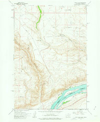
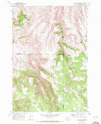
 1964 Turner Butte1965 Print · USGSMid-century Gilliam County comes into focus in this survey of the high desert along the Sherman Co Gilliam Co border. Trace the historical Oregon Trail (Approximate Route), the Union Pacific tracks, and the remote settlement of Barnett near the John Day River.2 unique versions available
 - 1964 Map of Shutler Flat, 1965 Print
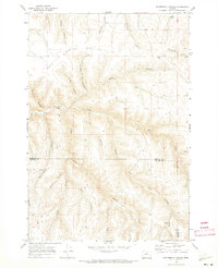
 1964 Shutler Flat1965 Print · USGSGilliam County's high plateau and deep canyons are documented in the mid-1960s, showing the intersection of pioneer history and modern industry. Trace the Oregon Trail near the Weatherford Historical Mon or locate rural landmarks like the Olex PO and Roddy.
 - 1964 Map of Hickland Butte, 1965 Print
 1964 Hickland Butte1965 Print · USGSOregon's high desert plateau near the Gilliam and Morrow county line is captured here in the mid-sixties. You can trace the historic Oregon Trail (Approx Route) and locate isolated rural landmarks like Hickland Butte and local Cem sites.
 - 1964 Map of Mc Donald, 1965 Print
 1964 Mc Donald1965 Print · USGSThe high plateau of Sherman County meets the John Day River in the mid-1960s, preserving the intersecting paths of early pioneers. You can trace the historic Oregon Trail and Barlow Cutoff as they descend toward the river crossing at McDonald Ford.2 unique versions available
 - 1964 Map of Horn Butte, 1965 Print
 1964 Horn Butte1965 Print · USGSGilliam County's high plateau comes into focus during the mid-1960s, showing a landscape defined by ranching and historic migration routes. Researchers can trace the original Oregon Tr across the coulees or follow the Union Pacific line as it winds past Willow Creek.
 - 1968 Map of Gooseberry, 1970 Print
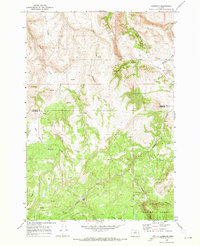
 1968 Gooseberry1970 Print · USGSGooseberry and the high canyon country of north-central Oregon are captured here in the late sixties. Researchers can trace the layout of the Gooseberry settlement, identifying local landmarks like the Gooseberry Cem and the remote Landing Strip among the deep draws.
 - 1968 Map of Dalreed Butte, 1970 Print
 1968 Dalreed Butte1970 Print · USGSMorrow and Gilliam counties were still remote desert landscapes in the late sixties, where pioneer history and rail infrastructure met. Trace the historic paths of the Oregon Tr and Immigrant Road as they overlook the Union Pacific tracks in the Willow Creek canyon.
 - 1968 Map of Cecil, 1970 Print
 1968 Cecil1970 Print · USGSMorrow County was a landscape of deep canyons and historic transit paths in the late 1960s. Researchers can trace the Oregon Trail and Immigrant Road as they cross the plateau above Willow Creek and the settlement of Morgan.
 - 1969 Map of Lefevre Prairie, 1972 Print
 1969 Lefevre Prairie1972 Print · USGSHigh-country prairies and deep canyons meet at the intersection of three counties during the late sixties. Genealogists and hikers can trace the Lonerock Cem, explore the reaches of The Frog, or follow the timbered boundaries of the Umatilla National Forest.2 unique versions available
 - 1969 Map of Buttermilk Canyon, 1973 Print
 1969 Buttermilk Canyon1973 Print · USGSMorrow and Gilliam Counties appear at the end of the sixties as a land of deep canyons and high cattle ridges. Researchers can trace historic ranching infrastructure and family-named landmarks like Rood Trail, Hale Ridge, and Fichter Canyon.
 - 1969 Map of Lonerock, 1973 Print
 1969 Lonerock1973 Print · USGSLonerock and the high plateau country of the Gilliam and Wheeler county line appear here as they were in the late sixties. Genealogists and researchers can locate the Lonerock settlement and local Cem, or trace landmarks like Cone Mill and the Jeep Tr.2 unique versions available
 - 1970 Map of Alderdale, 1972 Print
 1970 Alderdale1972 Print · USGSThe Columbia River corridor comes alive in the early seventies as a hub of rail activity and industrial transit. Trace the riverbank routes of the Union Pacific and Burlington Northern near Alderdale and Golgotha Butte.
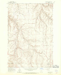
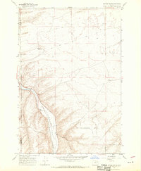
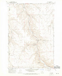
Showing maps 1-25 of 219
Top cities of Gilliam County
Frequently asked questions
- What are the different types of historical maps available for Gilliam County?
- What is the oldest map of Gilliam County?
- Where can I purchase historical maps of Gilliam County for my home or office?
- Where can I download high-res historical maps of Gilliam County?
- Are there historical topographic maps available for Gilliam County?
- Is there historical aerial imagery available for Gilliam County?
- Where are historical maps of Gilliam County sourced from?