Old Maps of Mount Vernon, Oregon for Genealogy
Trace your family roots with 11 historic maps of Mount Vernon. These high-res maps reveal old neighborhoods, homesites, landmarks, and streets — helping you uncover where your ancestors lived and how the area evolved over time.
- Explore historic neighborhoods: Identify where your relatives may have lived in the 1800s or 1900s.
- Compare maps over time: Trace the changes in streets, buildings, and landmarks for multi-generational research.
- Perfect for genealogy & ancestry research: Used by family historians and researchers to map out lineage and migration.
These maps are an incredible resource for exploring your personal connection to Mount Vernon's past.
Mount Vernon, OR maps
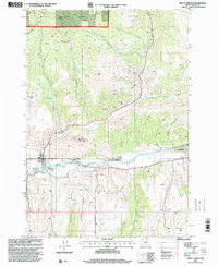
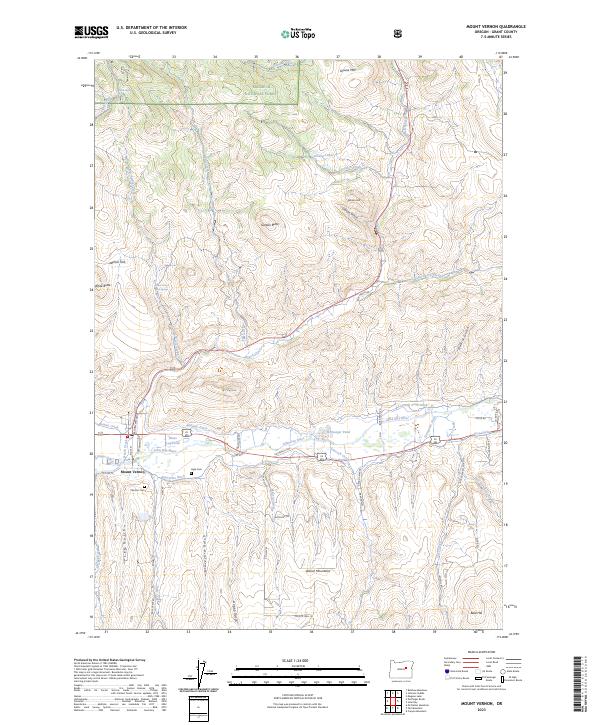
(11)- 1940 Map of Mount Vernon, 1959 Print
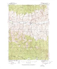 1940 Mount Vernon1959 Print · USGSMount Vernon and the John Day River valley are shown here just before mid-century, capturing a landscape of remote ranches and forest lookouts. Genealogists can locate family landmarks like Fletcher Ranch, Belshaw Sch, and the Cinnabar Mine.2 unique versions available
 - 1943 Map of Mount Vernon
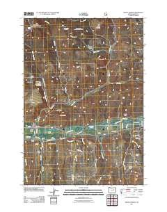
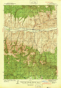 1943 Mount Vernon1943 Print · USGSMount Vernon and the surrounding Grant County highlands are seen here during the early 1940s as a hub for ranching and mercury mining. Genealogists and historians can locate early homesteads and community centers like the Belshaw Sch, Koehler Ranch, and the Cinnabar Mine.
 - 1955 Map of Canyon City, 1966 Print
 1955 Canyon City1966 Print · USGSCentral Oregon's high desert and timber country are captured here in the mid-fifties, showing the rugged ranching and logging landscape. Trace the path of the Sumpter Valley Ry or locate remote settlements like Izee, Whitney, and Ritter.4 unique versions available
 - 1959 Map of Canyon City
 1959 Canyon City1959 Print · USGSEastern Oregon in the late fifties was a landscape of high timber and remote river valleys shaped by the cattle and mining trades. Genealogists and historians can trace the paths of the Sumpter Valley RR and find early settlements like Antone, Richmond, and Dayville.2 unique versions available
 - 1972 Map of Mount Vernon, 1976 Print
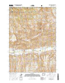
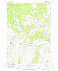 1972 Mount Vernon1976 Print · USGSMount Vernon and the John Day River valley are captured in the early 1970s during a period of transition between mining history and modern recreation. Trace local heritage at Ingle Cem, locate the Mt Vernon Hot Springs, and explore the legacy of the river at the Dredge Tailings.2 unique versions available
 - 1981 Map of Dayville
 1981 Dayville1981 Print · USGSEastern Oregon’s high-desert rangeland and timber country are captured here in the early eighties, centered on the John Day River valley. Genealogists and historians can trace isolated settlements like Izee and Suplee alongside historical mining sites including Chambers Mine.2 unique versions available
 - 1998 Map of Mount Vernon, 2000 Print
 1998 Mount Vernon2000 Print · USGSMount Vernon and the John Day River valley are shown here as they appeared in the late nineties, documenting a landscape shaped by river-bottom mining. Genealogists and local historians can locate Fletcher Cem, trace the extensive Dredge Tailings, and find the Mount Vernon Hot Springs.
 - 2011 Map of Mount Vernon, 2011 Print
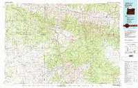
 2011 Mount Vernon2011 Print · USGSCovers Mount Vernon, including Grant County, United States, and other nearby areas
 - 2017 Map of Mount Vernon, 2017 Print
 2017 Mount Vernon2017 Print · USGSCovers Mount Vernon, including Grant County, United States, and other nearby areas
 - 2020 Map of Mount Vernon, 2020 Print
 2020 Mount Vernon2020 Print · USGSCovers Mount Vernon, including Grant County, United States, and other nearby areas
 - 2023 Map of Mount Vernon, 2023 Print
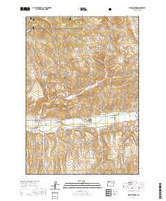
 2023 Mount Vernon2023 Print · USGSMount Vernon and the John Day River valley are shown here in the early twenty-first century, detailng a landscape shaped by water and timber. Researchers can trace irrigation history through the Panama Ditch or locate family roots at Ingle Cem and Fletcher Cem.
End of results
Showing maps 1-11 of 11
Top cities near Mount Vernon
Frequently asked questions
- What are the different types of historical maps available for Mount Vernon?
- What is the oldest map of Mount Vernon?
- Where can I purchase historical maps of Mount Vernon for my home or office?
- Where can I download high-res historical maps of Mount Vernon?
- Are there historical topographic maps available for Mount Vernon?
- Is there historical aerial imagery available for Mount Vernon?
- Where are historical maps of Mount Vernon sourced from?