Old Maps of Crane, Oregon for Academic Research
Study the evolution of Crane with 11 high-resolution historic maps. Whether you're teaching, researching, or modeling changes in land use, these maps provide essential visual documentation of urban, environmental, and geographic change.
- Analyze long-term change: Track patterns in development, transportation, and natural features.
- Ideal for environmental or urban studies: Support academic projects with primary historical map data.
- Use in the classroom or lab: Educators and researchers rely on these maps to bring historical context to life.
These maps are a powerful tool for teaching, research, and visualizing how Crane has changed over the decades.
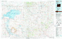
Crane, OR maps
(11)- 1955 Map of Burns, 1964 Print
 1955 Burns1964 Print · USGSHarney County's high desert ranching and timber heartland is captured here in the mid-fifties, centered on the hub of Burns and Hines. Genealogists and researchers can locate remote landmarks like the Suntex School, New Princeton P. O., and the Lumber Mill.3 unique versions available
 - 1958 Map of Burns
 1958 Burns1958 Print · USGSHarney County ranching and timber lands are captured here in the late fifties. Genealogists and local historians can trace family holdings and rural institutions, from the Kimball Flat School to remote outposts like Crow Camp Ranch and the Sutton Ranch.
 - 1959 Map of Burns
 1959 Burns1959 Print · USGSHarney County in the late fifties remains a landscape of high-desert ranching and timber production, centered on the hubs of Burns and Hines. Researchers can locate remote rural institutions like the Suntex School or trace family landholdings such as the Stallard Ranch and O'Keefe Homestead.
 - 1960 Map of Crane, 1962 Print
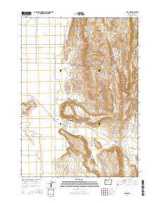
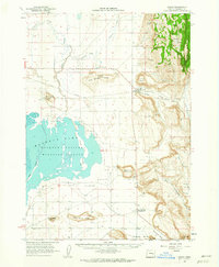 1960 Crane1962 Print · USGSHarney County's high desert landscape comes alive in the early sixties, showing the vital relationship between the Union Pacific rail line and the vast Malheur Lake basin. Genealogists and historians can trace the foundations of Crane and New Princeton, while locating landmarks like Kruger Field and the Hot Springs.2 unique versions available
 - 1978 Map of Malheur Lake, 1997 Print
 1978 Malheur Lake1997 Print · USGSThe Harney Basin in the late seventies reveals a land of vast wetlands and volcanic remnants. Researchers can trace isolated outposts like New Princeton and Venator or the unique geological formations of Diamond Craters.
 - 1990 Map of Crane
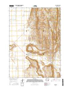
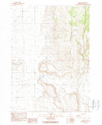 1990 Crane1990 Print · USGSHigh-desert ranching and water resources define the Crane area in the late 1980s. Genealogists and researchers can trace local landmarks like Krueger Field, the Crane Butte volcanic rises, and the waters of Temple Spring.
 - 2011 Map of Crane, 2011 Print
 2011 Crane2011 Print · USGSCovers Crane, including Harney County, United States, and other nearby areas
 - 2014 Map of Crane, 2014 Print
 2014 Crane2014 Print · USGSCovers Crane, including Harney County, United States, and other nearby areas
 - 2017 Map of Crane, 2017 Print
 2017 Crane2017 Print · USGSCovers Crane, including Harney County, United States, and other nearby areas
 - 2020 Map of Crane, 2020 Print
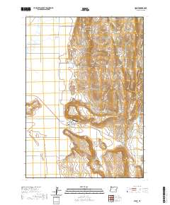 2020 Crane2020 Print · USGSCovers Crane, including Harney County, United States, and other nearby areas
 - 2023 Map of Crane, 2023 Print
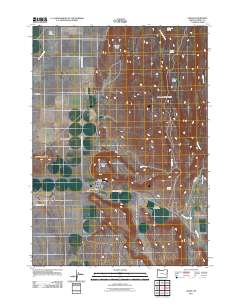
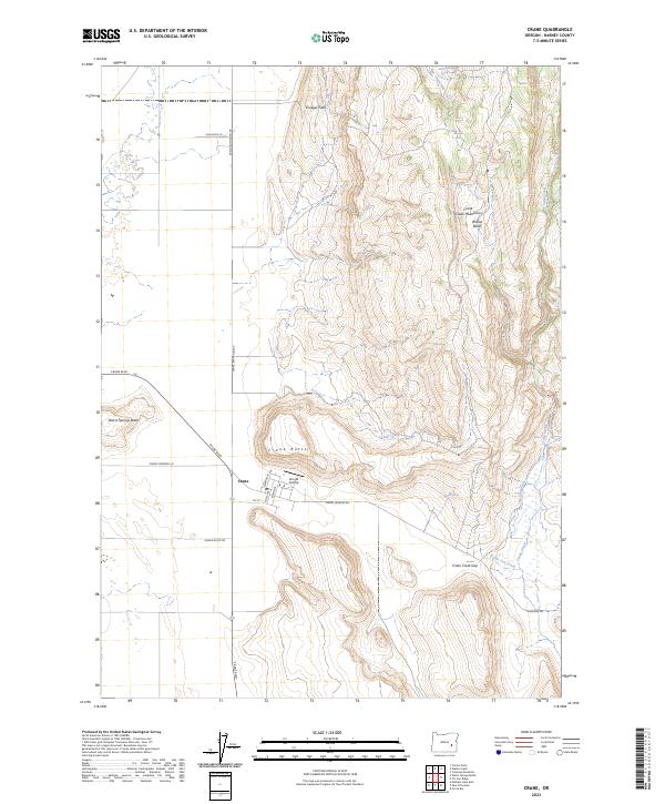 2023 Crane2023 Print · USGSHarney County's high-desert landscape comes into focus in this contemporary survey of the Crane area. Researchers can trace local landmarks like the Arnold Airstrip, the street grid of the town site, and geographic features such as Crane Butte and Crane Creek Gap.
End of results
Showing maps 1-11 of 11
Frequently asked questions
- What are the different types of historical maps available for Crane?
- What is the oldest map of Crane?
- Where can I purchase historical maps of Crane for my home or office?
- Where can I download high-res historical maps of Crane?
- Are there historical topographic maps available for Crane?
- Is there historical aerial imagery available for Crane?
- Where are historical maps of Crane sourced from?