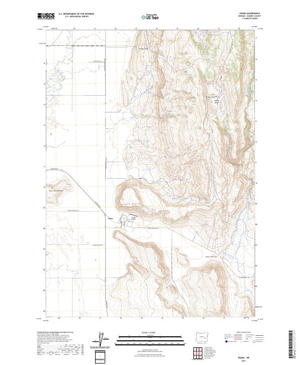
2023 Map of Crane
USGS Topo · Published 2023About this map
Crane sits at a critical junction of high-desert terrain and hydraulic management in Harney County, where the infrastructure of local aviation and ranching meets the prominent relief of the Crane Creek Mountains. This 2023 survey illustrates a settlement layout defined by a grid of streets including Main Ave and Clyde Ave, situated directly below the massive volcanic profile of Crane Butte. The landscape is a study in water distribution across an arid basin, evidenced by the Cody Ditch and the winding course of Crane Cut Creek through the Crane Creek Gap. Notable landmarks such as the Arnold Airstrip and Krueger Field reflect the region's reliance on aerial access, while the placement of Crane Cemetery Ln provides a fixed point of reference for local genealogy. From the heights of Warm Springs Butte to the drainages of Crowcamp Creek, the map details a community deeply integrated with its physical geography.
Find a feature on this map
32 named features on this map. Tap any name to fly to it.
Don’t see what you’re looking for? This feature index may not catch every label — zoom into the map to look around manually.
Map Details
Editions of this 2023 Crane Map
This is the sole edition of this map. No revisions or reprints were ever made.
Other maps of this area

1955 · Burns
USGS Topo · 1:250,000

1958 · Burns
USGS Topo · 1:250,000

1959 · Burns
USGS Topo · 1:250,000

1960 · Crane
USGS Topo · 1:62,500

1968 · Venator
USGS Topo · 1:62,500

1972 · Circle Bar
USGS Topo · 1:24,000
1972 · Tin Can Ridge
USGS Topo · 1:24,000

1973 · Mahon Creek
USGS Topo · 1:24,000

1973 · Carson Point
USGS Topo · 1:24,000

1978 · Malheur Lake
USGS Topo · 1:100,000