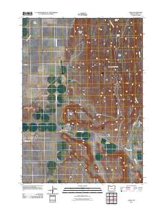
2011 Map of Crane
USGS Topo · Published 2011About this map
Crane serves as the primary hub of activity in this portion of the Harney Valley, situated along the intersection of Crane-Buchanan RD and Crane-Venator RD. The settlement's essential services are anchored by the Crane Post Office, while regional aviation is supported by Krueger Field and the Arnold Airstrip. The landscape is defined by its water management and arid terrain, featuring several natural springs like McDonald Spring and Temple Spring, alongside man-made improvements such as the Cary Ditch.
Find a feature on this map
25 named features on this map. Tap any name to fly to it.
Don’t see what you’re looking for? This feature index may not catch every label — zoom into the map to look around manually.
Map Details
Editions of this 2011 Crane Map
This is the sole edition of this map. No revisions or reprints were ever made.
Other maps of this area

1955 · Burns
USGS Topo · 1:250,000

1958 · Burns
USGS Topo · 1:250,000

1959 · Burns
USGS Topo · 1:250,000

1960 · Crane
USGS Topo · 1:62,500

1968 · Venator
USGS Topo · 1:62,500

1972 · Circle Bar
USGS Topo · 1:24,000
1972 · Tin Can Ridge
USGS Topo · 1:24,000

1973 · Mahon Creek
USGS Topo · 1:24,000

1973 · Carson Point
USGS Topo · 1:24,000

1978 · Malheur Lake
USGS Topo · 1:100,000