Old Maps of Harney, Oregon for Academic Research
Study the evolution of Harney with 11 high-resolution historic maps. Whether you're teaching, researching, or modeling changes in land use, these maps provide essential visual documentation of urban, environmental, and geographic change.
- Analyze long-term change: Track patterns in development, transportation, and natural features.
- Ideal for environmental or urban studies: Support academic projects with primary historical map data.
- Use in the classroom or lab: Educators and researchers rely on these maps to bring historical context to life.
These maps are a powerful tool for teaching, research, and visualizing how Harney has changed over the decades.
Harney, OR maps
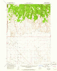
(11)- 1955 Map of Burns, 1964 Print
 1955 Burns1964 Print · USGSHarney County's high desert ranching and timber heartland is captured here in the mid-fifties, centered on the hub of Burns and Hines. Genealogists and researchers can locate remote landmarks like the Suntex School, New Princeton P. O., and the Lumber Mill.3 unique versions available
 - 1958 Map of Burns
 1958 Burns1958 Print · USGSHarney County ranching and timber lands are captured here in the late fifties. Genealogists and local historians can trace family holdings and rural institutions, from the Kimball Flat School to remote outposts like Crow Camp Ranch and the Sutton Ranch.
 - 1959 Map of Burns
 1959 Burns1959 Print · USGSHarney County in the late fifties remains a landscape of high-desert ranching and timber production, centered on the hubs of Burns and Hines. Researchers can locate remote rural institutions like the Suntex School or trace family landholdings such as the Stallard Ranch and O'Keefe Homestead.
 - 1959 Map of Harney, 1961 Print
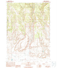
 1959 Harney1961 Print · USGSThe Harney County high desert and forest transition are captured here in the late fifties, showing the area's vital water and rail infrastructure. Researchers can locate the Fort Harney (Site), trace the Union Pacific railroad, and find small locales like Gradon and Harney.2 unique versions available
 - 1978 Map of Stinkingwater Mountains, 1997 Print
 1978 Stinkingwater Mountains1997 Print · USGSHarney County in the late seventies is a land of high tables and deep basins, where the Stinkingwater Mountains rise over the Malheur River. Researchers can trace the Oregon and Northwestern Railroad and locate historic points like Fort Harney (Site) and Drewsey.2 unique versions available
 - 1990 Map of Harney
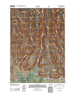
 1990 Harney1990 Print · USGSHarney Valley and the timbered fringes of the Malheur National Forest are captured here during the late twentieth century. Genealogists and local historians can pinpoint the Fort Harney (Site) and the settlement of Harney at the base of Mortimer Canyon.
 - 1999 Map of Harney, 2002 Print
 1999 Harney2002 Print · USGSThe high desert valley meets the forest edge in Harney County during the late nineties. Genealogists and historians can locate the Fort Harney (Site), the settlement of Harney, and local landmarks like Mortimer Canyon Reservoir.
 - 2011 Map of Harney, 2011 Print
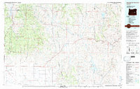
 2011 Harney2011 Print · USGSCovers Harney, including Harney County, United States, and other nearby areas
 - 2017 Map of Harney, 2017 Print
 2017 Harney2017 Print · USGSCovers Harney, including Harney County, United States, and other nearby areas
 - 2020 Map of Harney, 2020 Print
 2020 Harney2020 Print · USGSCovers Harney, including Harney County, United States, and other nearby areas
 - 2023 Map of Harney, 2023 Print
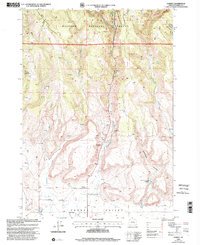
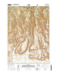
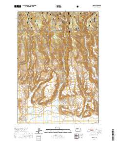
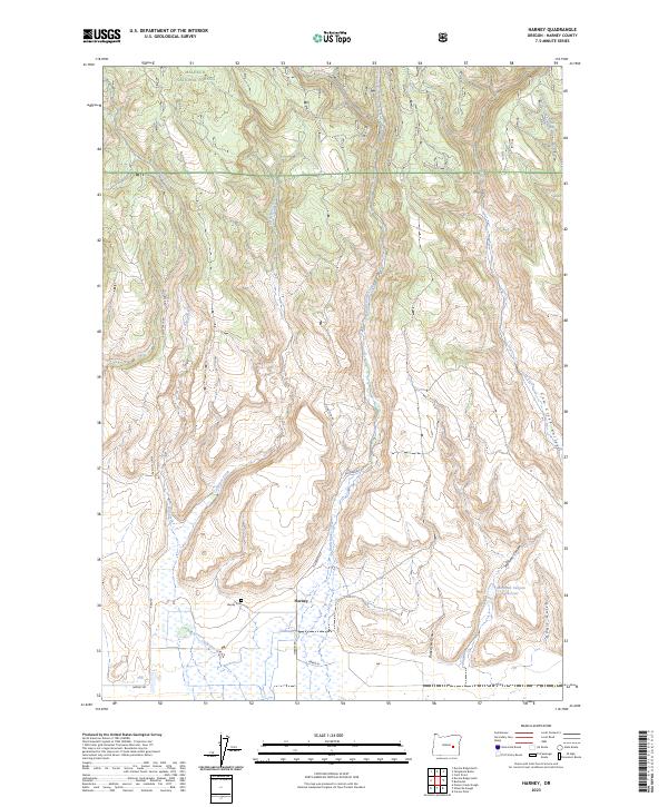 2023 Harney2023 Print · USGSThe settlement of Harney and the southern fringes of the Malheur National Forest are shown in high detail. Genealogists and researchers can trace local family landmarks like Harney Cem and water sources including Mortimer Canyon Reservoir.
End of results
Showing maps 1-11 of 11
Top cities near Harney
Frequently asked questions
- What are the different types of historical maps available for Harney?
- What is the oldest map of Harney?
- Where can I purchase historical maps of Harney for my home or office?
- Where can I download high-res historical maps of Harney?
- Are there historical topographic maps available for Harney?
- Is there historical aerial imagery available for Harney?
- Where are historical maps of Harney sourced from?